Category:Locator maps of communities in Wrexham County Borough
Jump to navigation
Jump to search
Media in category "Locator maps of communities in Wrexham County Borough"
The following 34 files are in this category, out of 34 total.
-
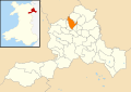
 Wales Wrexham Community Abenbury map.svg 512 × 362; 495 KB
-
 Wales Wrexham Community Acton map.svg 512 × 362; 495 KB
-
 Wales Wrexham Community Bangor is-y-Coed map.svg 512 × 362; 495 KB
-
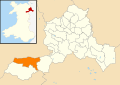
 Wales Wrexham Community Bronington map.svg 512 × 362; 495 KB
-
 Wales Wrexham Community Broughton map.svg 512 × 362; 495 KB
-
 Wales Wrexham Community Brymbo map.svg 512 × 362; 495 KB
-
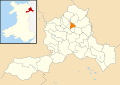
 Wales Wrexham Community Caia Park map.svg 512 × 362; 495 KB
-
 Wales Wrexham Community Cefn map.svg 512 × 362; 495 KB
-
 Wales Wrexham Community Ceiriog Ucha map.svg 512 × 362; 495 KB
-
 Wales Wrexham Community Chirk map.svg 512 × 362; 495 KB
-
 Wales Wrexham Community Coedpoeth map.svg 512 × 362; 495 KB
-
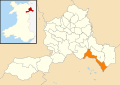
 Wales Wrexham Community Erbistock map.svg 512 × 362; 495 KB
-
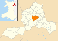
 Wales Wrexham Community Esclusham map.svg 512 × 362; 495 KB
-
 Wales Wrexham Community Glyntraian map.svg 512 × 362; 495 KB
-
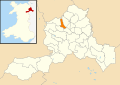
 Wales Wrexham Community Gresford map.svg 512 × 362; 495 KB
-
 Wales Wrexham Community Gwersyllt map.svg 512 × 362; 495 KB
-
 Wales Wrexham Community Hanmer map.svg 512 × 362; 495 KB
-
 Wales Wrexham Community Holt map.svg 512 × 362; 495 KB
-
 Wales Wrexham Community Isycoed map.svg 512 × 362; 495 KB
-
 Wales Wrexham Community Llangollen Rural map.svg 512 × 362; 495 KB
-
 Wales Wrexham Community Llansantffraid Glyn Ceiriog map.svg 512 × 362; 495 KB
-
 Wales Wrexham Community Llay map.svg 512 × 362; 495 KB
-
 Wales Wrexham Community Maelor South map.svg 512 × 362; 495 KB
-
 Wales Wrexham Community Marchwiel map.svg 512 × 362; 495 KB
-
 Wales Wrexham Community Minera map.svg 512 × 362; 495 KB
-
 Wales Wrexham Community Offa map.svg 512 × 362; 495 KB
-
 Wales Wrexham Community Overton map.svg 512 × 362; 495 KB
-
 Wales Wrexham Community Penycae map.svg 512 × 362; 495 KB
-
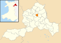
 Wales Wrexham Community Rhosddu map.svg 512 × 362; 495 KB
-
 Wales Wrexham Community Rhosllanerchrugog map.svg 512 × 362; 495 KB
-
 Wales Wrexham Community Rossett map.svg 512 × 362; 495 KB
-
 Wales Wrexham Community Ruabon map.svg 512 × 362; 495 KB
-
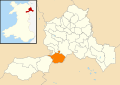
 Wales Wrexham Community Sesswick map.svg 512 × 362; 495 KB
-
 Wales Wrexham Community Willington Worthenbury map.svg 512 × 362; 495 KB


