Category:Locator maps of communities in Neath Port Talbot in 2024
Jump to navigation
Jump to search
Media in category "Locator maps of communities in Neath Port Talbot in 2024"
The following 33 files are in this category, out of 33 total.
-
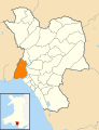
 2024 Wales Neath Port Talbot Community Aberavon map.svg 512 × 666; 548 KB
-
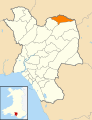
 2024 Wales Neath Port Talbot Community Baglan Bay map.svg 512 × 666; 548 KB
-
 2024 Wales Neath Port Talbot Community Baglan map.svg 512 × 666; 548 KB
-
 2024 Wales Neath Port Talbot Community Baglan Moors map.svg 512 × 666; 548 KB
-
 2024 Wales Neath Port Talbot Community Blaengwrach map.svg 512 × 666; 548 KB
-
 2024 Wales Neath Port Talbot Community Blaenhonddan map.svg 512 × 666; 548 KB
-
 2024 Wales Neath Port Talbot Community Briton Ferry map.svg 512 × 666; 548 KB
-
 2024 Wales Neath Port Talbot Community Bryn map.svg 512 × 666; 548 KB
-
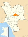
 2024 Wales Neath Port Talbot Community Cilybebyll map.svg 512 × 666; 548 KB
-
 2024 Wales Neath Port Talbot Community Clyne and Melincourt map.svg 512 × 666; 548 KB
-
 2024 Wales Neath Port Talbot Community Coedffranc map.svg 512 × 666; 548 KB
-
 2024 Wales Neath Port Talbot Community Crynant map.svg 512 × 666; 548 KB
-
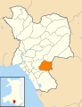
 2024 Wales Neath Port Talbot Community Cwmavon map.svg 512 × 666; 548 KB
-
 2024 Wales Neath Port Talbot Community Cwmllynfell map.svg 512 × 666; 548 KB
-
 2024 Wales Neath Port Talbot Community Cymer and Glyncorrwg map.svg 512 × 666; 548 KB
-
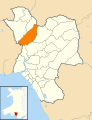
 2024 Wales Neath Port Talbot Community Dyffryn Clydach map.svg 512 × 666; 548 KB
-
 2024 Wales Neath Port Talbot Community Glynneath map.svg 512 × 666; 548 KB
-
 2024 Wales Neath Port Talbot Community Gwaun-Cae-Gurwen map.svg 512 × 666; 548 KB
-
 2024 Wales Neath Port Talbot Community Gwynfi and Croeserw map.svg 512 × 666; 548 KB
-
 2024 Wales Neath Port Talbot Community Margam map.svg 512 × 666; 548 KB
-
 2024 Wales Neath Port Talbot Community Margam Moors map.svg 512 × 666; 548 KB
-
 2024 Wales Neath Port Talbot Community Neath map.svg 512 × 666; 548 KB
-
 2024 Wales Neath Port Talbot Community Onllwyn map.svg 512 × 666; 548 KB
-
 2024 Wales Neath Port Talbot Community Pelenna map.svg 512 × 666; 548 KB
-
 2024 Wales Neath Port Talbot Community Pontardawe map.svg 512 × 666; 548 KB
-
 2024 Wales Neath Port Talbot Community Port Talbot map.svg 512 × 666; 548 KB
-
 2024 Wales Neath Port Talbot Community Resolven map.svg 512 × 666; 548 KB
-
 2024 Wales Neath Port Talbot Community Sandfields East map.svg 512 × 666; 548 KB
-
 2024 Wales Neath Port Talbot Community Sandfields West map.svg 512 × 666; 548 KB
-
 2024 Wales Neath Port Talbot Community Seven Sisters map.svg 512 × 666; 548 KB
-
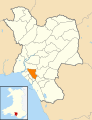
 2024 Wales Neath Port Talbot Community Tai-Bach map.svg 512 × 666; 548 KB
-
 2024 Wales Neath Port Talbot Community Tonna map.svg 512 × 666; 548 KB
-
 2024 Wales Neath Port Talbot Community Ystalyfera map.svg 512 × 666; 548 KB


