Category:Locator maps of communities in Monmouthshire in 2024
Jump to navigation
Jump to search
Media in category "Locator maps of communities in Monmouthshire in 2024"
The following 30 files are in this category, out of 30 total.
-
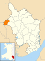
 2024 Wales Monmouthshire Community Abergavenny map.svg 512 × 682; 603 KB
-
 2024 Wales Monmouthshire Community Caerwent map.svg 512 × 682; 603 KB
-
 2024 Wales Monmouthshire Community Caldicot map.svg 512 × 682; 603 KB
-
 2024 Wales Monmouthshire Community Chepstow map.svg 512 × 682; 603 KB
-
 2024 Wales Monmouthshire Community Crucorney map.svg 512 × 682; 603 KB
-
 2024 Wales Monmouthshire Community Devauden map.svg 512 × 682; 603 KB
-
 2024 Wales Monmouthshire Community Gobion Fawr map.svg 512 × 682; 603 KB
-
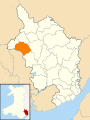
 2024 Wales Monmouthshire Community Goetre Fawr map.svg 512 × 682; 603 KB
-
 2024 Wales Monmouthshire Community Grosmont map.svg 512 × 682; 603 KB
-
 2024 Wales Monmouthshire Community Llanarth map.svg 512 × 682; 603 KB
-
 2024 Wales Monmouthshire Community Llanbadoc map.svg 512 × 682; 603 KB
-
 2024 Wales Monmouthshire Community Llanelly map.svg 512 × 682; 603 KB
-
 2024 Wales Monmouthshire Community Llanfoist Fawr map.svg 512 × 682; 603 KB
-
 2024 Wales Monmouthshire Community Llangybi map.svg 512 × 682; 603 KB
-
 2024 Wales Monmouthshire Community Llantilio Pertholey map.svg 512 × 682; 603 KB
-
 2024 Wales Monmouthshire Community Llantrisant Fawr map.svg 512 × 682; 603 KB
-
 2024 Wales Monmouthshire Community Magor with Undy map.svg 512 × 682; 603 KB
-
 2024 Wales Monmouthshire Community Mathern map.svg 512 × 682; 603 KB
-
 2024 Wales Monmouthshire Community Mitchel Troy map.svg 512 × 682; 603 KB
-
 2024 Wales Monmouthshire Community Monmouth map.svg 512 × 682; 603 KB
-
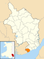
 2024 Wales Monmouthshire Community Portskewett map.svg 512 × 682; 603 KB
-
 2024 Wales Monmouthshire Community Raglan map.svg 512 × 682; 603 KB
-
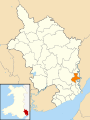
 2024 Wales Monmouthshire Community Rogiet map.svg 512 × 682; 603 KB
-
 2024 Wales Monmouthshire Community Shirenewton map.svg 512 × 682; 603 KB
-
 2024 Wales Monmouthshire Community Skenfrith map.svg 512 × 682; 603 KB
-
 2024 Wales Monmouthshire Community St Arvans map.svg 512 × 682; 603 KB
-
 2024 Wales Monmouthshire Community Trellech United map.svg 512 × 682; 603 KB
-
 2024 Wales Monmouthshire Community Usk map.svg 512 × 682; 603 KB
-
 2024 Wales Monmouthshire Community Whitecastle map.svg 512 × 682; 603 KB
-
 2024 Wales Monmouthshire Community Wye Valley map.svg 512 × 682; 603 KB


