Category:Locator maps of communities in Ceredigion
Jump to navigation
Jump to search
Media in category "Locator maps of communities in Ceredigion"
The following 51 files are in this category, out of 51 total.
-
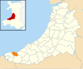
 Wales Ceredigion Community Aberaeron map.svg 512 × 428; 788 KB
-
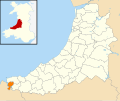
 Wales Ceredigion Community Aberporth map.svg 512 × 428; 788 KB
-
 Wales Ceredigion Community Aberystwyth map.svg 512 × 428; 788 KB
-
 Wales Ceredigion Community Beulah map.svg 512 × 428; 788 KB
-
 Wales Ceredigion Community Blaenrheidol map.svg 512 × 428; 788 KB
-
 Wales Ceredigion Community Borth map.svg 512 × 428; 788 KB
-
 Wales Ceredigion Community Cardigan map.svg 512 × 428; 788 KB
-
 Wales Ceredigion Community Ceulanamaesmawr map.svg 512 × 428; 788 KB
-
 Wales Ceredigion Community Ciliau Aeron map.svg 512 × 428; 788 KB
-
 Wales Ceredigion Community Dyffryn Arth map.svg 512 × 428; 788 KB
-
 Wales Ceredigion Community Faenor map.svg 512 × 428; 788 KB
-
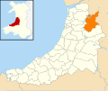
 Wales Ceredigion Community Geneu'r Glyn map.svg 512 × 428; 788 KB
-
 Wales Ceredigion Community Henfynyw map.svg 512 × 428; 788 KB
-
 Wales Ceredigion Community Lampeter map.svg 512 × 428; 788 KB
-
 Wales Ceredigion Community Llanarth map.svg 512 × 428; 788 KB
-
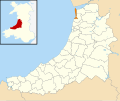
 Wales Ceredigion Community Llanbadarn Fawr map.svg 512 × 428; 788 KB
-
 Wales Ceredigion Community Llanddewi Brefi map.svg 512 × 428; 788 KB
-
 Wales Ceredigion Community Llandyfriog map.svg 512 × 428; 788 KB
-
 Wales Ceredigion Community Llandysiliogogo map.svg 512 × 428; 788 KB
-
 Wales Ceredigion Community Llandysul map.svg 512 × 428; 788 KB
-
 Wales Ceredigion Community Llanfair Clydogau map.svg 512 × 428; 788 KB
-
 Wales Ceredigion Community Llanfarian map.svg 512 × 428; 788 KB
-
 Wales Ceredigion Community Llanfihangel Ystrad map.svg 512 × 428; 788 KB
-
 Wales Ceredigion Community Llangeitho map.svg 512 × 428; 788 KB
-
 Wales Ceredigion Community Llangoedmor map.svg 512 × 428; 788 KB
-
 Wales Ceredigion Community Llangrannog map.svg 512 × 428; 788 KB
-
 Wales Ceredigion Community Llangwyryfon map.svg 512 × 428; 788 KB
-
 Wales Ceredigion Community Llangybi map.svg 512 × 428; 788 KB
-
 Wales Ceredigion Community Llangynfelyn map.svg 512 × 428; 788 KB
-
 Wales Ceredigion Community Llanilar map.svg 512 × 428; 788 KB
-
 Wales Ceredigion Community Llanllwchaiarn map.svg 512 × 428; 788 KB
-
 Wales Ceredigion Community Llanrhystyd map.svg 512 × 428; 788 KB
-
 Wales Ceredigion Community Llansantffraed map.svg 512 × 428; 788 KB
-
 Wales Ceredigion Community Llanwenog map.svg 512 × 428; 788 KB
-
 Wales Ceredigion Community Llanwnnen map.svg 512 × 428; 788 KB
-
 Wales Ceredigion Community Lledrod map.svg 512 × 428; 788 KB
-
 Wales Ceredigion Community Melindwr map.svg 512 × 428; 788 KB
-
 Wales Ceredigion Community Nantcwnlle map.svg 512 × 428; 788 KB
-
 Wales Ceredigion Community New Quay map.svg 512 × 428; 788 KB
-
 Wales Ceredigion Community Penbryn map.svg 512 × 428; 788 KB
-
 Wales Ceredigion Community Pontarfynach map.svg 512 × 428; 788 KB
-
 Wales Ceredigion Community Tirymynach map.svg 512 × 428; 788 KB
-
 Wales Ceredigion Community Trawsgoed map.svg 512 × 428; 788 KB
-
 Wales Ceredigion Community Trefeurig map.svg 512 × 428; 788 KB
-
 Wales Ceredigion Community Tregaron map.svg 512 × 428; 788 KB
-
 Wales Ceredigion Community Troedyraur map.svg 512 × 428; 788 KB
-
 Wales Ceredigion Community Y Ferwig map.svg 512 × 428; 788 KB
-
 Wales Ceredigion Community Ysbyty Ystwyth map.svg 512 × 428; 788 KB
-
 Wales Ceredigion Community Ysgubor-y-Coed map.svg 512 × 428; 788 KB
-
 Wales Ceredigion Community Ystrad Fflur map.svg 512 × 428; 788 KB
-
 Wales Ceredigion Community Ystrad Meurig map.svg 512 × 428; 788 KB


