
Category:Locator maps of communities in Anglesey
Media in category "Locator maps of communities in Anglesey"
The following 45 files are in this category, out of 45 total.
-
 Angleseay communities transparent overlay.svg 520 × 400; 426 KB
-
 Angleseymôncloseup.png 541 × 522; 14 KB
-
 Holyhead (Caergybi) - Sir Ynys Mon (Isle of Anglesey) dot.png 1,802 × 2,589; 189 KB
-
 Isle of Anglesey Wales communities - Llanddyfnan locator.png 810 × 768; 142 KB
-
 Isle of Anglesey Wales communities - Rhosyr locator.png 810 × 768; 163 KB
-
 Wales Anglesey Community Aberffraw map.svg 512 × 451; 727 KB
-
 Wales Anglesey Community Amlwch map.svg 512 × 451; 727 KB
-
 Wales Anglesey Community Beaumaris map.svg 512 × 451; 727 KB
-
 Wales Anglesey Community Bodedern map.svg 512 × 451; 727 KB
-
 Wales Anglesey Community Bodffordd map.svg 512 × 451; 727 KB
-
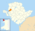
 Wales Anglesey Community Bodorgan map.svg 512 × 451; 727 KB
-
 Wales Anglesey Community Bryngwran map.svg 512 × 451; 727 KB
-
 Wales Anglesey Community Cwm Cadnant map.svg 512 × 451; 727 KB
-
 Wales Anglesey Community Cylch-y-Garn map.svg 512 × 451; 727 KB
-
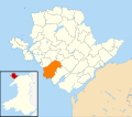
 Wales Anglesey Community Holyhead map.svg 512 × 451; 727 KB
-
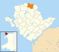
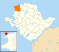
 Wales Anglesey Community Llanbadrig map.svg 512 × 451; 727 KB
-
 Wales Anglesey Community Llanddaniel Fab map.svg 512 × 451; 727 KB
-
 Wales Anglesey Community Llanddona map.svg 512 × 451; 727 KB
-
 Wales Anglesey Community Llanddyfnan map.svg 512 × 451; 727 KB
-
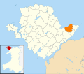
 Wales Anglesey Community Llaneilian map.svg 512 × 451; 727 KB
-
 Wales Anglesey Community Llaneugrad map.svg 512 × 451; 727 KB
-
 Wales Anglesey Community Llanfachraeth map.svg 512 × 451; 727 KB
-
 Wales Anglesey Community Llanfaelog map.svg 512 × 451; 727 KB
-
 Wales Anglesey Community Llanfaethlu map.svg 512 × 451; 727 KB
-
 Wales Anglesey Community Llanfair Pwllgwyngyll map.svg 512 × 451; 727 KB
-
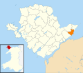
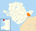
 Wales Anglesey Community Llanfair-Mathafarn-Eithaf map.svg 512 × 451; 727 KB
-
 Wales Anglesey Community Llanfair-yn-Neubwll map.svg 512 × 451; 727 KB
-
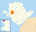
 Wales Anglesey Community Llanfihangel Ysgeifiog map.svg 512 × 451; 727 KB
-
 Wales Anglesey Community Llangefni map.svg 512 × 451; 727 KB
-
 Wales Anglesey Community Llangoed map.svg 512 × 451; 727 KB
-
 Wales Anglesey Community Llangristiolus map.svg 512 × 451; 727 KB
-
 Wales Anglesey Community Llanidan map.svg 512 × 451; 727 KB
-
 Wales Anglesey Community Llannerch-y-Medd map.svg 512 × 451; 727 KB
-
 Wales Anglesey Community Mechell map.svg 512 × 451; 727 KB
-
 Wales Anglesey Community Menai Bridge map.svg 512 × 451; 727 KB
-
 Wales Anglesey Community Moelfre map.svg 512 × 451; 727 KB
-
 Wales Anglesey Community Penmynydd map.svg 512 × 451; 727 KB
-
 Wales Anglesey Community Pentraeth map.svg 512 × 451; 727 KB
-
 Wales Anglesey Community Rhoscolyn map.svg 512 × 451; 727 KB
-
 Wales Anglesey Community Rhosybol map.svg 512 × 451; 727 KB
-
 Wales Anglesey Community Rhosyr map.svg 512 × 451; 727 KB
-
 Wales Anglesey Community Trearddur map.svg 512 × 451; 727 KB
-
 Wales Anglesey Community Tref Alaw map.svg 512 × 451; 727 KB
-
 Wales Anglesey Community Trewalchmai map.svg 512 × 451; 727 KB
-
 Wales Anglesey Community Valley map.svg 512 × 451; 727 KB

_-_Sir_Ynys_Mon_(Isle_of_Anglesey)_dot.png)


