Category:Locator maps of cantons of Puntarenas Province
Jump to navigation
Jump to search
Subcategories
This category has only the following subcategory.
Media in category "Locator maps of cantons of Puntarenas Province"
The following 12 files are in this category, out of 12 total.
-
 6-10Corredores.svg 1,211 × 1,174; 209 KB
-
 6-11Garabito.svg 1,211 × 1,174; 209 KB
-
 Cantones-PUN.svg 1,211 × 1,174; 209 KB
-
 Cantón de Puntarenas.svg 1,211 × 1,174; 209 KB
-
 CantónAguirre.svg 1,211 × 1,174; 209 KB
-
 CantónBuenos Aires.svg 1,211 × 1,174; 209 KB
-
 CantónCoto Brus.svg 1,211 × 1,174; 209 KB
-
 CantónEsparza.svg 1,211 × 1,174; 209 KB
-
 CantónGolfito.svg 1,211 × 1,174; 209 KB
-
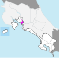
 CantónMontes de Oro.svg 1,211 × 1,174; 209 KB
-
 CantónOsa.svg 1,211 × 1,174; 209 KB
-
 CantónParrita.svg 1,211 × 1,174; 209 KB


