Category:Locator maps of cantons of Meurthe-et-Moselle to 2018
Jump to navigation
Jump to search
Media in category "Locator maps of cantons of Meurthe-et-Moselle to 2018"
The following 23 files are in this category, out of 23 total.
-
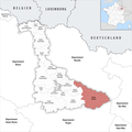 Locator map of Kanton Baccarat.png 2,500 × 2,499; 1.05 MB
-
 Locator map of Kanton Entre Seille et Meurthe.png 2,500 × 2,499; 1.04 MB
-
 Locator map of Kanton Grand Couronné.png 2,500 × 2,499; 1.04 MB
-
 Locator map of Kanton Jarny.png 2,500 × 2,499; 1.03 MB
-
 Locator map of Kanton Jarville-la-Malgrange.png 2,500 × 2,499; 1.04 MB
-
 Locator map of Kanton Laxou.png 2,500 × 2,499; 1.03 MB
-
 Locator map of Kanton Le Nord-Toulois.png 2,500 × 2,499; 1.04 MB
-
 Locator map of Kanton Longwy.png 2,500 × 2,499; 1.03 MB
-
 Locator map of Kanton Lunéville-1.png 2,500 × 2,499; 1.04 MB
-
 Locator map of Kanton Lunéville-2.png 2,500 × 2,499; 1.05 MB
-
 Locator map of Kanton Meine au Saintois.png 2,500 × 2,499; 1.05 MB
-
 Locator map of Kanton Mont-Saint-Martin.png 2,500 × 2,499; 1.04 MB
-
 Locator map of Kanton Nancy-1.png 2,500 × 2,499; 1.03 MB
-
 Locator map of Kanton Nancy-2.png 2,500 × 2,499; 1.03 MB
-
 Locator map of Kanton Nancy-3.png 2,500 × 2,499; 1.03 MB
-
 Locator map of Kanton Neuves-Maisons.png 2,500 × 2,499; 1.04 MB
-
 Locator map of Kanton Pays de Briey.png 2,500 × 2,499; 1.03 MB
-
 Locator map of Kanton Pont-à-Mousson.png 2,500 × 2,499; 1.04 MB
-
 Locator map of Kanton Saint-Max.png 2,500 × 2,499; 1.03 MB
-
 Locator map of Kanton Toul.png 2,500 × 2,499; 1.04 MB
-
 Locator map of Kanton Val de Lorraine Sud.png 2,500 × 2,499; 1.03 MB
-
 Locator map of Kanton Vandœuvre-lès-Nancy.png 2,500 × 2,499; 1.03 MB
-
 Locator map of Kanton Villerupt.png 2,500 × 2,499; 1.03 MB


