Category:Locator maps of boroughs in Hamburg (2011 opacity scheme)
Jump to navigation
Jump to search
Media in category "Locator maps of boroughs in Hamburg (2011 opacity scheme)"
The following 107 files are in this category, out of 107 total.
-
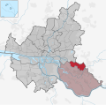
 Allermöhe in HH.svg 1,713 × 1,689; 780 KB
-
 Alsterdorf in HH.svg 1,713 × 1,689; 780 KB
-
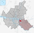
 Altengamme in HH.svg 1,713 × 1,689; 780 KB
-
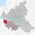
 Altenwerder in HH.svg 1,713 × 1,689; 780 KB
-
 Altona-Altstadt in HH.svg 1,713 × 1,689; 780 KB
-
 Altona in HH.svg 1,713 × 1,689; 780 KB
-
 Altona-Nord in HH.svg 1,713 × 1,689; 780 KB
-
 Bahrenfeld in HH.svg 1,713 × 1,689; 780 KB
-
 Barmbek in HH.svg 1,713 × 1,689; 780 KB
-
 Barmbek-Nord in HH.svg 1,713 × 1,689; 780 KB
-
 Barmbek-Süd in HH.svg 1,713 × 1,689; 780 KB
-
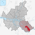
 Bergedorf in HH.svg 1,713 × 1,689; 780 KB
-
 Bergstedt in HH.svg 1,713 × 1,689; 780 KB
-
 Billbrook in HH.svg 1,713 × 1,689; 781 KB
-
 Billstedt in HH.svg 1,713 × 1,689; 780 KB
-
 Billwerder in HH.svg 1,713 × 1,689; 780 KB
-
 Blankenese in HH.svg 1,713 × 1,689; 780 KB
-
 Borgfelde in HH.svg 1,713 × 1,689; 780 KB
-
 Bramfeld in HH.svg 1,713 × 1,689; 780 KB
-
 Cranz in HH.svg 1,713 × 1,689; 780 KB
-
 Curslack in HH.svg 1,713 × 1,689; 780 KB
-
 Dulsberg in HH.svg 1,713 × 1,689; 780 KB
-
 Duvenstedt in HH.svg 1,713 × 1,689; 780 KB
-
 Eidelstedt in HH.svg 1,713 × 1,689; 780 KB
-
 Eilbek in HH.svg 1,713 × 1,689; 780 KB
-
 Eimsbüttel in HH.svg 1,713 × 1,689; 780 KB
-
 Eißendorf in HH.svg 1,713 × 1,689; 780 KB
-
 Eppendorf in HH.svg 1,713 × 1,689; 780 KB
-
 Farmsen-Berne in HH.svg 1,713 × 1,689; 780 KB
-
 Finkenwerder in HH.svg 1,713 × 1,689; 780 KB
-
 Francop in HH.svg 1,713 × 1,689; 780 KB
-
 Fuhlsbüttel in HH.svg 1,713 × 1,689; 780 KB
-
 Groß Borstel in HH.svg 1,713 × 1,689; 780 KB
-
 Groß Flottbek in HH.svg 1,713 × 1,689; 780 KB
-
 Gut Moor in HH.svg 1,713 × 1,689; 780 KB
-
 HafenCity in HH.svg 1,713 × 1,689; 780 KB
-
 Hamburg-Altstadt in HH.svg 1,713 × 1,689; 780 KB
-
 Hamm in HH.svg 1,713 × 1,689; 780 KB
-
 Hammerbrook in HH.svg 1,713 × 1,689; 780 KB
-
 Harburg in HH.svg 1,713 × 1,689; 780 KB
-
 Harvestehude in HH.svg 1,713 × 1,689; 780 KB
-
 Hausbruch in HH.svg 1,713 × 1,689; 780 KB
-
 Heimfeld in HH.svg 1,713 × 1,689; 780 KB
-
 Hoheluft in HH.svg 1,713 × 1,689; 780 KB
-
 Hoheluft-Ost in HH.svg 1,713 × 1,689; 780 KB
-
 Hoheluft-West in HH.svg 1,713 × 1,689; 780 KB
-
 Hohenfelde in HH.svg 1,713 × 1,689; 780 KB
-
 Horn in HH.svg 1,713 × 1,689; 781 KB
-
 Hummelsbüttel in HH.svg 1,713 × 1,689; 780 KB
-
 Iserbrook in HH.svg 1,713 × 1,689; 780 KB
-
 Jenfeld in HH.svg 1,713 × 1,689; 780 KB
-
 Kirchwerder in HH.svg 1,713 × 1,689; 780 KB
-
 Kleiner Grasbrook in HH.svg 1,713 × 1,689; 780 KB
-
 Langenbek in HH.svg 1,713 × 1,689; 780 KB
-
 Langenhorn in HH.svg 1,713 × 1,689; 780 KB
-
 Lemsahl-Mellingstedt in HH.svg 1,713 × 1,689; 780 KB
-
 Lohbrügge in HH.svg 1,713 × 1,689; 780 KB
-
 Lokstedt in HH.svg 1,713 × 1,689; 780 KB
-
 Lurup in HH.svg 1,713 × 1,689; 780 KB
-
 Marienthal in HH.svg 1,713 × 1,689; 780 KB
-
 Marmstorf in HH.svg 1,713 × 1,689; 780 KB
-
 Moorburg in HH.svg 1,713 × 1,689; 780 KB
-
 Moorfleet in HH.svg 1,713 × 1,689; 780 KB
-
 Neuallermöhe in HH.svg 1,713 × 1,689; 780 KB
-
 Neuenfelde in HH.svg 1,713 × 1,689; 780 KB
-
 Neuengamme in HH.svg 1,713 × 1,689; 780 KB
-
 Neugraben-Fischbek in HH.svg 1,713 × 1,689; 780 KB
-
 Neuland in HH.svg 1,713 × 1,689; 780 KB
-
 Neustadt in HH.svg 1,713 × 1,689; 780 KB
-
 Neuwerk in HH.svg 1,713 × 1,689; 780 KB
-
 Niendorf in HH.svg 1,713 × 1,689; 780 KB
-
 Nienstedten in HH.svg 1,713 × 1,689; 780 KB
-
 Ochsenwerder in HH.svg 1,713 × 1,689; 780 KB
-
 Ohlsdorf in HH.svg 1,713 × 1,689; 780 KB
-
 Osdorf in HH.svg 1,713 × 1,689; 780 KB
-
 Othmarschen in HH.svg 1,713 × 1,689; 780 KB
-
 Ottensen in HH.svg 1,713 × 1,689; 780 KB
-
 Poppenbüttel in HH.svg 1,713 × 1,689; 780 KB
-
 Rahlstedt in HH.svg 1,713 × 1,689; 780 KB
-
 Reitbrook in HH.svg 1,713 × 1,689; 780 KB
-
 Rissen in HH.svg 1,713 × 1,689; 780 KB
-
 Rothenburgsort in HH.svg 1,713 × 1,689; 780 KB
-
 Rotherbaum in HH.svg 1,713 × 1,689; 780 KB
-
 Rönneburg in HH.svg 1,713 × 1,689; 780 KB
-
 Sasel in HH.svg 1,713 × 1,689; 780 KB
-
 Schnelsen in HH.svg 1,713 × 1,689; 780 KB
-
 Sinstorf in HH.svg 1,713 × 1,689; 780 KB
-
 Spadenland in HH.svg 1,713 × 1,689; 780 KB
-
 St. Georg in HH.svg 1,713 × 1,689; 780 KB
-
 St. Pauli in HH.svg 1,713 × 1,689; 781 KB
-
 Steilshoop in HH.svg 1,713 × 1,689; 780 KB
-
 Steinwerder in HH.svg 1,713 × 1,689; 780 KB
-
 Stellingen in HH.svg 1,713 × 1,689; 780 KB
-
 Sternschanze in HH.svg 1,713 × 1,689; 780 KB
-
 Sülldorf in HH.svg 1,713 × 1,689; 780 KB
-
 Tatenberg in HH.svg 1,713 × 1,689; 780 KB
-
 Tonndorf in HH.svg 1,713 × 1,689; 780 KB
-
 Uhlenhorst in HH.svg 1,713 × 1,689; 780 KB
-
 Veddel in HH.svg 1,713 × 1,689; 780 KB
-
 Volksdorf in HH.svg 1,713 × 1,689; 780 KB
-
 Waltershof in HH.svg 1,713 × 1,689; 780 KB
-
 Wandsbek in HH.svg 1,713 × 1,689; 780 KB
-
 Wellingsbüttel in HH.svg 1,713 × 1,689; 780 KB
-
 Wilhelmsburg in HH.svg 1,713 × 1,689; 780 KB
-
 Wilstorf in HH.svg 1,713 × 1,689; 780 KB
-
 Winterhude in HH.svg 1,713 × 1,689; 780 KB
-
 Wohldorf-Ohlstedt in HH.svg 1,713 × 1,689; 780 KB


