Category:Locator maps of boroughs, villages, hamlets and neighbourhoods in Kreis Viersen
Jump to navigation
Jump to search
Media in category "Locator maps of boroughs, villages, hamlets and neighbourhoods in Kreis Viersen"
The following 18 files are in this category, out of 18 total.
-
 Positionskarte(KreisViersen-Amern).png 265 × 190; 6 KB
-
 Positionskarte(KreisViersen-Born).png 265 × 190; 5 KB
-
 Positionskarte(KreisViersen-Bracht).png 265 × 190; 6 KB
-
 Positionskarte(KreisViersen-Brempt).png 265 × 190; 6 KB
-
 Positionskarte(KreisViersen-Clörath).png 265 × 190; 6 KB
-
 Positionskarte(KreisViersen-Elmpt).png 265 × 190; 6 KB
-
 Positionskarte(KreisViersen-Hochbend).png 265 × 190; 6 KB
-
 Positionskarte(KreisViersen-Kehn).png 265 × 190; 6 KB
-
 Positionskarte(KreisViersen-Mülhausen).png 265 × 190; 6 KB
-
 Positionskarte(KreisViersen-Oedt).png 265 × 190; 6 KB
-
 Positionskarte(KreisViersen-Silverbeek).png 265 × 190; 6 KB
-
 Positionskarte(KreisViersen-StadtKrefeld-Holterhöfe).png 300 × 190; 7 KB
-
 Positionskarte(KreisViersen-StHubert).png 265 × 190; 6 KB
-
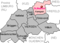
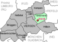
 Positionskarte(KreisViersen-Tönisberg).png 265 × 190; 6 KB
-
 Positionskarte(KreisViersen-Vennheide).png 265 × 190; 6 KB
-
 Positionskarte(KreisViersen-Vinkrath).png 265 × 190; 6 KB
-
 Positionskarte(KreisViersen-Vorst).png 265 × 190; 6 KB
-
 Positionskarte(KreisViersen-Waldniel).png 265 × 190; 6 KB
.png)
.png)
.png)
.png)
.png)
.png)
.png)
.png)
.png)
.png)
.png)
.png)
.png)
.png)
.png)
.png)
.png)
.png)