Category:Locator maps of autonomous communities of Spain (scheme 5)
Jump to navigation
Jump to search

|
All locator map images in this category could be re-created using vector graphics as SVG files. This has several advantages; see Commons:Media for cleanup for more information. If an SVG form of this image is available, please upload it and afterwards replace this template with
{{vector version available|new image name}}. |
Media in category "Locator maps of autonomous communities of Spain (scheme 5)"
The following 18 files are in this category, out of 18 total.
-
 Locator map of Andalusia.png 250 × 157; 5 KB
-
 Locator map of Aragon.png 250 × 157; 5 KB
-
 Locator map of Asturias.png 250 × 157; 5 KB
-
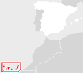
 Locator map of Balearic.png 250 × 157; 5 KB
-
 Locator map of Basque Country.png 250 × 157; 8 KB
-
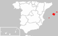
 Locator map of Canary.png 250 × 218; 8 KB
-
 Locator map of Cantabria.png 250 × 157; 5 KB
-
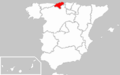
 Locator map of Castille-Leon.png 250 × 157; 5 KB
-
 Locator map of Castille-La Mancha.png 250 × 157; 5 KB
-
 Locator map of Catalonia.png 250 × 157; 5 KB
-
 Locator map of Extremadura.png 250 × 157; 5 KB
-
 Galicie-kaart.png 250 × 157; 10 KB
-
 Locator map of Galicia.png 250 × 157; 5 KB
-
 Locator map of La Rioja.png 250 × 157; 5 KB
-
 Locator map of Valenciana.png 250 × 157; 5 KB
-
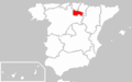
 Locator map of Madrid.png 250 × 157; 5 KB
-
 Locator map of Murcia.png 250 × 157; 5 KB
-
 Locator map of Navarre.png 250 × 157; 5 KB


