Category:Locator maps of arrondissements of Pas-de-Calais to 2018
Jump to navigation
Jump to search
Media in category "Locator maps of arrondissements of Pas-de-Calais to 2018"
The following 7 files are in this category, out of 7 total.
-
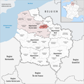
 Locator map of Arrondissement Arras.png 2,500 × 2,471; 1.65 MB
-
 Locator map of Arrondissement Boulogne-sur-Mer.png 2,500 × 2,471; 1.64 MB
-
 Locator map of Arrondissement Béthune.png 2,500 × 2,471; 1.64 MB
-
 Locator map of Arrondissement Calais.png 2,500 × 2,471; 1.64 MB
-
 Locator map of Arrondissement Lens.png 2,500 × 2,471; 1.64 MB
-
 Locator map of Arrondissement Montreuil.png 2,500 × 2,471; 1.65 MB
-
 Locator map of Arrondissement Saint-Omer.png 2,500 × 2,471; 1.64 MB


