Category:Locator maps of arrondissements of Isère to 2016
Jump to navigation
Jump to search
Media in category "Locator maps of arrondissements of Isère to 2016"
The following 12 files are in this category, out of 12 total.
-
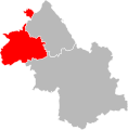
 Arrondissement de Grenoble.PNG 503 × 482; 19 KB
-
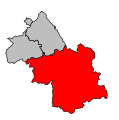
 Arrondissement de la Tour-du-Pin.PNG 503 × 482; 19 KB
-
 Arrondissement de Vienne.PNG 503 × 482; 19 KB
-
 Locator map of Arrondissement Grenoble 2016.png 2,500 × 1,995; 1.54 MB
-
 Isère - Grenoble arrondissement.svg 512 × 519; 10 KB
-
 Isère - La Tour-du-Pin arrondissement.svg 512 × 519; 10 KB
-
 Isère - Vienne arrondissement.svg 512 × 519; 10 KB
-
 Locator map of Arrondissement La Tour-du-Pin 2016.png 2,500 × 1,995; 1.53 MB
-
 Map arrondissement code 381.svg 453 × 456; 5 KB
-
 Map arrondissement code 382.svg 453 × 456; 5 KB
-
 Map arrondissement code 383.svg 453 × 456; 5 KB
-
 Locator map of Arrondissement Vienne 2016.png 2,500 × 1,995; 1.53 MB


