Category:Locator maps of arrondissements of Haut-Rhin to 2015
Jump to navigation
Jump to search
Media in category "Locator maps of arrondissements of Haut-Rhin to 2015"
The following 24 files are in this category, out of 24 total.
-
 Altkirch (Arrondissement) Plan.svg 299 × 508; 76 KB
-
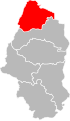
 Arrondissement d Altkirch.PNG 388 × 480; 12 KB
-
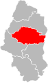
 Arrondissement de Colmar.PNG 388 × 480; 12 KB
-
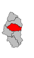
 Arrondissement de Guebwiller.PNG 388 × 480; 12 KB
-
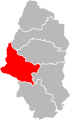
 Arrondissement de Mulhouse.PNG 388 × 480; 12 KB
-
 Arrondissement de Ribeauvillé.PNG 388 × 480; 12 KB
-
 Arrondissement de Thann.PNG 388 × 480; 12 KB
-
 Colmar (Arrondissement) Plan.svg 299 × 508; 76 KB
-
 Guebwiller (Arrondissement) Plan.svg 299 × 508; 76 KB
-
 Haut-Rhin - Altkirch arrondissement.svg 512 × 879; 10 KB
-
 Haut-Rhin - Colmar arrondissement.svg 512 × 879; 10 KB
-
 Haut-Rhin - Guebwiller arrondissement.svg 512 × 879; 10 KB
-
 Haut-Rhin - Mulhouse arrondissement.svg 512 × 879; 10 KB
-
 Haut-Rhin - Ribeauvillé arrondissement.svg 512 × 879; 10 KB
-
 Haut-Rhin - Thann arrondissement.svg 512 × 879; 10 KB
-
 Map arrondissement code 681.svg 269 × 456; 5 KB
-
 Map arrondissement code 682.svg 269 × 456; 5 KB
-
 Map arrondissement code 683.svg 269 × 456; 5 KB
-
 Map arrondissement code 684.svg 269 × 456; 5 KB
-
 Map arrondissement code 685.svg 269 × 456; 5 KB
-
 Map arrondissement code 686.svg 269 × 456; 5 KB
-
 Mulhouse (Arrondissement) Plan.svg 299 × 508; 76 KB
-
 Ribeauvillé (Arrondissement) Plan.svg 299 × 508; 76 KB
-
 Thann (Arrondissement) Plan.svg 299 × 508; 76 KB
_Plan.svg)


_Plan.svg)
_Plan.svg)


_Plan.svg)
_Plan.svg)
_Plan.svg)