Category:Locator maps of archaeological sites in Peru
Jump to navigation
Jump to search
Media in category "Locator maps of archaeological sites in Peru"
The following 15 files are in this category, out of 15 total.
-
 Armatambo location map.PNG 492 × 600; 51 KB
-
 Barranca und Caral 27.jpg 1,800 × 1,013; 365 KB
-
 EL Paraiso location Stared.png 512 × 624; 48 KB
-
 El Paraiso Location.png 256 × 312; 25 KB
-
 Huarmey location map.JPG 492 × 600; 23 KB
-
 Peru site locations.png 254 × 334; 35 KB
-
 Localização de El Brujo em Ascope.png 740 × 604; 88 KB
-
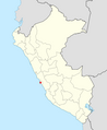
 Machu Picchu position.png 407 × 420; 13 KB
-
 Museo de sitio Pachacamac 20220402 141443 22.jpg 3,264 × 1,504; 1.88 MB
-
 Peru site locations Bandurria.png 254 × 334; 33 KB
-
 Plafó informatiu amb la ciutat antiga de Moche i Mapa de la Cultura Moche.jpg 3,968 × 2,976; 2.47 MB
-
 Localización de Sillustani.JPG 434 × 434; 42 KB
-
 Situació de Cumbe Mayo.jpg 2,976 × 3,968; 2.88 MB
-
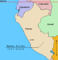
 UbicacionMachuPicchu.jpg 562 × 714; 80 KB
-


