Category:Locator maps of Yugoslavia
Jump to navigation
Jump to search
Subcategories
This category has the following 2 subcategories, out of 2 total.
Media in category "Locator maps of Yugoslavia"
The following 28 files are in this category, out of 28 total.
-
 Europe WWII 1942 locator map - Serbia.PNG 250 × 115; 6 KB
-
 Federal People's Republic of Yugoslavia. Socialist Federal Republic of Yugoslavia..png 3,560 × 2,816; 578 KB
-
 Federal Republic of Yugoslavia (1992).svg 450 × 456; 584 KB
-
 Gobierno Provisional para la Yugoslavia Federal Democrática.png 450 × 456; 50 KB
-
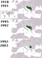
 History of Yugoslavia (tall).svg 450 × 1,380; 1.36 MB
-
 Independent State of Croatia (1942).svg 450 × 456; 593 KB
-
 Independent State of Croatia (1943).svg 450 × 456; 547 KB
-
 Independent State of Croatia-1942.svg 450 × 456; 500 KB
-
 Kingdom of Montenegro (1942).svg 450 × 456; 500 KB
-
 Kingdom of Yugoslavia 1920.png 1,950 × 1,647; 232 KB
-
 Kingdom of Yugoslavia 1930.svg 450 × 456; 474 KB
-
 Little Entente in Europe 1921-1938.png 2,000 × 2,027; 345 KB
-
 Location of Yugoslavia.png 250 × 115; 7 KB
-
 Location Yugoslavia.png 439 × 590; 148 KB
-
 LocationKingdom of Serbs& Croats and Slovenes.png 250 × 115; 7 KB
-
 LocationKingdomYugoslavia.PNG 250 × 115; 6 KB
-
 LocationYugoslavia.png 250 × 115; 6 KB
-
 LocationYugoslavia2.png 250 × 345; 13 KB
-
 Maps of Yugoslavia and FR Yugoslavia.svg 450 × 780; 1.06 MB
-
 Republic of Montenegro (1992).svg 450 × 456; 582 KB
-
 Republic of Serbia (1992).svg 450 × 456; 582 KB
-
 SFRYmap.PNG 1,600 × 1,200; 836 KB
-
 Locator map of the State of Slovenes, Croats and Serbs.svg 10,495 × 7,945; 334 KB
-
 Yugo3.jpg 250 × 345; 26 KB
-
 Yugoslavia 1945.png 1,920 × 1,946; 487 KB
-
 Yugoslavia 1956-1990.svg 450 × 456; 475 KB
-
 Yugoslavia location map.svg 450 × 521; 762 KB
-
 Zapadnijihoslovanske.jpg 683 × 384; 63 KB


.svg)

.svg)
.svg)

.svg)


.svg)
.svg)


.svg)