Category:Locator maps of Warstein
Jump to navigation
Jump to search
Media in category "Locator maps of Warstein"
The following 10 files are in this category, out of 10 total.
-
 Karte Warstein Ortsteil Allagen.png 984 × 1,000; 189 KB
-
 Karte Warstein Ortsteil Belecke.png 984 × 1,000; 186 KB
-
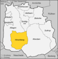 Karte Warstein Ortsteil Hirschberg.png 984 × 1,000; 186 KB
-
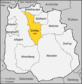
 Karte Warstein Ortsteil Mülheim.png 984 × 1,000; 185 KB
-
 Karte Warstein Ortsteil Niederbergheim.png 984 × 1,000; 186 KB
-
 Karte Warstein Ortsteil Sichtigvor.png 984 × 1,000; 187 KB
-
 Karte Warstein Ortsteil Suttrop.png 984 × 1,000; 186 KB
-
 Karte Warstein Ortsteil Waldhausen.png 984 × 1,000; 185 KB
-
 Karte Warstein Ortsteil Warstein.png 984 × 1,000; 187 KB
-
 Karte Warstein Ortsteile.png 984 × 1,000; 187 KB


