Category:Locator maps of South Kalimantan regencies
Jump to navigation
Jump to search
Media in category "Locator maps of South Kalimantan regencies"
The following 160 files are in this category, out of 160 total.
-
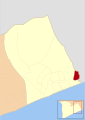
 63.00.00 KalimantanSelatan.svg 179 × 158; 863 KB
-
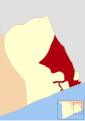
 63.01.00 KalimantanSelatan Tanah Laut.svg 179 × 158; 863 KB
-
 63.02.00 KalimantanSelatan Kotabaru.svg 179 × 158; 863 KB
-
 63.03.00 KalimantanSelatan Banjar.svg 179 × 158; 863 KB
-
 63.04.00 KalimantanSelatan Barito Kuala.svg 179 × 158; 863 KB
-
 63.05.00 KalimantanSelatan Tapin.svg 179 × 158; 863 KB
-
 63.06.00 KalimantanSelatan Hulu Sungai Selatan.svg 179 × 158; 863 KB
-
 63.07.00 KalimantanSelatan Hulu Sungai Tengah.svg 179 × 158; 863 KB
-
 63.08.00 KalimantanSelatan Hulu Sungai Utara.svg 179 × 158; 863 KB
-
 63.09.00 KalimantanSelatan Tabalong.svg 179 × 158; 863 KB
-
 63.10.00 KalimantanSelatan Tanah Bumbu.svg 179 × 158; 863 KB
-
 63.11.00 KalimantanSelatan Balangan.svg 179 × 158; 863 KB
-
 63.71.00 KalimantanSelatan Banjarmasin.svg 179 × 158; 863 KB
-
 63.72.00 KalimantanSelatan Banjarbaru.svg 179 × 158; 863 KB
-
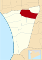
 Lokasi Kalimantan Selatan Kabupaten Tanah Laut.svg 744 × 1,053; 1.54 MB
-
 Lokasi Kecamatan Bajuin Desa Bajuin.svg 525 × 745; 70 KB
-
 Lokasi Kecamatan Bajuin Desa Galam.svg 525 × 745; 70 KB
-
 Lokasi Kecamatan Bajuin Desa Ketapang.svg 525 × 745; 70 KB
-
 Lokasi Kecamatan Bajuin Desa Kunyit.svg 525 × 745; 70 KB
-
 Lokasi Kecamatan Bajuin Desa Pamalongan.svg 525 × 745; 70 KB
-
 Lokasi Kecamatan Bajuin Desa Sungai Bakar.svg 525 × 745; 70 KB
-
 Lokasi Kecamatan Bajuin Desa Tanjung.svg 525 × 745; 70 KB
-
 Lokasi Kecamatan Bajuin Desa Tebing Siring.svg 525 × 745; 70 KB
-
 Lokasi Kecamatan Bajuin Desa Tirta Jaya.svg 525 × 745; 70 KB
-
 Lokasi Kecamatan Bati-Bati Desa Banyu Irang.svg 746 × 525; 124 KB
-
 Lokasi Kecamatan Bati-Bati Desa Bati-Bati.svg 746 × 525; 124 KB
-
 Lokasi Kecamatan Bati-Bati Desa Bentok Darat.svg 746 × 525; 122 KB
-
 Lokasi Kecamatan Bati-Bati Desa Bentok Kampung.svg 746 × 525; 117 KB
-
 Lokasi Kecamatan Bati-Bati Desa Benua Raya.svg 746 × 525; 117 KB
-
 Lokasi Kecamatan Bati-Bati Desa Kait-Kait Baru.svg 746 × 525; 116 KB
-
 Lokasi Kecamatan Bati-Bati Desa Kait-Kait.svg 746 × 525; 116 KB
-
 Lokasi Kecamatan Bati-Bati Desa Liang Anggang.svg 746 × 525; 110 KB
-
 Lokasi Kecamatan Bati-Bati Desa Nusa Indah.svg 746 × 525; 104 KB
-
 Lokasi Kecamatan Bati-Bati Desa Padang.svg 746 × 525; 108 KB
-
 Lokasi Kecamatan Bati-Bati Desa Pandahan.svg 746 × 525; 107 KB
-
 Lokasi Kecamatan Bati-Bati Desa Sambangan.svg 746 × 525; 105 KB
-
 Lokasi Kecamatan Bati-Bati Desa Ujung Baru.svg 746 × 525; 104 KB
-
 Lokasi Kecamatan Bati-Bati Desa Ujung.svg 746 × 525; 105 KB
-
 Lokasi Kecamatan Batu Ampar Desa Ambawang.svg 746 × 526; 172 KB
-
 Lokasi Kecamatan Batu Ampar Desa Batu Ampar.svg 746 × 526; 169 KB
-
 Lokasi Kecamatan Batu Ampar Desa Bluru.svg 746 × 526; 169 KB
-
 Lokasi Kecamatan Batu Ampar Desa Damar Lima.svg 746 × 526; 169 KB
-
 Lokasi Kecamatan Batu Ampar Desa Damit Hulu.svg 746 × 526; 169 KB
-
 Lokasi Kecamatan Batu Ampar Desa Damit.svg 746 × 526; 169 KB
-
 Lokasi Kecamatan Batu Ampar Desa Durian Bungkuk.svg 746 × 526; 169 KB
-
 Lokasi Kecamatan Batu Ampar Desa Gunung Mas.svg 746 × 526; 169 KB
-
 Lokasi Kecamatan Batu Ampar Desa Gunung Melati.svg 746 × 526; 169 KB
-
 Lokasi Kecamatan Batu Ampar Desa Jilatan Alur.svg 746 × 526; 169 KB
-
 Lokasi Kecamatan Batu Ampar Desa Jilatan.svg 746 × 526; 169 KB
-
 Lokasi Kecamatan Batu Ampar Desa Pantai Linuh.svg 746 × 526; 169 KB
-
 Lokasi Kecamatan Batu Ampar Desa Tajau Mulia.svg 746 × 526; 169 KB
-
 Lokasi Kecamatan Batu Ampar Desa Tajau Pecah.svg 746 × 526; 169 KB
-
 Lokasi Kecamatan Bumi Makmur Desa Handil Babirik.svg 1,057 × 748; 479 KB
-
 Lokasi Kecamatan Bumi Makmur Desa Handil Birayang Atas.svg 1,057 × 748; 479 KB
-
 Lokasi Kecamatan Bumi Makmur Desa Handil Birayang Bawah.svg 1,057 × 748; 479 KB
-
 Lokasi Kecamatan Bumi Makmur Desa Handil Gayam.svg 1,057 × 748; 479 KB
-
 Lokasi Kecamatan Bumi Makmur Desa Handil Labuan Amas.svg 1,057 × 748; 479 KB
-
 Lokasi Kecamatan Bumi Makmur Desa Handil Maluka.svg 1,057 × 748; 480 KB
-
 Lokasi Kecamatan Bumi Makmur Desa Handil Suruk.svg 1,057 × 748; 479 KB
-
 Lokasi Kecamatan Bumi Makmur Desa Kurau Utara.svg 1,057 × 748; 480 KB
-
 Lokasi Kecamatan Bumi Makmur Desa Pantai Harapan.svg 1,057 × 748; 480 KB
-
 Lokasi Kecamatan Bumi Makmur Desa Sungai Rasau.svg 1,057 × 748; 480 KB
-
 Lokasi Kecamatan Jorong Desa Alur.svg 746 × 527; 190 KB
-
 Lokasi Kecamatan Jorong Desa Asam Asam.svg 746 × 527; 190 KB
-
 Lokasi Kecamatan Jorong Desa Asam Jaya.svg 746 × 527; 190 KB
-
 Lokasi Kecamatan Jorong Desa Asri Mulia.svg 746 × 527; 190 KB
-
 Lokasi Kecamatan Jorong Desa Batalang.svg 746 × 527; 190 KB
-
 Lokasi Kecamatan Jorong Desa Jorong.svg 746 × 527; 190 KB
-
 Lokasi Kecamatan Jorong Desa Karang Rejo.svg 746 × 527; 190 KB
-
 Lokasi Kecamatan Jorong Desa Muara Asam Asam.svg 746 × 527; 190 KB
-
 Lokasi Kecamatan Jorong Desa Sabuhur.svg 746 × 527; 190 KB
-
 Lokasi Kecamatan Jorong Desa Simpang Empat Sungai Baru.svg 746 × 527; 190 KB
-
 Lokasi Kecamatan Jorong Desa Swarangan.svg 746 × 527; 190 KB
-
 Lokasi Kecamatan Kintap Desa Bukit Mulia.svg 525 × 743; 84 KB
-
 Lokasi Kecamatan Kintap Desa Kebun Raya.svg 525 × 743; 84 KB
-
 Lokasi Kecamatan Kintap Desa Kintap Kecil.svg 525 × 743; 84 KB
-
 Lokasi Kecamatan Kintap Desa Kintap.svg 525 × 743; 84 KB
-
 Lokasi Kecamatan Kintap Desa Kintapura.svg 525 × 743; 84 KB
-
 Lokasi Kecamatan Kintap Desa Mekar Sari.svg 525 × 743; 84 KB
-
 Lokasi Kecamatan Kintap Desa Muara Kintap.svg 525 × 743; 84 KB
-
 Lokasi Kecamatan Kintap Desa Pandansari.svg 525 × 743; 84 KB
-
 Lokasi Kecamatan Kintap Desa Pasir Putih.svg 525 × 743; 84 KB
-
 Lokasi Kecamatan Kintap Desa Riam Andungan.svg 525 × 743; 84 KB
-
 Lokasi Kecamatan Kintap Desa Salaman.svg 525 × 743; 84 KB
-
 Lokasi Kecamatan Kintap Desa Sebamban Baru.svg 525 × 743; 84 KB
-
 Lokasi Kecamatan Kintap Desa Sumber Jaya.svg 525 × 743; 84 KB
-
 Lokasi Kecamatan Kintap Desa Sungai Cuka.svg 525 × 743; 86 KB
-
 Lokasi Kecamatan Kurau Desa Bawah Layung.svg 525 × 744; 73 KB
-
 Lokasi Kecamatan Kurau Desa Handil Negara.svg 525 × 744; 73 KB
-
 Lokasi Kecamatan Kurau Desa Kali Besar.svg 525 × 744; 73 KB
-
 Lokasi Kecamatan Kurau Desa Kurau.svg 525 × 744; 73 KB
-
 Lokasi Kecamatan Kurau Desa Maluka Baulin.svg 525 × 744; 73 KB
-
 Lokasi Kecamatan Kurau Desa Padang Luas.svg 525 × 744; 73 KB
-
 Lokasi Kecamatan Kurau Desa Raden.svg 525 × 744; 73 KB
-
 Lokasi Kecamatan Kurau Desa Sarikandi.svg 525 × 744; 73 KB
-
 Lokasi Kecamatan Kurau Desa Sungai Bakau.svg 525 × 744; 73 KB
-
 Lokasi Kecamatan Kurau Desa Tambak Karya.svg 525 × 744; 73 KB
-
 Lokasi Kecamatan Kurau Desa Tambak Sarinah.svg 525 × 744; 73 KB
-
 Lokasi Kecamatan Panyipatan Desa Batakan.svg 525 × 744; 75 KB
-
 Lokasi Kecamatan Panyipatan Desa Batu Mulya.svg 525 × 744; 75 KB
-
 Lokasi Kecamatan Panyipatan Desa Batu Tungku.svg 525 × 744; 75 KB
-
 Lokasi Kecamatan Panyipatan Desa Bumi Asih.svg 525 × 744; 75 KB
-
 Lokasi Kecamatan Panyipatan Desa Kandangan Baru.svg 525 × 744; 73 KB
-
 Lokasi Kecamatan Panyipatan Desa Kandangan Lama.svg 525 × 744; 75 KB
-
 Lokasi Kecamatan Panyipatan Desa Kuringkit.svg 525 × 744; 75 KB
-
 Lokasi Kecamatan Panyipatan Desa Panyipatan.svg 525 × 744; 73 KB
-
 Lokasi Kecamatan Panyipatan Desa Suka Ramah.svg 525 × 744; 75 KB
-
 Lokasi Kecamatan Panyipatan Desa Tanjung Dewa.svg 525 × 744; 75 KB
-
 Lokasi Kecamatan Pelaihari Desa Ambungan.svg 525 × 745; 123 KB
-
 Lokasi Kecamatan Pelaihari Desa Atu Atu.svg 525 × 745; 127 KB
-
 Lokasi Kecamatan Pelaihari Desa Bumi Jaya.svg 525 × 745; 127 KB
-
 Lokasi Kecamatan Pelaihari Desa Guntung Besar.svg 525 × 745; 127 KB
-
 Lokasi Kecamatan Pelaihari Desa Kampung Baru.svg 525 × 745; 127 KB
-
 Lokasi Kecamatan Pelaihari Desa Panggung Baru.svg 525 × 745; 127 KB
-
 Lokasi Kecamatan Pelaihari Desa Panggung.svg 525 × 745; 127 KB
-
 Lokasi Kecamatan Pelaihari Desa Panjaratan.svg 525 × 745; 127 KB
-
 Lokasi Kecamatan Pelaihari Desa Pemuda.svg 525 × 745; 127 KB
-
 Lokasi Kecamatan Pelaihari Desa Sumber Mulia.svg 525 × 745; 127 KB
-
 Lokasi Kecamatan Pelaihari Desa Sungai Riam.svg 525 × 745; 127 KB
-
 Lokasi Kecamatan Pelaihari Desa Tampang.svg 525 × 745; 127 KB
-
 Lokasi Kecamatan Pelaihari Desa Telaga.svg 525 × 745; 127 KB
-
 Lokasi Kecamatan Pelaihari Desa Tungkaran.svg 525 × 745; 127 KB
-
 Lokasi Kecamatan Pelaihari Desa Ujung Batu.svg 525 × 745; 127 KB
-
 Lokasi Kecamatan Pelaihari Kelurahan Angsau.svg 525 × 745; 127 KB
-
 Lokasi Kecamatan Pelaihari Kelurahan Karang Taruna.svg 525 × 745; 127 KB
-
 Lokasi Kecamatan Pelaihari Kelurahan Pabahanan.svg 525 × 745; 127 KB
-
 Lokasi Kecamatan Pelaihari Kelurahan Pelaihari.svg 525 × 745; 127 KB
-
 Lokasi Kecamatan Pelaihari Kelurahan Sarang Halang.svg 525 × 745; 127 KB
-
 Lokasi Kecamatan Takisung Desa Batilai.svg 525 × 744; 87 KB
-
 Lokasi Kecamatan Takisung Desa Benua Lawas.svg 525 × 744; 87 KB
-
 Lokasi Kecamatan Takisung Desa Benua Tengah.svg 525 × 744; 87 KB
-
 Lokasi Kecamatan Takisung Desa Gunung Makmur.svg 525 × 744; 87 KB
-
 Lokasi Kecamatan Takisung Desa Kuala Tambangan.svg 525 × 744; 87 KB
-
 Lokasi Kecamatan Takisung Desa Pagatan Besar.svg 525 × 744; 87 KB
-
 Lokasi Kecamatan Takisung Desa Ranggang Dalam.svg 525 × 744; 87 KB
-
 Lokasi Kecamatan Takisung Desa Ranggang.svg 525 × 744; 87 KB
-
 Lokasi Kecamatan Takisung Desa Sumber Makmur.svg 525 × 744; 87 KB
-
 Lokasi Kecamatan Takisung Desa Tabanio.svg 525 × 744; 87 KB
-
 Lokasi Kecamatan Takisung Desa Takisung.svg 525 × 744; 87 KB
-
 Lokasi Kecamatan Takisung Desa Telaga Langsat.svg 525 × 744; 87 KB
-
 Lokasi Kecamatan Tambang Ulang Desa Bingkulu.svg 746 × 526; 59 KB
-
 Lokasi Kecamatan Tambang Ulang Desa Gunung Raja.svg 746 × 526; 59 KB
-
 Lokasi Kecamatan Tambang Ulang Desa Kayu Abang.svg 746 × 526; 59 KB
-
 Lokasi Kecamatan Tambang Ulang Desa Martadah Baru.svg 746 × 526; 59 KB
-
 Lokasi Kecamatan Tambang Ulang Desa Martadah.svg 746 × 526; 59 KB
-
 Lokasi Kecamatan Tambang Ulang Desa Pulau Sari.svg 746 × 526; 59 KB
-
 Lokasi Kecamatan Tambang Ulang Desa Sungai Jelai.svg 746 × 526; 59 KB
-
 Lokasi Kecamatan Tambang Ulang Desa Sungai Pinang.svg 746 × 526; 59 KB
-
 Lokasi Kecamatan Tambang Ulang Desa Tambang Ulang.svg 746 × 526; 59 KB
-
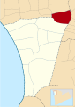
 Lokasi Tanah Laut Kecamatan Bajuin.svg 1,053 × 745; 113 KB
-
 Lokasi Tanah Laut Kecamatan Bati-Bati.svg 1,053 × 745; 115 KB
-
 Lokasi Tanah Laut Kecamatan Batu Ampar.svg 1,053 × 745; 114 KB
-
 Lokasi Tanah Laut Kecamatan Bumi Makmur.svg 1,053 × 745; 113 KB
-
 Lokasi Tanah Laut Kecamatan Jorong.svg 1,053 × 745; 114 KB
-
 Lokasi Tanah Laut Kecamatan Kintap.svg 1,053 × 745; 113 KB
-
 Lokasi Tanah Laut Kecamatan Kurau.svg 1,053 × 745; 113 KB
-
 Lokasi Tanah Laut Kecamatan Panyipatan.svg 1,053 × 745; 113 KB
-
 Lokasi Tanah Laut Kecamatan Pelaihari.svg 1,053 × 745; 114 KB
-
 Lokasi Tanah Laut Kecamatan Takisung.svg 1,053 × 745; 114 KB
-
 Lokasi Tanah Laut Kecamatan Tambang Ulang.svg 1,053 × 745; 113 KB


