Category:Locator maps of Patillas, Puerto Rico
Jump to navigation
Jump to search
Media in category "Locator maps of Patillas, Puerto Rico"
The following 18 files are in this category, out of 18 total.
-
 Apeadero, Patillas, Puerto Rico locator map.png 1,100 × 1,188; 129 KB
-
 Bajo, Patillas, Puerto Rico locator map.png 1,100 × 1,188; 129 KB
-
 Cacao Alto, Patillas, Puerto Rico locator map.png 1,100 × 1,188; 129 KB
-
 Cacao Bajo, Patillas, Puerto Rico locator map.png 1,100 × 1,188; 129 KB
-
 Egozcue, Patillas, Puerto Rico locator map.png 1,100 × 1,188; 129 KB
-
 Guardarraya, Patillas, Puerto Rico locator map.png 1,100 × 1,188; 129 KB
-
 Jacaboa, Patillas, Puerto Rico locator map.png 1,100 × 1,188; 129 KB
-
 Jagual, Patillas, Puerto Rico locator map.png 1,100 × 1,188; 129 KB
-
 Locator-map-Puerto-Rico-Patillas.svg 1,332 × 360; 97 KB
-
 Mamey, Patillas, Puerto Rico locator map.png 1,100 × 1,188; 129 KB
-
 Marín, Patillas, Puerto Rico locator map.png 1,100 × 1,188; 129 KB
-
 Mulas, Patillas, Puerto Rico locator map.png 1,100 × 1,188; 129 KB
-
 Muñoz Rivera, Patillas, Puerto Rico locator map.png 1,100 × 1,188; 129 KB
-
 Patillas barrio-pueblo, Patillas, Puerto Rico locator map.png 1,100 × 1,188; 129 KB
-
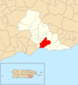
 Patillas, Puerto Rico locator map.png 1,103 × 909; 121 KB
-
 Pollos, Patillas, Puerto Rico locator map.png 1,100 × 1,188; 129 KB
-
 Quebrada Arriba, Patillas, Puerto Rico locator map.png 1,100 × 1,188; 129 KB
-
 Ríos, Patillas, Puerto Rico locator map.png 1,100 × 1,188; 129 KB


