Category:Locator maps of North America (gray and green scheme)
Jump to navigation
Jump to search
Subcategories
This category has the following 3 subcategories, out of 3 total.
Media in category "Locator maps of North America (gray and green scheme)"
The following 36 files are in this category, out of 36 total.
-
 5 nations attain independence in 1821 from Spain.png 250 × 115; 5 KB
-
 América do Norte.png 384 × 275; 43 KB
-
 LocationBelize.png 250 × 115; 6 KB
-
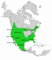 Bobcat distribution with subspecies.png 1,331 × 1,524; 484 KB
-
 BobcatSecond.jpg 1,331 × 1,524; 213 KB
-
 LocationCanada.png 250 × 115; 17 KB
-
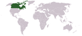
 Canada and USA.png 429 × 297; 8 KB
-
 CanadaWorldMap.png 1,427 × 628; 28 KB
-
 LocationCostaRica.png 250 × 115; 6 KB
-
 LocationCuba.png 250 × 115; 5 KB
-
 LocationDominicanRepublic.png 250 × 115; 5 KB
-
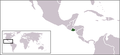 LocationElSalvador.png 250 × 115; 5 KB
-
 LocationGuatemala.png 250 × 115; 5 KB
-
 LocationHonduras.png 250 × 115; 6 KB
-
 Island nations.png 1,427 × 628; 56 KB
-
 LocationBahamas.png 250 × 115; 5 KB
-
 LocationCentralAmerica.png 2,759 × 1,404; 116 KB
-
 LocationNetherlandsAntillesWithAruba.png 250 × 115; 10 KB
-
 LocationNorthAmerica transparent.png 2,759 × 1,404; 43 KB
-
 LocationNorthAmerica.png 2,759 × 1,404; 43 KB
-
 LocationOECS.PNG 250 × 115; 7 KB
-
 Map-of-The-Bahamas-Map.gif 773 × 476; 43 KB
-
 MGA-members.PNG 684 × 687; 28 KB
-
 LocationNetherlandsAntilles.png 250 × 115; 10 KB
-
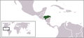
 LocationNicaragua.png 250 × 115; 6 KB
-
 Norteamerica.png 2,759 × 1,404; 82 KB
-
 North America 1320x1320.png 1,320 × 1,320; 6.66 MB
-
 North America Location.svg 496 × 261; 108 KB
-
 North America ortho.png 360 × 360; 68 KB
-
 LocationPanama.png 250 × 115; 6 KB
-
 SAAR27.png 650 × 540; 20 KB
-
 LocationSaintVincentAndTheGrenadines.png 250 × 115; 5 KB
-
 TinyNorthAmerica.png 85 × 48; 4 KB
-
 LocationUSA.png 1,427 × 628; 29 KB
-
 Wood turtle distribution.JPG 600 × 600; 63 KB
-
 WRCAI-map2.png 875 × 870; 116 KB


