Category:Locator maps of Maunabo, Puerto Rico
Jump to navigation
Jump to search
Media in category "Locator maps of Maunabo, Puerto Rico"
The following 12 files are in this category, out of 12 total.
-
 Calzada, Maunabo, Puerto Rico locator map.png 1,100 × 1,148; 102 KB
-
 Emajagua, Maunabo, Puerto Rico locator map.png 1,100 × 1,148; 103 KB
-
 Lizas, Maunabo, Puerto Rico locator map.png 1,100 × 1,148; 103 KB
-
 Locator-map-Puerto-Rico-Maunabo.svg 1,332 × 360; 97 KB
-
 Matuyas Alto, Maunabo, Puerto Rico locator map.png 1,100 × 1,148; 103 KB
-
 Matuyas Bajo, Maunabo, Puerto Rico locator map.png 1,100 × 1,148; 103 KB
-
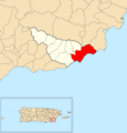
 Maunabo barrio-pueblo, Maunabo, Puerto Rico locator map.png 1,100 × 1,148; 102 KB
-
 Maunabo, Puerto Rico locator map.png 847 × 630; 59 KB
-
 Palo Seco, Maunabo, Puerto Rico locator map.png 1,100 × 1,148; 102 KB
-
 Quebrada Arenas, Maunabo, Puerto Rico locator map.png 1,100 × 1,148; 103 KB
-
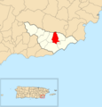 Talante, Maunabo, Puerto Rico locator map.png 1,100 × 1,148; 103 KB
-
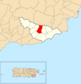 Tumbao, Maunabo, Puerto Rico locator map.png 1,100 × 1,148; 103 KB


