Category:Locator maps of Louisiana
Jump to navigation
Jump to search
States of the United States: Alabama · Alaska · Arizona · Arkansas · California · Colorado · Connecticut · Delaware · Florida · Georgia · Hawaii · Idaho · Illinois · Indiana · Iowa · Kansas · Kentucky · Louisiana · Maine · Maryland · Massachusetts · Michigan · Minnesota · Mississippi · Missouri · Montana · Nebraska · Nevada · New Hampshire · New Jersey · New Mexico · New York · North Carolina · North Dakota · Ohio · Oklahoma · Oregon · Pennsylvania · Rhode Island · South Carolina · South Dakota · Tennessee · Texas · Utah · Vermont · Virginia · Washington · West Virginia · Wisconsin · Wyoming – Washington, D.C.
insular area of the United States: American Samoa · Guam · Northern Mariana Islands · Puerto Rico · United States Virgin Islands – Baker Island · Howland Island · Jarvis Island · Johnston Atoll · Kingman Reef · Midway Atoll · Navassa Island · Palmyra Atoll · Wake Island
insular area of the United States: American Samoa · Guam · Northern Mariana Islands · Puerto Rico · United States Virgin Islands – Baker Island · Howland Island · Jarvis Island · Johnston Atoll · Kingman Reef · Midway Atoll · Navassa Island · Palmyra Atoll · Wake Island
Subcategories
This category has the following 3 subcategories, out of 3 total.
*
C
Media in category "Locator maps of Louisiana"
The following 5 files are in this category, out of 5 total.
-
 2012 Louisiana Democratic Primary by Parish.PNG 1,000 × 900; 143 KB
-
 Localización Nueva Iberia Luisiana.PNG 331 × 303; 14 KB
-
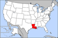 Map of USA highlighting Louisiana.png 280 × 183; 35 KB
-
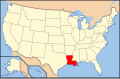 Map of USA LA.svg 286 × 186; 167 KB
-
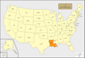 USA Names Louisiana.png 5,895 × 4,049; 1.51 MB


