Category:Locator maps of Indian reservations in the United States
Jump to navigation
Jump to search
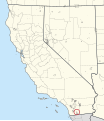
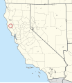
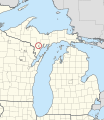
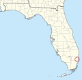
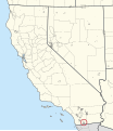
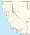
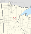
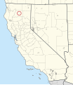
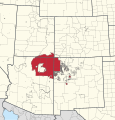
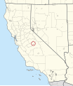
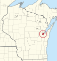
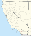
These are maps to show the location of Indian Reservations in the United States. These maps do not represent a complete list. For a more complete list, see List of Indian reservations in the United States.
Subcategories
This category has only the following subcategory.
Media in category "Locator maps of Indian reservations in the United States"
The following 200 files are in this category, out of 413 total.
(previous page) (next page)-
0010R Acoma Pueblo Locator Map.svg 1,181 × 1,331; 3.38 MB
-
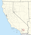
0020R Agua Caliente Indian Reservation Locator Map.svg 1,302 × 1,502; 4.28 MB
-
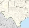
0050R Alabama-Coushatta Reservation Locator Map.svg 1,468 × 1,400; 11.61 MB
-
0080R Allegany Reservation Locator Map.svg 1,421 × 1,122; 13.13 MB
-
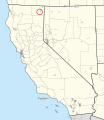
0095R Alturas Indian Rancheria Locator Map.svg 1,302 × 1,502; 4.23 MB
-
0115T Aroostook Band of Micmac Trust Land Locator Map.svg 979 × 1,483; 7.6 MB
-
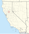
0120R Auburn Rancheria Locator Map.svg 1,302 × 1,502; 4.23 MB
-
0125R Augustine Reservation Locator Map.svg 1,302 × 1,502; 4.23 MB
-
0140R Bad River Reservation Locator Map.svg 1,210 × 1,283; 1.22 MB
-
0155R Barona Reservation Locator Map.svg 1,302 × 1,502; 4.23 MB
-
0165R Battle Mountain Reservation Locator Map.svg 1,064 × 1,572; 2.42 MB
-
0170R Bay Mills Reservation Locator Map.svg 1,240 × 1,426; 7.02 MB
-
0185R Benton Paiute Reservation Locator Map.svg 1,302 × 1,502; 4.23 MB
-
0200R Berry Creek Rancheria Locator Map.svg 1,302 × 1,502; 4.23 MB
-
0215R Big Bend Rancheria Locator Map.svg 1,302 × 1,502; 4.23 MB
-
0225R Big Cypress Reservation Locator Map.svg 1,310 × 1,264; 1.19 MB
-
0240R Big Lagoon Rancheria Locator Map.svg 1,302 × 1,502; 4.23 MB
-
0250R Big Pine Reservation Locator Map.svg 1,302 × 1,502; 4.23 MB
-
0265R Big Sandy Rancheria Locator Map.svg 1,302 × 1,502; 4.23 MB
-
0275R Big Valley Rancheria Locator Map.svg 1,302 × 1,502; 4.23 MB
-
0290R Bishop Reservation Locator Map.svg 1,302 × 1,502; 4.23 MB
-
0305R Blackfeet Indian Reservation Locator Map.svg 1,718 × 1,004; 16.87 MB
-
0325R Blue Lake Rancheria Locator Map.svg 1,302 × 1,502; 4.23 MB
-
0335R Bois Forte Reservation Locator Map.svg 1,253 × 1,377; 2.84 MB
-
0350R Bridgeport Reservation Locator Map.svg 1,302 × 1,502; 4.23 MB
-
0360R Brighton Reservation Locator Map.svg 1,310 × 1,264; 1.2 MB
-
0400R Burns Paiute Indian Colony Locator Map.svg 1,453 × 1,093; 1.76 MB
-
0415R Cabazon Reservation Locator Map.svg 1,302 × 1,502; 4.24 MB
-
0435R Cahuilla Reservation Locator Map.svg 1,302 × 1,502; 4.23 MB
-
0440R Campbell Ranch Locator Map.svg 1,064 × 1,572; 2.42 MB
-
0450R Campo Indian Reservation Locator Map.svg 1,302 × 1,502; 4.24 MB
-
0495R Capitan Grande Reservation Locator Map.svg 1,302 × 1,502; 4.24 MB
-
0510R Carson Colony Locator Map.svg 1,064 × 1,572; 2.42 MB
-
0525R Catawba Reservation Locator Map.svg 1,278 × 1,027; 1.47 MB
-
0540R Cattaraugus Reservation Locator Map.svg 1,421 × 1,122; 13.13 MB
-
0555R Cedarville Rancheria Locator Map.svg 1,302 × 1,502; 4.23 MB
-
0560T Celilo Village Locator Map.svg 1,453 × 1,093; 1.76 MB
-
0575R Chehalis Reservation Locator Map.svg 1,507 × 1,004; 7.13 MB
-
0585R Chemehuevi Reservation Locator Map.svg 1,302 × 1,502; 4.36 MB
-
0605R Cheyenne River Reservation Locator Map.svg 1,510 × 985; 1,010 KB
-
0620R Chicken Ranch Rancheria Locator Map.svg 1,302 × 1,502; 4.23 MB
-
0635R Chitimacha Reservation Locator Map.svg 1,238 × 1,136; 1.42 MB
-
0680R Pueblo de Cochiti Locator Map.svg 1,181 × 1,331; 3.35 MB
-
0690T Coconut Creek Trust Land Locator Map.svg 1,310 × 1,264; 1.19 MB
-
0695R Cocopah Reservation Locator Map.svg 1,150 × 1,357; 3.92 MB
-
0705R Coeur d'Alene Reservation Locator Map.svg 1,043 × 1,656; 6.5 MB
-
0720R Cold Springs Rancheria Locator Map.svg 1,302 × 1,502; 4.23 MB
-
0735R Colorado River Indian Reservation Locator Map.svg 1,563 × 1,368; 8.44 MB
-
0750R Colusa Rancheria Locator Map.svg 1,302 × 1,502; 4.23 MB
-
0760R Colville Reservation Locator Map.svg 1,507 × 1,004; 7.18 MB
-
0770R Coos, Lower Umpqua, and Siuslaw Reservation Locator Map.svg 1,453 × 1,093; 1.76 MB
-
0775R Coquille Reservation Locator Map.svg 1,453 × 1,093; 1.78 MB
-
0780R Cortina Indian Rancheria Locator Map.svg 1,302 × 1,502; 4.23 MB
-
0795R Coushatta Reservation Locator Map.svg 1,238 × 1,136; 1.41 MB
-
0815R Cow Creek Reservation Locator Map.svg 1,453 × 1,093; 1.79 MB
-
0820R Cowlitz Reservation Locator Map.svg 1,507 × 1,004; 7.12 MB
-
0825R Coyote Valley Reservation Locator Map.svg 1,302 × 1,502; 4.23 MB
-
0845R Crow Reservation Locator Map.svg 1,718 × 1,004; 16.83 MB
-
0855R Crow Creek Reservation Locator Map.svg 1,510 × 985; 977 KB
-
0940R Dresslerville Colony Locator Map.svg 1,064 × 1,572; 2.42 MB
-
0955R Dry Creek Rancheria Locator Map.svg 1,302 × 1,502; 4.23 MB
-
0965R Duck Valley Reservation Locator Map.svg 1,015 × 2,095; 15.49 MB
-
0975R Duckwater Reservation Locator Map.svg 1,064 × 1,572; 2.42 MB
-
0990R Eastern Cherokee Reservation Locator Map.svg 1,823 × 745; 3.35 MB
-
1005R Elko Colony Locator Map.svg 1,064 × 1,572; 2.42 MB
-
1010R Elk Valley Rancheria Locator Map.svg 1,302 × 1,502; 4.23 MB
-
1040R Ely Reservation Locator Map.svg 1,064 × 1,572; 2.42 MB
-
1055R Enterprise Rancheria Locator Map.svg 1,302 × 1,502; 4.23 MB
-
1065R Ewiiaapaayp Reservation Locator Map.svg 1,302 × 1,502; 4.23 MB
-
1070R Fallon Paiute-Shoshone Colony Locator Map.svg 1,064 × 1,572; 2.42 MB
-
1075R Fallon Paiute-Shoshone Reservation Locator Map.svg 1,064 × 1,572; 2.42 MB
-
1100R Flandreau Reservation Locator Map.svg 1,510 × 985; 981 KB
-
1110R Flathead Reservation Locator Map.svg 1,718 × 1,004; 16.88 MB
-
1125R Fond du Lac Reservation Locator Map.svg 1,253 × 1,377; 2.83 MB
-
1135R Forest County Potawatomi Community Locator Map.svg 1,210 × 1,283; 1.21 MB
-
1140R Fort Apache Reservation Locator Map.svg 1,150 × 1,357; 4.06 MB
-
1150R Fort Belknap Reservation Locator Map.svg 1,718 × 1,004; 16.9 MB
-
1160R Fort Berthold Reservation Locator Map.svg 1,528 × 954; 3 MB
-
1170R Fort Bidwell Reservation Locator Map.svg 1,302 × 1,502; 4.23 MB
-
1185R Fort Hall Reservation Locator Map.svg 1,043 × 1,656; 6.48 MB
-
1195R Fort Independence Reservation Locator Map.svg 1,302 × 1,502; 4.23 MB
-
1210R Fort McDermitt Indian Reservation Locator Map.svg 1,217 × 1,703; 9.39 MB
-
1220R Fort McDowell Yavapai Nation Reservation Locator Map.svg 1,150 × 1,357; 3.91 MB
-
1235R Fort Mojave Reservation Locator Map.svg 1,563 × 1,368; 8.46 MB
-
1250R Fort Peck Indian Reservation Locator Map.svg 1,718 × 1,004; 17.03 MB
-
1260R Fort Pierce Reservation Locator Map.svg 1,310 × 1,264; 1.19 MB
-
1270R Fort Sill Apache Indian Reservation Locator Map.svg 1,181 × 1,331; 3.35 MB
-
1280R Fort Yuma Indian Reservation Locator Map.svg 1,563 × 1,368; 8.45 MB
-
1310R Gila River Indian Reservation Locator Map.svg 1,150 × 1,357; 3.93 MB
-
1340R Goshute Reservation Locator Map.svg 1,492 × 1,232; 5.47 MB
-
1355R Grand Portage Reservation Locator Map.svg 1,253 × 1,377; 2.84 MB
-
1365R Grand Ronde Community Locator Map.svg 1,453 × 1,093; 1.77 MB
-
1370R Grand Traverse Reservation Locator Map.svg 1,240 × 1,426; 7.01 MB
-
1380R Greenville Rancheria Locator Map.svg 1,302 × 1,502; 4.23 MB
-
1395R Grindstone Indian Rancheria Locator Map.svg 1,302 × 1,502; 4.23 MB
-
1400R Guidiville Rancheria Locator Map.svg 1,302 × 1,502; 4.23 MB
-
1410R Hannahville Indian Community Locator Map.svg 1,240 × 1,426; 7.02 MB
-
1440R Havasupai Reservation Locator Map.svg 1,150 × 1,357; 3.92 MB
-
1450R Ho-Chunk Nation Reservation Locator Map.svg 1,210 × 1,283; 1.2 MB
-
1460R Hoh Indian Reservation Locator Map.svg 1,507 × 1,004; 7.12 MB
-
1475R Hollywood Reservation Locator Map.svg 1,310 × 1,264; 1.19 MB
-
1490R Hoopa Valley Reservation Locator Map.svg 1,302 × 1,502; 4.23 MB
-
1505R Hopi Reservation Locator Map.svg 1,150 × 1,357; 3.97 MB
-
1515R Hopland Rancheria Locator Map.svg 1,302 × 1,502; 4.23 MB
-
1530R Houlton Maliseet Reservation Locator Map.svg 979 × 1,483; 7.6 MB
-
1545R Hualapai Indian Reservation Locator Map.svg 1,150 × 1,357; 3.96 MB
-
1550R Huron Potawatomi Reservation Locator Map.svg 1,240 × 1,426; 7.01 MB
-
1555R Immokalee Reservation Locator Map.svg 1,310 × 1,264; 1.19 MB
-
1560R Inaja and Cosmit Reservation Locator Map.svg 1,302 × 1,502; 4.23 MB
-
1575R Indian Township Reservation Locator Map.svg 979 × 1,483; 7.6 MB
-
1590R Iowa (KS-NE) Reservation Locator Map.svg 1,442 × 1,208; 1.21 MB
-
1610R Isabella Reservation Locator Map.svg 1,240 × 1,426; 7.02 MB
-
1625R Isleta Pueblo Locator Map.svg 1,181 × 1,331; 3.37 MB
-
1640R Jackson Rancheria Locator Map.svg 1,302 × 1,502; 4.23 MB
-
1655R Jamestown S'Klallam Reservation Locator Map.svg 1,507 × 1,004; 7.12 MB
-
1670R Jamul Indian Village Locator Map.svg 1,302 × 1,502; 4.23 MB
-
1685R Jemez Pueblo Locator Map.svg 1,181 × 1,331; 3.36 MB
-
1690R Jena Band of Choctaw Reservation Locator Map.svg 1,238 × 1,136; 1.41 MB
-
1700R Jicarilla Apache Nation Reservation Locator Map.svg 1,181 × 1,331; 3.38 MB
-
1720R Kaibab Indian Reservation Locator Map.svg 1,150 × 1,357; 3.92 MB
-
1735R Kalispel Reservation Locator Map.svg 1,507 × 1,004; 7.13 MB
-
1750R Karuk Reservation Locator Map.svg 1,302 × 1,502; 4.23 MB
-
1770R Kickapoo (KS) Reservation Locator Map.svg 1,607 × 865; 546 KB
-
1775R Kickapoo (TX) Reservation Locator Map.svg 1,468 × 1,400; 11.61 MB
-
1785R Klamath Reservation Locator Map.svg 1,453 × 1,093; 1.77 MB
-
1800R Kootenai Reservation Locator Map.svg 1,043 × 1,656; 6.43 MB
-
1815R Lac Courte Oreilles Reservation Locator Map.svg 1,210 × 1,283; 1.22 MB
-
1825R Lac du Flambeau Reservation Locator Map.svg 1,210 × 1,283; 1.2 MB
-
1830R Lac Vieux Desert Reservation Locator Map.svg 1,240 × 1,426; 7.01 MB
-
1840R Laguna Pueblo Locator Map.svg 1,181 × 1,331; 3.41 MB
-
1850R La Jolla Reservation Locator Map.svg 1,302 × 1,502; 4.23 MB
-
1860R Lake Traverse Reservation Locator Map.svg 1,202 × 1,463; 5.57 MB
-
1880R L'Anse Reservation Locator Map.svg 1,240 × 1,426; 7.02 MB
-
1895R La Posta Indian Reservation Locator Map.svg 1,302 × 1,502; 4.23 MB
-
1915R Las Vegas Indian Colony Locator Map.svg 1,064 × 1,572; 2.42 MB
-
1925R Laytonville Rancheria Locator Map.svg 1,302 × 1,502; 4.23 MB
-
1940R Leech Lake Reservation Locator Map.svg 1,253 × 1,377; 2.97 MB
-
1955R Likely Rancheria Locator Map.svg 1,302 × 1,502; 4.23 MB
-
1960R Little River Reservation Locator Map.svg 1,240 × 1,426; 7.01 MB
-
1963R Little Traverse Bay Reservation Locator Map.svg 1,240 × 1,426; 7.01 MB
-
1970R Lone Pine Reservation Locator Map.svg 1,302 × 1,502; 4.23 MB
-
1980R Lookout Rancheria Locator Map.svg 1,302 × 1,502; 4.23 MB
-
1995R Los Coyotes Reservation Locator Map.svg 1,302 × 1,502; 4.23 MB
-
2015R Lovelock Indian Colony Locator Map.svg 1,064 × 1,572; 2.42 MB
-
2030R Lower Brule Reservation Locator Map.svg 1,510 × 985; 980 KB
-
2040R Lower Elwha Reservation Locator Map.svg 1,507 × 1,004; 7.13 MB
-
2055R Lower Sioux Indian Community Locator Map.svg 1,253 × 1,377; 2.82 MB
-
2070R Lummi Reservation Locator Map.svg 1,507 × 1,004; 7.12 MB
-
2075R Lytton Rancheria Locator Map.svg 1,302 × 1,502; 4.23 MB
-
2085R Makah Indian Reservation Locator Map.svg 1,507 × 1,004; 7.17 MB
-
2115R Manzanita Reservation Locator Map.svg 1,302 × 1,502; 4.23 MB
-
2130R Maricopa (Ak Chin) Indian Reservation Locator Map.svg 1,150 × 1,357; 3.92 MB
-
2145R Mashantucket Pequot Reservation Locator Map.svg 1,093 × 819; 333 KB
-
2147T Mashpee Wampanoag Trust Land Locator Map.svg 1,308 × 835; 689 KB
-
2150R Match-e-be-nash-she-wish Band of Pottawatomi Reservation Locator Map.svg 1,240 × 1,426; 7.01 MB
-
2175R Menominee Reservation Locator Map.svg 1,210 × 1,283; 1.2 MB
-
2190R Mesa Grande Reservation Locator Map.svg 1,302 × 1,502; 4.23 MB
-
2205R Mescalero Reservation Locator Map.svg 1,181 × 1,331; 3.35 MB
-
2240R Miccosukee Reservation Locator Map.svg 1,310 × 1,264; 1.19 MB
-
2255R Middletown Rancheria Locator Map.svg 1,302 × 1,502; 4.23 MB
-
2270R Mille Lacs Reservation Locator Map.svg 1,253 × 1,377; 2.88 MB
-
2285T Minnesota Chippewa Trust Land Locator Map.svg 1,253 × 1,377; 2.82 MB
-
2300R Mississippi Choctaw Reservation Locator Map.svg 935 × 1,478; 1.33 MB
-
2315R Moapa River Indian Reservation Locator Map.svg 1,064 × 1,572; 2.42 MB
-
2320R Mohegan Reservation Locator Map.svg 1,093 × 819; 321 KB
-
2330R Montgomery Creek Rancheria Locator Map.svg 1,302 × 1,502; 4.23 MB
-
2340R Mooretown Rancheria Locator Map.svg 1,302 × 1,502; 4.23 MB
-
2360R Morongo Reservation Locator Map.svg 1,302 × 1,502; 4.25 MB
-
2375R Muckleshoot Reservation Locator Map.svg 1,507 × 1,004; 7.12 MB
-
2400R Nambe Pueblo Locator Map.svg 1,181 × 1,331; 3.35 MB
-
2415R Narragansett Reservation Locator Map.svg 689 × 1,065; 226 KB
-
2430R Navajo Nation Reservation Locator Map.svg 1,412 × 1,472; 9.4 MB
-
2445R Nez Perce Reservation Locator Map.svg 1,043 × 1,656; 6.44 MB
-
2460R Nisqually Reservation Locator Map.svg 1,507 × 1,004; 7.12 MB
-
2475R Nooksack Reservation Locator Map.svg 1,507 × 1,004; 7.12 MB
-
2490R Northern Cheyenne Indian Reservation Locator Map.svg 1,718 × 1,004; 16.84 MB
-
2495R North Fork Rancheria Locator Map.svg 1,302 × 1,502; 4.23 MB
-
2505R Northwestern Shoshone Reservation Locator Map.svg 1,084 × 1,389; 2.66 MB
-
2510R Ohkay Owingeh Locator Map.svg 1,181 × 1,331; 3.35 MB
-
2535R Oil Springs Reservation Locator Map.svg 1,421 × 1,122; 13.13 MB
-
2550R Omaha Reservation Locator Map.svg 1,720 × 833; 794 KB
-
2555R Oneida Nation Reservation Locator Map.svg 1,421 × 1,122; 13.13 MB
-
2560R Oneida (WI) Reservation Locator Map.svg 1,210 × 1,283; 1.2 MB
-
2570R Onondaga Nation Reservation Locator Map.svg 1,421 × 1,122; 13.13 MB
-
2580R Ontonagon Reservation Locator Map.svg 1,240 × 1,426; 7.01 MB
-
2595R Osage Reservation Locator Map.svg 1,685 × 857; 836 KB
-
2625R Paiute (UT) Reservation Locator Map.svg 1,084 × 1,389; 2.67 MB
-
2635R Pala Reservation Locator Map.svg 1,302 × 1,502; 4.24 MB
-
2680R Pascua Pueblo Yaqui Reservation Locator Map.svg 1,150 × 1,357; 3.91 MB
-
2685R Paskenta Rancheria Locator Map.svg 1,302 × 1,502; 4.23 MB
-
2695T Passamaquoddy Trust Land Locator Map.svg 979 × 1,483; 7.69 MB
-
2715R Pauma and Yuima Reservation Locator Map.svg 1,302 × 1,502; 4.23 MB
-
2745R Pechanga Reservation Locator Map.svg 1,302 × 1,502; 4.23 MB
-
2760R Penobscot Reservation Locator Map.svg 979 × 1,483; 7.75 MB
-
2775R Picayune Rancheria Locator Map.svg 1,302 × 1,502; 4.23 MB
-
2785R Picuris Pueblo Locator Map.svg 1,181 × 1,331; 3.35 MB
-
2810R Pine Ridge Reservation Locator Map.svg 1,510 × 985; 1.04 MB
-
2820R Pinoleville Rancheria Locator Map.svg 1,302 × 1,502; 4.23 MB
-
2835T Pit River Trust Land Locator Map.svg 1,302 × 1,502; 4.23 MB
-
2850R Pleasant Point Reservation Locator Map.svg 979 × 1,483; 7.6 MB


