Category:Locator maps of Dautphetal
Jump to navigation
Jump to search
Media in category "Locator maps of Dautphetal"
The following 19 files are in this category, out of 19 total.
-
 Dautphetal in MR-BID.jpg 1,638 × 1,007; 193 KB
-
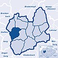
 Dautphetal-Übersichtskarte.png 2,086 × 2,305; 1.07 MB
-
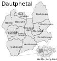 Karte der Gemeinde Dautphetal.svg 436 × 465; 179 KB
-
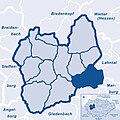
 Lage des Ortsteils Buchenau in der Gemeinde Dautphetal (Karte).png 908 × 968; 91 KB
-
 Lagekarte Allendorf.jpg 674 × 674; 89 KB
-
 Lagekarte Buchenau.jpg 674 × 674; 87 KB
-
 Lagekarte Damshausen.jpg 674 × 674; 88 KB
-
 Lagekarte Dautphe.jpg 674 × 674; 88 KB
-
 Lagekarte Elmshausen.jpg 674 × 674; 89 KB
-
 Lagekarte Friedensdorf.jpg 674 × 674; 88 KB
-
 Lagekarte Herzhausen.jpg 674 × 674; 88 KB
-
 Lagekarte Holzhausen.jpg 674 × 674; 87 KB
-
 Lagekarte Hommertshausen.jpg 674 × 674; 88 KB
-
 Lagekarte Mornshausen a.D..jpg 674 × 674; 88 KB
-
 Lagekarte Silberg.jpg 674 × 674; 88 KB
-
 Lagekarte Wolfgruben.jpg 674 × 674; 89 KB
-
 Location of Schloss Hohenfels (Hessen).png 1,018 × 732; 73 KB
-
 Marburg-Biedenkopf Dautphetal.png 1,033 × 712; 136 KB
-
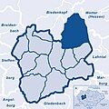
 Municipality borders of Dautphetal (Germany).png 1,119 × 1,000; 145 KB


.png)


.png)

.png)