Category:Locator maps of Danish islands
Jump to navigation
Jump to search
Subcategories
This category has only the following subcategory.
Media in category "Locator maps of Danish islands"
The following 33 files are in this category, out of 33 total.
-
 DK - Ærø.png 200 × 240; 28 KB
-
 DK - Als.PNG 449 × 557; 16 KB
-
 Karte Insel Als.jpg 330 × 354; 37 KB
-
 DK - Amagar.PNG 449 × 557; 16 KB
-
 DK - Anholt.PNG 449 × 557; 16 KB
-
 Bornholm Island.png 744 × 599; 113 KB
-
 Christiansø Administration (1970-2006).png 854 × 960; 329 KB
-
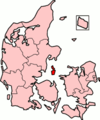
 DenmarkBornholm.png 200 × 240; 6 KB
-
 DenmarkBornholm1.png 326 × 240; 23 KB
-
 DenmarkBornholm2.png 326 × 240; 24 KB
-
 DenmarkFunen.png 200 × 240; 28 KB
-
 DenmarkVendsyssel.png 200 × 240; 27 KB
-
 DK-Ærø.PNG 449 × 557; 9 KB
-
 DK - Endelave.PNG 449 × 557; 16 KB
-
 DK - Falster.PNG 449 × 557; 16 KB
-
 Wadden - Fano.PNG 440 × 467; 14 KB
-
 DK - Funen.PNG 449 × 557; 16 KB
-
 Greenland Qeqertarsuaq.png 200 × 300; 4 KB
-
 DK - Laeso.PNG 449 × 557; 16 KB
-
 DK - Langeland.PNG 449 × 557; 16 KB
-
 DK - Lolland.PNG 449 × 557; 16 KB
-
 Wadden - Mando.PNG 440 × 467; 14 KB
-
 Map DK Bornholm.PNG 465 × 550; 19 KB
-
 DK - Mon.PNG 449 × 557; 16 KB
-
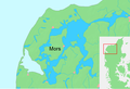 DK - Mors (text).PNG 791 × 543; 61 KB
-
 DK - Mors.PNG 791 × 543; 60 KB
-
 Northfrisianmap.png 554 × 551; 14 KB
-
 Wadden - Romo.PNG 440 × 467; 14 KB
-
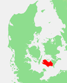
 DenmarkSamsø.png 200 × 240; 6 KB
-
 DK - Samso.PNG 449 × 557; 16 KB
-
 Waddeneilanden.PNG 554 × 551; 14 KB
-
 DenmarkZealand.png 200 × 240; 27 KB
-
 DK - Zealand.PNG 449 × 557; 16 KB


.png)


.PNG)


