Category:Locator maps of Culebra, Puerto Rico
Jump to navigation
Jump to search
Media in category "Locator maps of Culebra, Puerto Rico"
The following 12 files are in this category, out of 12 total.
-
 Culebra, Puerto Rico locator map.png 847 × 630; 20 KB
-
 Locator-map-Puerto-Rico-Culebra.svg 1,332 × 360; 97 KB
-
 Map of Culebra (non political).png 1,535 × 895; 156 KB
-
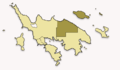
 Map of Culebra highlighting Culebra Pueblo.png 3,198 × 1,865; 344 KB
-
 Map of Culebra highlighting Dewey (Pueblo).jpg 768 × 448; 70 KB
-
 Map of Culebra highlighting Dewey (Pueblo).png 768 × 448; 29 KB
-
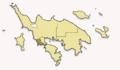
 Map of Culebra highlighting Flamenco.png 768 × 448; 32 KB
-
 Map of Culebra highlighting Fraile.png 768 × 448; 32 KB
-
 Map of Culebra highlighting Playa Sardina I.png 768 × 448; 31 KB
-
 Map of Culebra highlighting Playa Sardina II.png 768 × 448; 31 KB
-
 Map of Culebra highlighting San Isidro.png 768 × 448; 32 KB
-
 Map of Puerto Rico highlighting Culebra.svg 6,234 × 4,511; 66 KB

.png)

.jpg)
.png)


