Category:Locator maps of Brazil
Jump to navigation
Jump to search
Subcategories
This category has the following 8 subcategories, out of 8 total.
Media in category "Locator maps of Brazil"
The following 29 files are in this category, out of 29 total.
-
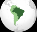
 BRA-orthographic.PNG 2,000 × 2,000; 653 KB
-
 BRAorthographic.PNG 2,000 × 1,700; 561 KB
-
 Brazil in South America.png 1,100 × 1,432; 38 KB
-
 Brazil locator map.png 330 × 354; 26 KB
-
 Brazil locator.png 451 × 466; 11 KB
-
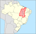
 Brazil Pernambuco location map (base cartográfica IBGE 2014).svg 1,351 × 543; 1.86 MB
-
 Brazil Pernambuco location map base cartográfica IBGE 2014.svg 1,351 × 543; 1.61 MB
-
 Brazil-Pos.png 330 × 399; 19 KB
-
 Brazilië lokatie.png 460 × 533; 11 KB
-
 BrazilWorldMap.png 1,427 × 628; 28 KB
-
 Campanha Cada Livro seu Público 2024 e Wiki encontro.png 524 × 654; 140 KB
-
 Centros patrianovistas conhecidos.png 8,263 × 8,263; 706 KB
-
 Delimitacaomatopibagite.png 889 × 831; 31 KB
-
 Igarapé Omerê Indigenous Territory location map.svg 1,039 × 678; 102 KB
-
 Indigenous Territories in Rondônia.svg 1,039 × 678; 120 KB
-
 Linhão de Tucuruí.png 630 × 440; 119 KB
-
 Localização São Sebastião Indaiá Petrópolis Brasil - PU1JFC.gif 800 × 468; 244 KB
-
 LocationBrazil.png 1,427 × 628; 47 KB
-
 LocationBrazil2.png 461 × 627; 9 KB
-
 LocMap of WH Brasilia ja.png 910 × 892; 13 KB
-
 LocMap of WH Brasilia.png 612 × 600; 63 KB
-
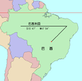
 Mapa h.jpg 600 × 631; 71 KB
-
 Parcerias GLAM-Wiki do WMB.jpg 604 × 604; 29 KB
-
 Range map Holoaden bradei.png 960 × 720; 527 KB
-
 Roraima Metro BoaVista.png 544 × 599; 75 KB
-
 South America location BRA.png 762 × 1,091; 385 KB
-
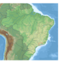
 Upper-Xingu-in-South-America.jpg 265 × 371; 59 KB
-
 Wiki encontros abril 2024.png 604 × 604; 124 KB
-
 Wiki encontros setembro 2024.png 557 × 542; 122 KB


.svg)