Category:Locator maps of Bezirk Perg
Jump to navigation
Jump to search
Media in category "Locator maps of Bezirk Perg"
The following 26 files are in this category, out of 26 total.
-
 Allerheiligen im Mühlkreis im Bezirk PE.png 645 × 645; 24 KB
-
 Arbing im Bezirk PE.png 645 × 645; 24 KB
-
 Bad Kreuzen im Bezirk PE.png 645 × 645; 24 KB
-
 Baumgartenberg im Bezirk PE.png 645 × 645; 24 KB
-
 Dimbach im Bezirk PE.png 645 × 645; 24 KB
-
 Grein im Bezirk PE.png 645 × 645; 24 KB
-
 Katsdorf im Bezirk PE.png 645 × 645; 24 KB
-
 Klam im Bezirk PE.png 645 × 645; 24 KB
-
 Langenstein im Bezirk PE.png 645 × 645; 24 KB
-
 Luftenberg an der Donau im Bezirk PE.png 645 × 645; 24 KB
-
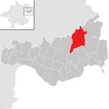
 Mauthausen im Bezirk PE.png 645 × 645; 24 KB
-
 Mitterkirchen im Machland im Bezirk PE.png 645 × 645; 24 KB
-
 Münzbach im Bezirk PE.png 645 × 645; 24 KB
-
 Naarn im Machlande im Bezirk PE.png 645 × 645; 24 KB
-
 Pabneukirchen im Bezirk PE.png 645 × 645; 24 KB
-
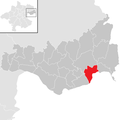
 Perg im Bezirk PE.png 645 × 645; 24 KB
-
 Rechberg im Bezirk PE.png 645 × 645; 24 KB
-
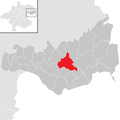
 Ried in der Riedmark im Bezirk PE.png 645 × 645; 24 KB
-
 Sankt Georgen am Walde im Bezirk PE.png 645 × 645; 24 KB
-
 Sankt Georgen an der Gusen im Bezirk PE.png 645 × 645; 24 KB
-
 Sankt Nikola an der Donau im Bezirk PE.png 645 × 645; 24 KB
-
 Sankt Thomas am Blasenstein im Bezirk PE.png 645 × 645; 24 KB
-
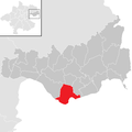
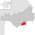 Saxen im Bezirk PE.png 645 × 645; 24 KB
-
 Schwertberg im Bezirk PE.png 645 × 645; 24 KB
-
 Waldhausen im Strudengau im Bezirk PE.png 645 × 645; 24 KB
-
 Windhaag bei Perg im Bezirk PE.png 645 × 645; 24 KB


