Category:Location maps of the Dutch Caribbean
Jump to navigation
Jump to search
- This category is for location maps of the Dutch Caribbean, consisting of Aruba, Curaçao, Sint Maarten, Bonaire, Sint Eustatius, and Saba.
 |
This category should only contain blank "Location maps" created for geo-location purposes which follow a same uniform standard, and have been created with a Geographic information system (GIS) software program using a compatible equirectangular or conical projection and for which the geographic coordinate system is known. For more information or questions see the wikiproject: German Wikipedia:Kartenwerkstatt/Positionskarten and this discussion page. |
Media in category "Location maps of the Dutch Caribbean"
The following 10 files are in this category, out of 10 total.
-
 ABC Islands location map.svg 2,200 × 1,100; 87 KB
-
 Aruba location map (2).svg 889 × 878; 397 KB
-
 Aruba location map.svg 2,200 × 1,100; 94 KB
-
 Aruba relief location map.jpg 888 × 878; 161 KB
-
 Curaçao location map.svg 994 × 1,016; 88 KB
-
 Netherlands Antilles (Leeward Islands) location map.svg 1,102 × 2,200; 42 KB
-
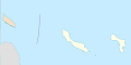 Netherlands Antilles (Windward Islands) location map.svg 2,200 × 1,100; 94 KB
-
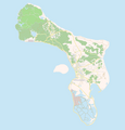 OSM Bonaire 2.png 1,948 × 2,033; 520 KB
-
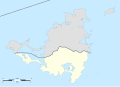 Sint Maarten location map.svg 1,175 × 849; 145 KB
-
 Sint Maarten relief location map.jpg 1,175 × 849; 161 KB

.svg)


_location_map.svg)
_location_map.svg)


