Category:Location maps of powiats in West Pomeranian Voivodeship
Jump to navigation
Jump to search
Media in category "Location maps of powiats in West Pomeranian Voivodeship"
The following 18 files are in this category, out of 18 total.
-
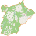
 Powiat białogardzki location map.png 1,112 × 864; 199 KB
-
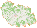
 Powiat choszczeński location map.png 1,240 × 1,003; 160 KB
-
 Powiat drawski location map.png 1,301 × 1,231; 192 KB
-
 Powiat goleniowski location map.png 1,409 × 1,049; 145 KB
-
 Powiat gryficki location map.png 884 × 1,097; 203 KB
-
 Powiat gryfiński location map.png 575 × 854; 167 KB
-
 Powiat kamieński location map.png 1,052 × 740; 204 KB
-
 Powiat koszaliński location map.png 1,522 × 1,136; 179 KB
-
 Powiat kołobrzeski location map.png 805 × 904; 199 KB
-
 Powiat myśliborski location map.png 1,337 × 1,138; 133 KB
-
 Powiat policki location map.png 569 × 1,289; 144 KB
-
 Powiat pyrzycki location map.png 817 × 778; 117 KB
-
 Powiat stargardzki location map.png 1,476 × 1,169; 166 KB
-
 Powiat szczecinecki location map.png 1,172 × 1,341; 178 KB
-
 Powiat sławieński location map.png 988 × 978; 200 KB
-
 Powiat wałecki location map.png 1,127 × 1,123; 160 KB
-
 Powiat łobeski location map.png 979 × 1,024; 218 KB
-
 Powiat świdwiński location map.png 1,104 × 834; 219 KB


