Category:Location maps of gminas in powiat turecki
Jump to navigation
Jump to search
Media in category "Location maps of gminas in powiat turecki"
The following 8 files are in this category, out of 8 total.
-
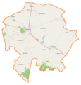
 Brudzew (gmina) location map.png 690 × 517; 78 KB
-
 Dobra (gmina w województwie wielkopolskim) location map.png 634 × 668; 87 KB
-
 Kawęczyn (gmina) location map.png 570 × 637; 75 KB
-
 Malanów (gmina) location map.png 579 × 680; 74 KB
-
 Przykona (gmina) location map.png 613 × 563; 73 KB
-
 Tuliszków (gmina) location map.png 695 × 726; 74 KB
-
 Turek (gmina wiejska) location map.png 698 × 646; 78 KB
-
 Władysławów (gmina) location map.png 616 × 572; 63 KB
_location_map.png)
_location_map.png)
_location_map.png)
_location_map.png)
_location_map.png)
_location_map.png)
_location_map.png)
_location_map.png)