Category:Location maps of gminas in powiat sokołowski
Jump to navigation
Jump to search
Media in category "Location maps of gminas in powiat sokołowski"
The following 8 files are in this category, out of 8 total.
-
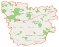
 Bielany (gmina) location map.png 1,104 × 625; 94 KB
-
 Ceranów (gmina) location map.png 925 × 738; 74 KB
-
 Jabłonna Lacka (gmina) location map.png 781 × 963; 87 KB
-
 Kosów Lacki (gmina) location map.png 821 × 973; 95 KB
-
 Repki (gmina) location map.png 985 × 789; 111 KB
-
 Sabnie (gmina) location map.png 847 × 724; 83 KB
-
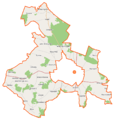 Sokołów Podlaski (gmina wiejska) location map.png 903 × 945; 98 KB
-
 Sterdyń (gmina) location map.png 929 × 836; 83 KB
_location_map.png)
_location_map.png)
_location_map.png)
_location_map.png)
_location_map.png)
_location_map.png)
_location_map.png)
_location_map.png)