Category:Location maps of gminas in powiat inowrocławski
Jump to navigation
Jump to search
Media in category "Location maps of gminas in powiat inowrocławski"
The following 8 files are in this category, out of 8 total.
-
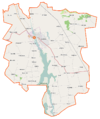
 Dąbrowa Biskupia (gmina) location map.png 1,026 × 838; 146 KB
-
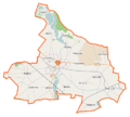
 Gniewkowo (gmina) location map.png 1,054 × 918; 114 KB
-
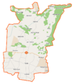
 Inowrocław (gmina wiejska) location map.png 957 × 998; 134 KB
-
 Janikowo (gmina) location map.png 803 × 676; 71 KB
-
 Kruszwica (gmina) location map.png 830 × 991; 112 KB
-
 Pakość (gmina) location map.png 826 × 741; 80 KB
-
 Rojewo (gmina) location map.png 788 × 896; 96 KB
-
 Złotniki Kujawskie (gmina) location map.png 971 × 906; 100 KB
_location_map.png)
_location_map.png)
_location_map.png)
_location_map.png)
_location_map.png)
_location_map.png)
_location_map.png)
_location_map.png)