Category:Location maps of gminas in powiat bydgoski
Jump to navigation
Jump to search
Media in category "Location maps of gminas in powiat bydgoski"
The following 8 files are in this category, out of 8 total.
-
 Białe Błota (gmina) location map.png 959 × 718; 134 KB
-
 Dobrcz (gmina) location map.png 895 × 965; 152 KB
-
 Dąbrowa Chełmińska (gmina) location map.png 846 × 916; 142 KB
-
 Koronowo (gmina) location map.png 769 × 784; 118 KB
-
 Nowa Wieś Wielka (gmina) location map.png 1,136 × 951; 117 KB
-
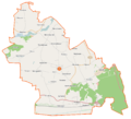
 Osielsko (gmina) location map.png 957 × 710; 112 KB
-
 Sicienko (gmina) location map.png 1,096 × 995; 121 KB
-
 Solec Kujawski (gmina) location map.png 1,212 × 819; 110 KB
_location_map.png)
_location_map.png)
_location_map.png)
_location_map.png)
_location_map.png)
_location_map.png)
_location_map.png)
_location_map.png)