Category:Location maps of gminas in powiat łosicki
Jump to navigation
Jump to search
Media in category "Location maps of gminas in powiat łosicki"
The following 6 files are in this category, out of 6 total.
-
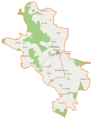
 Huszlew (gmina) location map.png 1,022 × 776; 119 KB
-
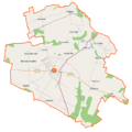
 Olszanka (gmina w województwie mazowieckim) location map.png 781 × 695; 91 KB
-
 Platerów (gmina) location map.png 792 × 1,016; 143 KB
-
 Sarnaki (gmina) location map.png 1,107 × 910; 261 KB
-
 Stara Kornica (gmina) location map.png 907 × 827; 117 KB
-
 Łosice (gmina) location map.png 818 × 816; 145 KB
_location_map.png)
_location_map.png)
_location_map.png)
_location_map.png)
_location_map.png)
_location_map.png)