Category:Location maps of gminas in Silesian Voivodeship
Jump to navigation
Jump to search
Media in category "Location maps of gminas in Silesian Voivodeship"
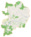
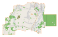
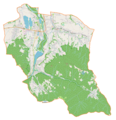
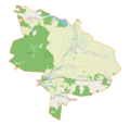
The following 107 files are in this category, out of 107 total.
-
 Bestwina (gmina) location map.png 1,725 × 2,309; 1.03 MB
-
 Blachownia (gmina) location map.png 2,456 × 1,613; 634 KB
-
 Bobrowniki (gmina w województwie śląskim) location map.png 2,072 × 1,928; 832 KB
-
 Bojszowy (gmina) location map.png 2,137 × 1,859; 590 KB
-
 Boronów (gmina) location map.png 2,078 × 1,872; 535 KB
-
 Buczkowice (gmina ) location map.png 2,205 × 1,778; 1.05 MB
-
 Chełm Śląski (gmina) location map.png 1,985 × 1,945; 811 KB
-
 Ciasna (gmina) location map.png 2,111 × 1,869; 643 KB
-
 Czernichów (gmina w województwie śląskim) location map.png 1,842 × 2,132; 893 KB
-
 Czerwionka-Leszczyny (gmina) location map.png 1,961 × 2,021; 1,001 KB
-
 Dąbrowa Zielona (gmina) location map.png 2,277 × 1,720; 413 KB
-
 Gaszowice (gmina) location map.png 2,058 × 1,896; 669 KB
-
 Gierałtowice (gmina) location map.png 1,921 × 2,080; 885 KB
-
 Gilowice (gmina) location map.png 2,177 × 1,836; 661 KB
-
 Gmina Koszęcin location map.png 1,987 × 1,988; 1.81 MB
-
 Gmina Krupski Młyn location map.png 2,096 × 1,846; 1.82 MB
-
 Gmina Ożarowice location map.png 1,976 × 1,924; 1.79 MB
-
 Gmina Tworóg location map.png 2,043 × 1,929; 2.1 MB
-
 Gmina Wielowieś location map.png 2,259 × 1,760; 1.76 MB
-
 Gmina Zbrosławice location map.png 1,769 × 2,236; 3.1 MB
-
 Gmina Świerklaniec location map.png 2,077 × 1,902; 5.33 MB
-
 Goczałkowice-Zdrój (gmina) location map.png 2,948 × 1,322; 440 KB
-
 Godów (gmina) location map.png 2,039 × 1,896; 776 KB
-
 Gorzyce (gmina w województwie śląskim) location map.png 2,456 × 1,580; 1.11 MB
-
 Herby (gmina) location map.png 2,177 × 1,805; 620 KB
-
 Irządze (gmina) location map.png 1,719 × 2,272; 381 KB
-
 Istebna (gmina) location map.png 2,078 × 1,894; 1.04 MB
-
 Janów (gmina w województwie śląskim) location map.png 2,123 × 1,875; 767 KB
-
 Jasienica (gmina) location map.png 2,004 × 1,957; 1.24 MB
-
 Jaworze (gmina) location map.png 1,696 × 2,338; 996 KB
-
 Jejkowice (gmina) location map.png 1,637 × 2,272; 594 KB
-
 Jeleśnia (gmina) location map.png 2,032 × 1,949; 815 KB
-
 Kamienica Polska (gmina) location map.png 2,241 × 1,738; 421 KB
-
 Kobiór (gmina) location map.png 2,817 × 1,415; 485 KB
-
 Kochanowice (gmina) location map.png 2,259 × 1,727; 667 KB
-
 Koniecpol (gmina) location map.png 2,007 × 1,960; 638 KB
-
 Konopiska (gmina) location map.png 1,930 × 2,045; 666 KB
-
 Kornowac (gmina) location map.png 2,289 × 1,693; 702 KB
-
 Koszarawa (gmina) location map.png 2,025 × 1,974; 676 KB
-
 Koziegłowy (gmina) location map.png 2,061 × 1,938; 728 KB
-
 Kozy (gmina) location map.png 1,663 × 2,398; 1.13 MB
-
 Kroczyce (gmina) location map.png 2,135 × 1,832; 692 KB
-
 Kruszyna (gmina) location map.png 2,231 × 1,767; 646 KB
-
 Krzepice (gmina) location map.png 2,071 × 1,907; 548 KB
-
 Krzyżanowice (gmina) location map.png 1,860 × 2,107; 595 KB
-
 Kuźnia Raciborska (gmina) location map.png 2,510 × 1,590; 749 KB
-
 Kłobuck (gmina) location map.png 2,267 × 1,738; 666 KB
-
 Kłomnice (gmina) location map.png 2,115 × 1,881; 634 KB
-
 Lelów (gmina) location map.png 2,157 × 1,826; 566 KB
-
 Lipie (gmina) location map.png 2,421 × 1,620; 527 KB
-
 Lipowa (gmina) location map.png 2,255 × 1,745; 644 KB
-
 Lubomia (gmina) location map.png 2,129 × 1,850; 810 KB
-
 Lyski (gmina) location map.png 2,345 × 1,691; 765 KB
-
 Marklowice (gmina) location map.png 1,915 × 2,006; 770 KB
-
 Miedźna (gmina) location map.png 1,920 × 2,030; 644 KB
-
 Miedźno (gmina) location map.png 2,485 × 1,600; 491 KB
-
 Mierzęcice (gmina) location map.png 1,727 × 2,273; 492 KB
-
 Milówka (gmina) location map.png 2,202 × 1,813; 843 KB
-
 Mstów (gmina) location map.png 2,522 × 1,575; 614 KB
-
 Mszana (gmina) location map.png 2,090 × 1,893; 839 KB
-
 Mykanów (gmina) location map.png 1,960 × 2,001; 647 KB
-
 Niegowa (gmina) location map.png 2,488 × 1,575; 557 KB
-
 Nędza (gmina) location map.png 2,405 × 1,629; 705 KB
-
 Ogrodzieniec (gmina) location map.png 2,157 × 1,822; 680 KB
-
 Olsztyn (gmina wiejska) location map.png 2,084 × 1,904; 710 KB
-
 Opatów (gmina w województwie śląskim) location map.png 2,031 × 1,921; 380 KB
-
 Ornontowice (gmina) location map.png 1,836 × 2,153; 1.04 MB
-
 Panki (gmina) location map.png 1,784 × 2,192; 437 KB
-
 Pawonków (gmina) location map.png 1,862 × 2,145; 684 KB
-
 Pawłowice (gmina) location map.png 1,673 × 2,370; 733 KB
-
 Pietrowice Wielkie (gmina) location map.png 1,684 × 2,360; 530 KB
-
 Pilchowice (gmina) location map.png 2,081 × 1,902; 812 KB
-
 Pilica (gmina) location map.png 1,839 × 2,172; 642 KB
-
 Poczesna (gmina) location map.png 2,506 × 1,578; 604 KB
-
 Popów (gmina) location map.png 2,149 × 1,859; 454 KB
-
 Poraj (gmina) location map.png 1,886 × 2,076; 556 KB
-
 Porąbka (gmina) location map.png 1,954 × 2,029; 1.25 MB
-
 Przyrów (gmina) location map.png 2,026 × 1,945; 524 KB
-
 Przystajń (gmina) location map.png 1,775 × 2,246; 477 KB
-
 Psary (gmina) location map.png 2,163 × 1,799; 952 KB
-
 Pszczyna (gmina) location map.png 2,345 × 1,691; 927 KB
-
 Radziechowy-Wieprz (gmina) location map.png 2,631 × 1,497; 577 KB
-
 Rajcza (gmina) location map.png 2,009 × 1,986; 878 KB
-
 Rudnik (gmina w województwie śląskim) location map.png 2,383 × 1,645; 468 KB
-
 Rudziniec (gmina) location map.png 2,084 × 1,884; 842 KB
-
 Rędziny (gmina) location map.png 1,910 × 2,036; 438 KB
-
 Siewierz (gmina) location map.png 1,806 × 2,189; 790 KB
-
 Sośnicowice (gmina) location map.png 1,913 × 2,069; 771 KB
-
 Starcza (gmina) location map.png 2,069 × 1,847; 310 KB
-
 Suszec (gmina) location map.png 2,047 × 1,910; 750 KB
-
 Szczekociny (gmina) location map.png 1,760 × 2,234; 510 KB
-
 Toszek (gmina) location map.png 2,316 × 1,701; 683 KB
-
 Ujsoły (gmina) location map.png 1,944 × 2,012; 626 KB
-
 Wilamowice (gmina) location map.png 1,867 × 2,140; 1.22 MB
-
 Wilkowice (gmina) location map.png 2,442 × 1,633; 764 KB
-
 Woźniki (gmina) location map.png 1,643 × 2,409; 829 KB
-
 Wyry (gmina) location map.png 2,131 × 1,847; 606 KB
-
 Węgierska Górka (gmina) location map.png 2,058 × 1,896; 923 KB
-
 Włodowice (gmina) location map.png 2,047 × 1,945; 612 KB
-
 Łazy (gmina) location map.png 2,290 × 1,712; 811 KB
-
 Łodygowice (gmina) location map.png 1,672 × 2,352; 1.21 MB
-
 Łękawica (gmina) location map.png 2,157 × 1,852; 640 KB
-
 Ślemień (gmina) location map.png 1,910 × 2,052; 522 KB
-
 Świerklany (gmina) location map.png 1,943 × 2,034; 907 KB
-
 Świnna (gmina) location map.png 2,394 × 1,652; 612 KB
-
 Żarki (gmina) location map.png 2,291 × 1,733; 627 KB
-
 Żarnowiec (gmina) location map.png 2,137 × 1,844; 428 KB
_location_map.png)
_location_map.png)
_location_map.png)
_location_map.png)
_location_map.png)
_location_map.png)
_location_map.png)
_location_map.png)
_location_map.png)
_location_map.png)
_location_map.png)
_location_map.png)
_location_map.png)
_location_map.png)


_location_map.png)
_location_map.png)
_location_map.png)
_location_map.png)
_location_map.png)
_location_map.png)
_location_map.png)
_location_map.png)
_location_map.png)
_location_map.png)
_location_map.png)
_location_map.png)
_location_map.png)
_location_map.png)
_location_map.png)
_location_map.png)
_location_map.png)
_location_map.png)
_location_map.png)
_location_map.png)
_location_map.png)
_location_map.png)
_location_map.png)
_location_map.png)
_location_map.png)
_location_map.png)
_location_map.png)
_location_map.png)
_location_map.png)
_location_map.png)
_location_map.png)
_location_map.png)
_location_map.png)
_location_map.png)
_location_map.png)
_location_map.png)
_location_map.png)
_location_map.png)
_location_map.png)
_location_map.png)
_location_map.png)
_location_map.png)
_location_map.png)
_location_map.png)
_location_map.png)
_location_map.png)
_location_map.png)
_location_map.png)
_location_map.png)
_location_map.png)
_location_map.png)
_location_map.png)
_location_map.png)
_location_map.png)
_location_map.png)
_location_map.png)
_location_map.png)
_location_map.png)
_location_map.png)
_location_map.png)
_location_map.png)
_location_map.png)
_location_map.png)
_location_map.png)
_location_map.png)
_location_map.png)
_location_map.png)
_location_map.png)
_location_map.png)
_location_map.png)
_location_map.png)
_location_map.png)
_location_map.png)
_location_map.png)
_location_map.png)
_location_map.png)
_location_map.png)
_location_map.png)
_location_map.png)
_location_map.png)
_location_map.png)
_location_map.png)
_location_map.png)
_location_map.png)
_location_map.png)
_location_map.png)