Category:Location maps of districts in Gnarrenburg
Jump to navigation
Jump to search
Media in category "Location maps of districts in Gnarrenburg"
The following 13 files are in this category, out of 13 total.
-
 Augustendorf in Gnarrenburg.svg 700 × 700; 16 KB
-
 Barkhausen in Gnarrenburg.svg 700 × 700; 17 KB
-
 Brillit in Gnarrenburg.svg 700 × 700; 16 KB
-
 Fahrendorf in Gnarrenburg.svg 700 × 700; 16 KB
-
 Findorf in Gnarrenburg.svg 700 × 700; 17 KB
-
 Glinstedt in Gnarrenburg.svg 700 × 700; 16 KB
-
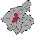 Gnarrenburg in Gnarrenburg.svg 700 × 700; 16 KB
-
 Karlshöfen in Gnarrenburg.svg 700 × 700; 16 KB
-
 Klenkendorf in Gnarrenburg.svg 700 × 700; 16 KB
-
 Kuhstedt in Gnarrenburg.svg 700 × 700; 16 KB
-
 Kuhstedtermoor in Gnarrenburg.svg 700 × 700; 16 KB
-
 Langenhausen in Gnarrenburg.svg 700 × 700; 16 KB
-
 Ortschaften Gnarrenburg Blanko.svg 700 × 700; 15 KB


