Category:Location maps of Valle del Cauca Department
Jump to navigation
Jump to search
 |
This category should only contain blank "Location maps" created for geo-location purposes which follow a same uniform standard, and have been created with a Geographic information system (GIS) software program using a compatible equirectangular or conical projection and for which the geographic coordinate system is known. For more information or questions see the wikiproject: German Wikipedia:Kartenwerkstatt/Positionskarten and this discussion page. |
Media in category "Location maps of Valle del Cauca Department"
The following 15 files are in this category, out of 15 total.
-
 Colombia Valle del Cauca location map (+locator map).svg 1,142 × 1,203; 487 KB
-
 Colombia Valle del Cauca location map (+urban areas +locator map).svg 1,142 × 1,203; 514 KB
-
 Colombia Valle del Cauca location map (+urban areas).svg 1,142 × 1,203; 321 KB
-
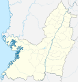
 Colombia Valle del Cauca location map (adm +urban areas +locator map).svg 1,142 × 1,203; 456 KB
-
 Colombia Valle del Cauca location map (adm +urban areas).svg 1,142 × 1,203; 264 KB
-
 Colombia Valle del Cauca location map (adm colored).svg 1,142 × 1,203; 457 KB
-
 Colombia Valle del Cauca location map 2 (+locator map).svg 1,142 × 1,203; 487 KB
-
 Colombia Valle del Cauca location map 2 (+urban areas +locator map).svg 1,142 × 1,203; 514 KB
-
 Colombia Valle del Cauca location map 2 (+urban areas).svg 1,142 × 1,203; 321 KB
-
 Colombia Valle del Cauca location map 2 (adm +urban areas +locator map).svg 1,142 × 1,203; 456 KB
-
 Colombia Valle del Cauca location map 2 (adm +urban areas).svg 1,142 × 1,203; 264 KB
-
 Colombia Valle del Cauca location map 2.svg 1,142 × 1,203; 294 KB
-
 Colombia Valle del Cauca location map.svg 1,142 × 1,203; 294 KB
-
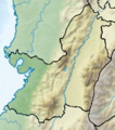
 Valle del Cauca Topographic 2.png 1,350 × 1,436; 4.43 MB
-
 Valle del Cauca Topographic.png 207 × 234; 88 KB
.svg)
.svg)
.svg)
.svg)
.svg)
.svg)
.svg)
.svg)
.svg)
.svg)
.svg)


