Category:Location maps of Tibet Autonomous Region
Jump to navigation
Jump to search
 |
This category should only contain blank "Location maps" created for geo-location purposes which follow a same uniform standard, and have been created with a Geographic information system (GIS) software program using a compatible equirectangular or conical projection and for which the geographic coordinate system is known. For more information or questions see the wikiproject: German Wikipedia:Kartenwerkstatt/Positionskarten and this discussion page. |
Media in category "Location maps of Tibet Autonomous Region"
The following 7 files are in this category, out of 7 total.
-
 China Tibet Autonomous Region adm location map.svg 2,013 × 1,137; 510 KB
-
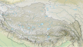 China Tibet Autonomous Region rel location map.svg 2,013 × 1,137; 1.31 MB
-
 China Tibet location map.svg 2,013 × 1,137; 465 KB
-
 China Tibet Ngari location map.svg 850 × 1,137; 507 KB
-
 China Tibet Ngari relief location map.svg 850 × 1,137; 733 KB
-
 Greater Tibet locator map.svg 1,181 × 940; 2.6 MB
-
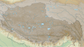 Tibet loc rel map.svg 2,013 × 1,137; 5.86 MB


