Category:Location maps of Russian Federal Districts
Jump to navigation
Jump to search
Wikimedia category | |||||
| Upload media | |||||
| Instance of |
| ||||
|---|---|---|---|---|---|
| Category combines topics | |||||
| Category contains | |||||
| |||||
Media in category "Location maps of Russian Federal Districts"
The following 23 files are in this category, out of 23 total.
-
Outline Map of Central Russia.svg 684 × 719; 615 KB
-
Relief Map of Central Russia.png 684 × 719; 1.03 MB
-
Outline Map of North Caucasian Federal District.svg 600 × 532; 953 KB
-
Relief Map of North Caucasian Federal District.jpg 1,200 × 1,064; 300 KB
-
Relief Map of North Caucasian Federal District.svg 600 × 532; 1.08 MB
-
Outline Map of Far Eastern Federal District.svg 1,000 × 862; 2.35 MB
-
Outline Map of Northwestern Federal District.svg 1,000 × 1,244; 2.57 MB
-
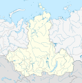
Outline Map of Siberian Federal District (2018).svg 1,033 × 1,045; 643 KB
-
Outline Map of Siberian Federal District.svg 1,033 × 1,045; 664 KB
-
Outline Map of Southern Federal District (Crimea disputed).svg 1,136 × 872; 1.64 MB
-
Outline Map of Volga Federal District.svg 1,000 × 989; 528 KB
-
Relief Map of Far Eastern Federal District (Sikhote-Alin).jpg 219 × 277; 52 KB
-
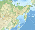
Relief Map of Far Eastern Federal District.jpg 1,200 × 1,034; 323 KB
-
Relief Map of Northwestern Federal District.jpg 1,200 × 1,493; 392 KB
-
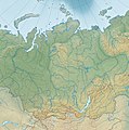
Relief Map of Siberian Federal District.jpg 1,595 × 1,614; 1.07 MB
-
Relief Map of Southern Federal District-(Crimea disputed).jpg 1,200 × 921; 550 KB
-
Relief Map of Volga Federal District.jpg 1,500 × 1,483; 459 KB
-
Outline Map of Southern Federal District.svg 600 × 540; 898 KB
-
Relief Map of Southern Federal District.jpg 1,200 × 1,080; 287 KB
-
Relief Map of Southern Federal District.svg 600 × 540; 898 KB
-
Outline map of Urals Federal District.svg 447 × 600; 538 KB
-
Relief map of Urals Federal District.jpg 893 × 1,200; 420 KB
-
Relief map of Urals Federal District.svg 447 × 600; 4.59 MB


