Category:Location maps of Malaysia
Jump to navigation
Jump to search
 |
This category should only contain blank "Location maps" created for geo-location purposes which follow a same uniform standard, and have been created with a Geographic information system (GIS) software program using a compatible equirectangular or conical projection and for which the geographic coordinate system is known. For more information or questions see the wikiproject: German Wikipedia:Kartenwerkstatt/Positionskarten and this discussion page. |
Media in category "Location maps of Malaysia"
The following 10 files are in this category, out of 10 total.
-
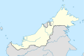
 East Malaysia location map with districts.svg 686 × 457; 999 KB
-
 East Malaysia location map.svg 686 × 457; 467 KB
-
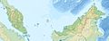
 Location map Malaysia Borneo.png 979 × 675; 946 KB
-
 Location map Peninsula Malaysia.png 539 × 656; 449 KB
-
 Malaysia location map with districts.svg 1,200 × 457; 998 KB
-
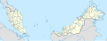
 Malaysia location map.svg 1,200 × 457; 499 KB
-
 Malaysia relief location map.jpg 1,200 × 457; 396 KB
-
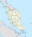 West Malaysia location map with districts.svg 400 × 457; 998 KB
-
 West Malaysia location map.svg 400 × 457; 467 KB
-
 West Malaysia relief location map.jpg 400 × 457; 110 KB


