Category:Local transport centre of Jyväskylä
Jump to navigation
Jump to search
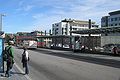
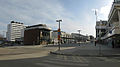
English: Local transport centre of Jyväskylä on the street Vapaudenkatu, Jyväskylä.
Suomi: Jyväskylän Paikallisliikennekeskus Vapaudenkadulla Jyväskylässä.
| Object location | | View all coordinates using: OpenStreetMap |
|---|
Media in category "Local transport centre of Jyväskylä"
The following 7 files are in this category, out of 7 total.
-
 Jyväskylä - Forum & Nikolainkulma.jpg 3,720 × 2,752; 2.11 MB
-
 Jyväskylä - Local transport center.jpg 3,664 × 2,904; 2.3 MB
-
 Jyväskylä bus terminal.jpg 1,950 × 1,300; 458 KB
-
 Jyväskylä bus timetable.JPG 4,608 × 3,072; 5.16 MB
-
 Jyväskylä paikallisliikennekeskus.jpg 4,631 × 2,252; 1.73 MB
-
 Jyväskylä paikallisliikennekeskus2.jpg 4,032 × 2,753; 2.2 MB
-
 Paikallisliikennekeskus Jyväskylä.jpg 3,866 × 2,166; 1.88 MB


