Category:Llywel
Jump to navigation
Jump to search
village and community in Powys, Wales  | |||||
| Upload media | |||||
| Instance of | |||||
|---|---|---|---|---|---|
| Location | Powys, Wales | ||||
| Population |
| ||||
 | |||||
Cymraeg: Pentref (a chymuned) ym Mhowys, yw Llywel. Saif ger y briffordd A40 i'r gorllewin o Bontsenni. Yn Eglwys Dewi Sant, sy'n enghraifft o bensaernïaeth Berpendicwlar Gothig, ceir carreg ag arysgrifen Ogam arni. Mae Carreg Llywel, sydd hefyd yn dwyn arysgrifen Ogam, yn awr yn yr Amgueddfa Brydeinig. Yn y fynwent, mae David Owen wedi ei gladdu.
English: Llywel is a small village that gives its name to Llywel community in Powys, Wales. According to the 2001 Census the population of Llywel community is 524.
Media in category "Llywel"
The following 200 files are in this category, out of 566 total.
(previous page) (next page)-
 A glimpse of Fan Foel - geograph.org.uk - 6035119.jpg 800 × 680; 241 KB
-
 A perfect place for a picnic - geograph.org.uk - 6424664.jpg 2,048 × 1,536; 1.48 MB
-
 A Quarry In Halfway Forest - geograph.org.uk - 482046.jpg 640 × 624; 120 KB
-
 A step towards Fan Brycheiniog - geograph.org.uk - 6424662.jpg 2,048 × 1,536; 1.83 MB
-
 A40 approaching Trecastle - geograph.org.uk - 6284979.jpg 5,179 × 3,451; 4.6 MB
-
 A40 at Neaudd-wen - geograph.org.uk - 4670812.jpg 640 × 481; 99 KB
-
 A40 at Penvay - geograph.org.uk - 4532655.jpg 1,920 × 1,440; 689 KB
-

-
 A40 at Trecastle village boundary - geograph.org.uk - 4670783.jpg 640 × 481; 72 KB
-
 A40 heading to Halfway - geograph.org.uk - 937789.jpg 640 × 480; 94 KB
-
 A40 lay-by and Trecastle Snack Van - geograph.org.uk - 4670790.jpg 640 × 480; 73 KB
-
 A40 lay-by north of Tai-Newydd - geograph.org.uk - 4670809.jpg 640 × 481; 79 KB
-
 A40 near Graiggoch Farm - geograph.org.uk - 4532668.jpg 1,920 × 875; 490 KB
-
 A40 near Pantysgallog - geograph.org.uk - 4670759.jpg 640 × 481; 50 KB
-
 A40 south of Penvay - geograph.org.uk - 4670780.jpg 640 × 481; 37 KB
-
 A40 westbound at Cwm Dwr - geograph.org.uk - 4670810.jpg 640 × 481; 80 KB
-
 A40 westbound near Llywel - geograph.org.uk - 4670804.jpg 640 × 481; 65 KB
-
 A4067 at Bwlch Bryn-rhudd - geograph.org.uk - 6043883.jpg 800 × 572; 125 KB
-
 A4067 near Birch Bank - geograph.org.uk - 4670099.jpg 640 × 480; 71 KB
-
 A4067 near Blaen Twyni Farm - geograph.org.uk - 4670096.jpg 640 × 481; 74 KB
-
 A4067 near Cefn Cul - geograph.org.uk - 4670105.jpg 640 × 481; 49 KB
-
 A4067 nearing the top - geograph.org.uk - 4670111.jpg 640 × 481; 50 KB
-
 Abandoned (^) equipment at Pwll Byfre quarry - geograph.org.uk - 4393614.jpg 4,000 × 3,000; 3.47 MB
-
 Abandoned filling station on the A40 - geograph.org.uk - 2569577.jpg 640 × 480; 97 KB
-
 Aber-Henwen-fawr - geograph.org.uk - 4807808.jpg 3,264 × 2,448; 1.5 MB
-
 Aber-Henwenfawr Farm - geograph.org.uk - 4807263.jpg 3,264 × 2,448; 1.08 MB
-
 Aber-Hydfer Farm - geograph.org.uk - 4808303.jpg 3,264 × 2,448; 1.99 MB
-
 Access road for Usk Reservoir - geograph.org.uk - 2274307.jpg 640 × 480; 57 KB
-
 Affon Haffes - geograph.org.uk - 6606166.jpg 1,024 × 768; 251 KB
-
 Afon Giedd - geograph.org.uk - 3121555.jpg 1,024 × 768; 199 KB
-
 Afon Giedd - geograph.org.uk - 3121572.jpg 1,024 × 768; 235 KB
-
 Afon Giedd - geograph.org.uk - 6606197.jpg 1,024 × 768; 251 KB
-
 Afon Giedd fault-bound^ - geograph.org.uk - 3121559.jpg 768 × 1,024; 239 KB
-
 Afon Haffes - geograph.org.uk - 6606169.jpg 1,024 × 768; 283 KB
-
 Afon Haffes - geograph.org.uk - 6606172.jpg 1,024 × 768; 308 KB
-
 Afon Haffes valley - geograph.org.uk - 4791917.jpg 640 × 480; 77 KB
-
 Afon Hyder - geograph.org.uk - 4808293.jpg 2,279 × 3,038; 1.1 MB
-
 Afon Tawe - geograph.org.uk - 4784079.jpg 640 × 480; 117 KB
-
 Afon Tawe - geograph.org.uk - 5173990.jpg 640 × 480; 149 KB
-
 Afon Tawr - River Tawr - geograph.org.uk - 6040123.jpg 800 × 600; 144 KB
-
 Afon Tawr - River Tawr - geograph.org.uk - 6040125.jpg 800 × 600; 149 KB
-
 Afon Tawr - River Tawr near Maen Mawr - geograph.org.uk - 6043866.jpg 800 × 523; 120 KB
-
 Afon Tawr - River Tawr valley - geograph.org.uk - 6043876.jpg 800 × 517; 134 KB
-
 Afon Wysg-River Usk - geograph.org.uk - 2949070.jpg 1,024 × 680; 256 KB
-
 Air crash site in late 2012 - geograph.org.uk - 3121303.jpg 1,024 × 768; 237 KB
-
 Aircraft wreckage close up - geograph.org.uk - 3121305.jpg 768 × 1,024; 241 KB
-
 Allt-y-fan in the Usk valley - geograph.org.uk - 6033468.jpg 800 × 706; 156 KB
-
 Approaching a gate on the track from Fan Gyhirych - geograph.org.uk - 4393568.jpg 4,000 × 3,000; 3.63 MB
-
 Approaching the disused quarries of Pwll Byfre - geograph.org.uk - 4393602.jpg 4,000 × 3,000; 3.5 MB
-
 Army Truck - geograph.org.uk - 4066929.jpg 4,320 × 3,240; 4.23 MB
-
 Barrier at north end of Usk Reservoir Dam - geograph.org.uk - 4381469.jpg 3,648 × 2,736; 2.02 MB
-
 Barrier at south end of Usk Reservoir Dam - geograph.org.uk - 4388103.jpg 3,648 × 2,736; 1.7 MB
-
 Black Mountain dusk - geograph.org.uk - 6425644.jpg 2,048 × 1,536; 474 KB
-
 Blaenau Isaf - geograph.org.uk - 4808225.jpg 3,264 × 2,448; 1.36 MB
-
 Boundary Stone on Fan Gihirych - geograph.org.uk - 6599928.jpg 593 × 1,024; 188 KB
-
 Boundary Stone on Fan Gihirych - geograph.org.uk - 6599929.jpg 635 × 1,024; 221 KB
-
 Boundary Stone on Fan Gihirych - geograph.org.uk - 6599934.jpg 646 × 1,024; 214 KB
-
 Boundary Stone on Fan Gihirych - geograph.org.uk - 6599935.jpg 1,024 × 659; 163 KB
-

-
 Bridge on the Dismantled Railway - geograph.org.uk - 6519531.jpg 1,024 × 542; 215 KB
-

-
 Bridleway to Wern - geograph.org.uk - 1448439.jpg 640 × 480; 88 KB
-
 Byfre Fechan - geograph.org.uk - 6457322.jpg 2,048 × 1,536; 1.64 MB
-
 Cairn at Y Pigwyn - geograph.org.uk - 6741591.jpg 1,600 × 900; 616 KB
-
 Cairn on Twr y Fan Foel - geograph.org.uk - 2952174.jpg 1,024 × 680; 215 KB
-
 Cairn on Twynwalter - geograph.org.uk - 4246644.jpg 640 × 480; 113 KB
-
 Capel Horeb Chapel, Cwmdwr - geograph.org.uk - 3106440.jpg 690 × 518; 240 KB
-
 Capel Horeb Quarry - geograph.org.uk - 428029.jpg 640 × 480; 105 KB
-
 Car park at Pont'ar Wysg - geograph.org.uk - 6039731.jpg 800 × 472; 122 KB
-
 Car park for Halfway Forest walks - geograph.org.uk - 520934.jpg 640 × 480; 109 KB
-
 Car park, Halfway Forest - geograph.org.uk - 5697124.jpg 5,179 × 3,451; 5.18 MB
-
 Carn yr Onnen - geograph.org.uk - 4298072.jpg 640 × 480; 74 KB
-
 Carreg Haffes - geograph.org.uk - 4597927.jpg 640 × 480; 109 KB
-
 Castell y Geifr - geograph.org.uk - 5907157.jpg 3,264 × 2,448; 1.86 MB
-
 Cattle grid - geograph.org.uk - 6286351.jpg 2,048 × 1,536; 974 KB
-
 Cefn Disgwylfa - geograph.org.uk - 5772402.jpg 640 × 480; 110 KB
-
 Cefn Rhudd - geograph.org.uk - 2952147.jpg 1,024 × 680; 200 KB
-
 Cerrig Duon stone row - geograph.org.uk - 5683298.jpg 1,600 × 964; 751 KB
-
 Change of course - geograph.org.uk - 3121291.jpg 1,024 × 768; 221 KB
-
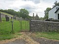
 Churchyard in Llywel - geograph.org.uk - 3463643.jpg 1,024 × 680; 219 KB
-
 Cilffordd Llywel - Llywel byway - geograph.org.uk - 3106743.jpg 690 × 518; 260 KB
-

-
 Country lane in the Usk valley - geograph.org.uk - 6033543.jpg 800 × 500; 125 KB
-
 Country road near Mynydd Wysg - geograph.org.uk - 2948997.jpg 1,024 × 680; 160 KB
-
 Cracking peat - geograph.org.uk - 6458714.jpg 1,536 × 2,048; 2.31 MB
-
 Cronfa Ddwr Wysg - Usk Reservoir - geograph.org.uk - 5214148.jpg 640 × 434; 54 KB
-

-
 Cwm Nant Lloi - geograph.org.uk - 6431892.jpg 5,664 × 3,589; 7.63 MB
-
 Cycle route down to A40 - geograph.org.uk - 937712.jpg 640 × 480; 96 KB
-
 Cyclist on mountain road - geograph.org.uk - 6431895.jpg 4,032 × 3,024; 2.53 MB
-
 Dark Sky Discovery Site - geograph.org.uk - 4807243.jpg 2,448 × 3,264; 2.57 MB
-
 Dderi Farm - geograph.org.uk - 6286456.jpg 2,048 × 1,536; 976 KB
-
 Deciduous and Evergreen - geograph.org.uk - 4807789.jpg 2,444 × 1,826; 689 KB
-
 Derelict motel at Llywel - geograph.org.uk - 1126246.jpg 640 × 480; 67 KB
-
 Disused Forest Sawmill - geograph.org.uk - 482051.jpg 640 × 480; 54 KB
-
 Disused Mill, Trecastle - geograph.org.uk - 4749922.jpg 1,600 × 1,200; 555 KB
-
 Drive to Wern-fawr - geograph.org.uk - 3461308.jpg 1,024 × 680; 310 KB
-

-
 Dual carriageway to Llywel - geograph.org.uk - 1178058.jpg 640 × 427; 132 KB
-

-
 Eastern end of the Usk Reservoir - geograph.org.uk - 6034045.jpg 800 × 556; 147 KB
-
 Eastern end of the Usk Reservoir - geograph.org.uk - 6034901.jpg 800 × 675; 114 KB
-
 Enclosure on the Garn Las moor - geograph.org.uk - 4791739.jpg 640 × 480; 59 KB
-
 Entering The Mynydd Epynt Range - geograph.org.uk - 5333690.jpg 1,562 × 1,172; 440 KB
-
 Exposed limestone - geograph.org.uk - 6457306.jpg 2,048 × 1,536; 896 KB
-
 Fan Brycheiniog - geograph.org.uk - 2184493.jpg 690 × 517; 95 KB
-
 Fan Brycheiniog - geograph.org.uk - 2954876.jpg 1,024 × 680; 232 KB
-
 Fan Brycheiniog - geograph.org.uk - 6433385.jpg 3,024 × 4,032; 2.65 MB
-
 Fan Brycheiniog as seen from near Fan Hir summit - geograph.org.uk - 6462333.jpg 1,799 × 1,199; 330 KB
-
 Fan Brycheiniog Trig Point - geograph.org.uk - 3298134.jpg 1,600 × 1,200; 942 KB
-
 Fan Fechan from Fan Hir - geograph.org.uk - 3121309.jpg 1,024 × 768; 209 KB
-
 Fan Foel (2500') - geograph.org.uk - 5973716.jpg 1,080 × 810; 144 KB
-
 Fan Foel - geograph.org.uk - 3918733.jpg 640 × 480; 66 KB
-
 Fan Foel summit - geograph.org.uk - 2119531.jpg 1,024 × 768; 219 KB
-
 Fan Hir - geograph.org.uk - 2952144.jpg 680 × 1,024; 194 KB
-
 Fan Hir - geograph.org.uk - 3298143.jpg 1,600 × 1,200; 778 KB
-
 Fan Hir - geograph.org.uk - 4791820.jpg 640 × 480; 52 KB
-
 Fan Hir - geograph.org.uk - 5174036.jpg 640 × 480; 36 KB
-
 Fan Hir - geograph.org.uk - 5174106.jpg 640 × 480; 58 KB
-
 Fan Hir - geograph.org.uk - 6458824.jpg 1,600 × 1,200; 386 KB
-
 Fan Sir Gaer - geograph.org.uk - 6237457.jpg 6,590 × 3,000; 6.23 MB
-

-
 Farmland and Cefntwrch - geograph.org.uk - 3461303.jpg 1,024 × 680; 224 KB
-
 Farmland in the Usk valley - geograph.org.uk - 2948234.jpg 1,024 × 680; 206 KB
-
 Farmland in the Usk valley - geograph.org.uk - 2948836.jpg 1,024 × 680; 178 KB
-
 Farmland near Ceftwrch - geograph.org.uk - 3459605.jpg 1,024 × 680; 222 KB
-
 Farmland near Llywel - geograph.org.uk - 3463621.jpg 1,024 × 680; 207 KB
-
 Fence by River Usk - geograph.org.uk - 4791769.jpg 640 × 480; 61 KB
-
 Ffald Dolau Haffes - geograph.org.uk - 6606162.jpg 1,024 × 768; 272 KB
-
 Ffarm Sychnant - Sychnant Farm - geograph.org.uk - 3329116.jpg 690 × 518; 160 KB
-
 Fferm Aberhydfer Farm - geograph.org.uk - 4808305.jpg 3,264 × 2,448; 913 KB
-
 Field of stones near Forest Fawr - geograph.org.uk - 4393591.jpg 4,000 × 3,000; 3.86 MB
-
 Fields south of A40, Llywel - geograph.org.uk - 6284638.jpg 5,184 × 3,456; 5.57 MB
-
 Foel Darw (424m) - geograph.org.uk - 4362893.jpg 640 × 480; 65 KB
-
 Foel Darw - geograph.org.uk - 4793536.jpg 640 × 480; 66 KB
-
 Footbridge over Nant Henwen - geograph.org.uk - 4807878.jpg 3,264 × 2,448; 1.37 MB
-
 Footpath at Pwllcoediog Farm - geograph.org.uk - 3727983.jpg 640 × 480; 70 KB
-
 Ford on Nant Gwydderig - geograph.org.uk - 3463639.jpg 1,024 × 680; 264 KB
-
 Ford over Afon Tawe - geograph.org.uk - 2107187.jpg 640 × 480; 65 KB
-
 Forest at Bwlch Cerrig Duon - geograph.org.uk - 6039857.jpg 800 × 602; 96 KB
-
 Forest Fawr - geograph.org.uk - 6286367.jpg 6,633 × 2,469; 3.7 MB
-
 Forest road, Halfway Forest - geograph.org.uk - 5697155.jpg 5,179 × 3,451; 6.31 MB
-
 Forestry gateway - geograph.org.uk - 6457260.jpg 2,048 × 1,536; 1.48 MB
-
 Frogspawn and the Black Mountain - geograph.org.uk - 6425569.jpg 2,048 × 1,536; 1.27 MB
-
 Gate into a field in the Usk valley - geograph.org.uk - 2948236.jpg 1,024 × 680; 238 KB
-

-

-
 Glacial debris and the Brecon Beacons - geograph.org.uk - 2955720.jpg 1,024 × 680; 246 KB
-

-
 Glasfynydd Forest near the Usk Reservoir - geograph.org.uk - 6035132.jpg 800 × 600; 166 KB
-
 Gorse And Dry Stone Wall - geograph.org.uk - 479248.jpg 640 × 480; 75 KB
-

-
 Grazing sheep at Bwlch Cerrig Duon - geograph.org.uk - 6039870.jpg 800 × 599; 124 KB
-
 Group of Canoeists - geograph.org.uk - 4807729.jpg 3,264 × 2,448; 1.15 MB
-

-
 Gât geffyl Meity isaf Bridlegate - geograph.org.uk - 3329089.jpg 690 × 518; 152 KB
-
 Happy Birthday - geograph.org.uk - 4807856.jpg 3,264 × 2,448; 1.03 MB
-
 Hay Bales and Barn - geograph.org.uk - 4808341.jpg 3,264 × 2,448; 1.81 MB
-

-
 Hen heol i Llywel - Old road to Llywel - geograph.org.uk - 3106753.jpg 690 × 518; 261 KB
-
 Heol Callwen,Glyntawe - geograph.org.uk - 2565041.jpg 640 × 476; 76 KB
-
 Highest beach in Wales^ - geograph.org.uk - 4786417.jpg 1,024 × 768; 208 KB
-
 Hillside above Meity Fawr - geograph.org.uk - 4808234.jpg 3,264 × 2,448; 2.09 MB
-
 Houses - geograph.org.uk - 3727971.jpg 640 × 480; 77 KB
-
 Incised stream - geograph.org.uk - 3121286.jpg 1,024 × 768; 231 KB
-
 Indistinct Path - geograph.org.uk - 4793616.jpg 640 × 480; 64 KB
-
 Infant Afon Tawe - geograph.org.uk - 2107178.jpg 640 × 480; 74 KB
-
 Information Board at Usk Reservoir - geograph.org.uk - 4040875.jpg 1,024 × 768; 768 KB
-
 Information boards at Pont'ar Wysg - geograph.org.uk - 6038564.jpg 800 × 535; 137 KB
-

-
 Kissing gate to Sharon Chapel Graveyard - geograph.org.uk - 4388192.jpg 3,648 × 2,736; 2.61 MB
-
 Landslip, Neath and Brecon Railway - geograph.org.uk - 2973695.jpg 640 × 445; 88 KB
-
 Lane descending towards Aberhenwenfawr - geograph.org.uk - 6036659.jpg 800 × 483; 125 KB
-
 Lane in the shallow Nant Pedwar valley - geograph.org.uk - 6034000.jpg 800 × 619; 100 KB
-
 Lane in the Usk valley - geograph.org.uk - 6033456.jpg 800 × 493; 163 KB
-
 Lane near Mynydd Wysg - geograph.org.uk - 6034022.jpg 800 × 600; 106 KB
-
 Lane to the Usk Reservoir - geograph.org.uk - 6035090.jpg 800 × 627; 131 KB
-
 Lane towards Mynydd Wysg - geograph.org.uk - 6033556.jpg 800 × 533; 163 KB
-
 Large Rock - geograph.org.uk - 4940301.jpg 640 × 500; 102 KB
-
 Large Rock - geograph.org.uk - 4940317.jpg 640 × 505; 110 KB
-

-
 Lay-by beside the A40 - geograph.org.uk - 4463687.jpg 3,264 × 2,448; 3.8 MB
-
 Layby for the A40 - geograph.org.uk - 4375739.jpg 3,648 × 2,736; 2.19 MB
-
 Limestone quarry - geograph.org.uk - 6457311.jpg 2,048 × 1,536; 1.11 MB
-
 Lloc Afon Giedd - Afon Giedd sheepfold - geograph.org.uk - 6606215.jpg 1,024 × 768; 308 KB
-

-

-
 Llwybr ceffyl Gam-rhiw - Gam-rhiw bridleway - geograph.org.uk - 6052692.jpg 1,024 × 768; 311 KB
-
 Llwybr ceffyl Gam-rhiw - Gam-rhiw bridleway - geograph.org.uk - 6052696.jpg 1,024 × 768; 347 KB
-
 Llwybr Ceffyl Sychnant Bridleway - geograph.org.uk - 3329113.jpg 690 × 518; 152 KB
-
 Llyn Traeth Bach - geograph.org.uk - 3329106.jpg 690 × 518; 150 KB
-
 Llyn Traeth-bach - geograph.org.uk - 2715088.jpg 800 × 600; 111 KB
-
 Llyn y Fan Fawr - geograph.org.uk - 2952130.jpg 1,024 × 680; 207 KB
-
 Llyn y Fan Fawr - geograph.org.uk - 2955725.jpg 1,024 × 680; 140 KB
-
 Llyn y Fan Fawr - geograph.org.uk - 3914897.jpg 640 × 480; 70 KB
-
 Llyn y Fan Fawr - geograph.org.uk - 6424813.jpg 2,048 × 1,536; 1.58 MB
-
 Llyn y Fan Fawr - geograph.org.uk - 6425226.jpg 2,048 × 1,536; 670 KB
-
 Llyn y Fan Fawr and Fan Foel - geograph.org.uk - 2955709.jpg 1,024 × 680; 186 KB
-
 Llyn-y-Fan Fawr - geograph.org.uk - 5973711.jpg 1,080 × 810; 139 KB
-
 Llyn-y-Fan Fawr from Bwlch Giedd - geograph.org.uk - 1950990.jpg 1,280 × 690; 153 KB


_equipment_at_Pwll_Byfre_quarry_-_geograph.org.uk_-_4393614.jpg)


_-_geograph.org.uk_-_5973716.jpg)


_-_geograph.org.uk_-_4362893.jpg)


