Category:Llysfaen
Jump to navigation
Jump to search

village and community in Conwy County Borough, Wales  | |||||
| Upload media | |||||
| Instance of | |||||
|---|---|---|---|---|---|
| Location | Conwy County Borough, Wales | ||||
| Population |
| ||||
| Area |
| ||||
 | |||||
Cymraeg: Pentref a chymuned ar arfordir gogledd Cymru ym mwrdeisdref sirol Conwy yw Llysfaen. Gorwedd hanner milltir o'r môr tua hanner ffordd rhwng Abergele i'r dwyrain a Bae Colwyn i'r gorllewin. Mae'r pentrefi cyfagos yn cynnwys Hen Golwyn, Llanddulas, Dolwyn a Betws-yn-Rhos. I'r dwyrain ceir Mynydd Marian. Mae tua 2,680 o bobl yn byw yno ( [1] 2005).
English: Llysfaen is a village in Conwy county borough on the north coast of Wales. For local government purposes, it is also a community and Conwy County Borough Council ward.
Subcategories
This category has the following 2 subcategories, out of 2 total.
L
M
- Mynydd Marian (3 F)
Media in category "Llysfaen"
The following 108 files are in this category, out of 108 total.
-
 A55 approaching Colwyn Bay - geograph.org.uk - 3163178.jpg 640 × 430; 41 KB
-
 A55 east of Penmaen Rhos - geograph.org.uk - 2344582.jpg 640 × 480; 29 KB
-
 A55 North Wales Expressway towards junction 23 - geograph.org.uk - 4164566.jpg 1,600 × 1,200; 1.04 MB
-
 A55 westbound - geograph.org.uk - 2480504.jpg 640 × 480; 38 KB
-
 A55, Penmaen Rhos - geograph.org.uk - 3163206.jpg 640 × 430; 52 KB
-
 A55, westbound - geograph.org.uk - 3163186.jpg 640 × 413; 47 KB
-
 Bus terminus - geograph.org.uk - 730747.jpg 640 × 480; 79 KB
-
 Castle Inn Quarry - geograph.org.uk - 2531949.jpg 2,736 × 3,648; 3.71 MB
-
 Chwarel Merllyn - Raynes Quarry (2) - geograph.org.uk - 6448092.jpg 640 × 501; 90 KB
-
 Chwarel Merllyn - Raynes Quarry - geograph.org.uk - 6448088.jpg 535 × 640; 116 KB
-
 Coaster 1950s style - geograph.org.uk - 4402585.jpg 1,629 × 793; 348 KB
-

-
 Concrete sea defences near Llanddulas - geograph.org.uk - 6127718.jpg 800 × 548; 100 KB
-
 Concrete sea defences near Llanddulas - geograph.org.uk - 6323677.jpg 800 × 600; 100 KB
-
 Concrete silo and jetty Llanddulas - geograph.org.uk - 2717506.jpg 2,304 × 1,728; 563 KB
-
 Concrete Units near Llanddulas - geograph.org.uk - 5042656.jpg 5,184 × 3,456; 4.81 MB
-
 Cropped image of Tabor baptist chapel 730745 7806e08f.jpg 443 × 333; 61 KB
-
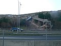
 Cycle way bridge - geograph.org.uk - 3650781.jpg 1,600 × 1,200; 477 KB
-
 Dechreuad a Chynydd y Methodistiaid Calfinaidd yn Abergele, Pensarn etc.pdf 779 × 1,164, 94 pages; 80.14 MB
-
 Deep quarry - keep out - geograph.org.uk - 846545.jpg 640 × 480; 98 KB
-

-
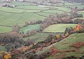 Dyffryn Dulas - The Dulas Valley - geograph.org.uk - 5971622.jpg 640 × 450; 64 KB
-

-
 Ffordd Isallt - geograph.org.uk - 5971625.jpg 640 × 486; 109 KB
-
 Footbridge along the Wales Coast Path - geograph.org.uk - 6322933.jpg 800 × 534; 132 KB
-

-
 Footpath and Cefn yr Ogof - geograph.org.uk - 846557.jpg 640 × 480; 108 KB
-
 Footpath and waste - geograph.org.uk - 1147705.jpg 640 × 480; 93 KB
-
 Footpath descent - geograph.org.uk - 3185123.jpg 640 × 480; 99 KB
-
 Footpath ^ Cycle path - geograph.org.uk - 3652265.jpg 1,600 × 1,200; 418 KB
-

-
 Gorse in bloom - geograph.org.uk - 2378389.jpg 640 × 480; 89 KB
-
 Grazing by Peulwys Lane - geograph.org.uk - 1147689.jpg 640 × 480; 96 KB
-
 Heading west along the Wales Coast Path - geograph.org.uk - 6323667.jpg 800 × 503; 100 KB
-
 Inscription on the Parc Peulwys stone - geograph.org.uk - 4092080.jpg 640 × 480; 111 KB
-
 Jetty at Raynes Quarry - geograph.org.uk - 4177911.jpg 1,600 × 1,064; 639 KB
-
 Jetty at Raynes Quarry - geograph.org.uk - 4177927.jpg 1,600 × 1,064; 548 KB
-
 Jetty at Raynes Quarry - geograph.org.uk - 4177937.jpg 1,600 × 1,064; 580 KB
-
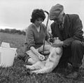 Lambing at Tŷ Mawr, Llysfaen (7000048829).jpg 600 × 592; 129 KB
-
 Llanddulas Jetty - geograph.org.uk - 4402553.jpg 1,426 × 906; 435 KB
-
 Llanddulas Quarry - geograph.org.uk - 2153813.jpg 480 × 640; 80 KB
-
 Llysfaen village sign - geograph.org.uk - 1893074.jpg 640 × 480; 61 KB
-
-
 M.V. Carrier St John's near Raynes Quarry jetty - geograph.org.uk - 2883522.jpg 3,296 × 2,472; 1.92 MB
-
 Methodistiaeth yn Nosbarth Colwyn Bay.djvu 1,753 × 2,520, 237 pages; 15.98 MB
-
 Mynydd Marian - geograph.org.uk - 3329765.jpg 1,600 × 1,200; 565 KB
-
 North Wales Expressway, Colwyn Bay - geograph.org.uk - 5688907.jpg 640 × 427; 305 KB
-
 North Wales LDP - geograph.org.uk - 846567.jpg 640 × 480; 121 KB
-
 Old Llanddulas jetty - geograph.org.uk - 2580573.jpg 2,304 × 1,728; 571 KB
-
 Parc Peulwys - geograph.org.uk - 4092059.jpg 640 × 480; 91 KB
-
 Pentre Du - geograph.org.uk - 846553.jpg 640 × 480; 143 KB
-
 Pentregwyddel Terrace - geograph.org.uk - 3185144.jpg 640 × 480; 99 KB
-

-
 Quarry entrance road - geograph.org.uk - 3185127.jpg 640 × 480; 109 KB
-
 Quarry view - geograph.org.uk - 3185140.jpg 640 × 480; 101 KB
-
 Raynes Jetty and Shipwreck - geograph.org.uk - 2927852.jpg 640 × 480; 76 KB
-
 Raynes Jetty, Llanddulas - geograph.org.uk - 2791388.jpg 640 × 475; 39 KB
-
 Raynes Jetty, Llanddulas - geograph.org.uk - 2791389.jpg 640 × 480; 45 KB
-
 Raynes Jetty, Llanddulas - geograph.org.uk - 5042732.jpg 5,184 × 3,456; 4.95 MB
-
 Raynes Quarry and jetty and the M.V. Carrier St John's - geograph.org.uk - 2882889.jpg 3,296 × 2,472; 1.97 MB
-
 Raynes Quarry jetty near Penmaen Rhos - geograph.org.uk - 6323761.jpg 800 × 577; 154 KB
-
 Raynes Quarry ^ Jetty - geograph.org.uk - 2892589.jpg 3,906 × 2,930; 5.03 MB
-
 Rose and steps - geograph.org.uk - 846554.jpg 480 × 640; 172 KB
-
 Sea Defence and Path near Raynes Jetty - geograph.org.uk - 5042673.jpg 5,184 × 3,456; 5.77 MB
-
-
 Semaphore lodge - geograph.org.uk - 730759.jpg 640 × 480; 74 KB
-
 Sport climbing - geograph.org.uk - 2531961.jpg 2,736 × 3,648; 3.33 MB
-
 The A55 North Wales Expressway - geograph.org.uk - 4177696.jpg 1,600 × 1,064; 710 KB
-
 The Castle Inn - geograph.org.uk - 730729.jpg 640 × 480; 75 KB
-
 The Wales Coast Path - geograph.org.uk - 5035982.jpg 5,000 × 3,333; 4.85 MB
-
 The Wales Coast Path approaching Llanddulas - geograph.org.uk - 5035971.jpg 3,184 × 2,123; 2.06 MB
-
 The Wales Coast Path near Raynes Jetty - geograph.org.uk - 5042756.jpg 5,184 × 3,456; 6.39 MB
-

-
 Twmpath y defaid - geograph.org.uk - 730751.jpg 640 × 480; 99 KB
-
 Ty Mawr enterprise park - geograph.org.uk - 1147698.jpg 640 × 480; 98 KB
-
 Under the Expressway - geograph.org.uk - 2791380.jpg 640 × 480; 73 KB
-
 View to the A547 - geograph.org.uk - 3163214.jpg 640 × 430; 54 KB
-
 View up from the Coastal Path - geograph.org.uk - 2791400.jpg 640 × 480; 62 KB
-
 Village street - geograph.org.uk - 730753.jpg 640 × 480; 93 KB
-

-
 Wales Coast Path near Penmaen Rhos - geograph.org.uk - 6323681.jpg 800 × 550; 117 KB
-
 Wales Coast Path towards Colwyn Bay - geograph.org.uk - 4177690.jpg 1,600 × 1,064; 701 KB
-
 Wales Coast Path towards Colwyn Bay - geograph.org.uk - 4177693.jpg 1,600 × 1,064; 659 KB
-
 Wales Coast Path towards Colwyn Bay - geograph.org.uk - 4177700.jpg 1,600 × 1,048; 698 KB
-
 Wales Coast Path towards Colwyn Bay - geograph.org.uk - 4177864.jpg 1,600 × 1,064; 604 KB
-
 Wales Coast Path towards Colwyn Bay - geograph.org.uk - 4177869.jpg 1,600 × 1,064; 596 KB
-
 Wales Coast Path towards Colwyn Bay - geograph.org.uk - 4177880.jpg 1,600 × 1,064; 715 KB
-
 Wales Coast Path towards Colwyn Bay - geograph.org.uk - 4177886.jpg 1,600 × 1,064; 590 KB
-
 Wales Coast Path towards Raynes Quarry Jetty - geograph.org.uk - 4177902.jpg 1,600 × 1,064; 547 KB
-
 Wales Conwy Community Llysfaen map.svg 512 × 458; 612 KB
-

-
-

-
 Year of construction Llanddulas jetty silo - geograph.org.uk - 2717512.jpg 2,304 × 1,728; 249 KB
-
 Carboniferous Limestone - geograph.org.uk - 730739.jpg 640 × 480; 99 KB
-
 Cottages on approach to Llysfaen - geograph.org.uk - 156084.jpg 640 × 480; 151 KB
-
 Disused quarry - geograph.org.uk - 730725.jpg 640 × 480; 113 KB
-
 Green fields and blue skies - geograph.org.uk - 125451.jpg 640 × 480; 70 KB
-
 Limestone cliffs - geograph.org.uk - 730746.jpg 640 × 480; 98 KB
-
 Llysfaen - geograph.org.uk - 156012.jpg 640 × 480; 52 KB
-
 Llysfaen cottages - geograph.org.uk - 156015.jpg 640 × 480; 84 KB
-
 Llysfaen cottages view - geograph.org.uk - 156018.jpg 640 × 480; 46 KB
-
 Llysfaen from the valley - geograph.org.uk - 156089.jpg 640 × 480; 45 KB
-
 Llysfaen lane - geograph.org.uk - 156023.jpg 640 × 480; 58 KB
-
 Llysfaen pink ^ - geograph.org.uk - 156020.jpg 640 × 480; 77 KB
-
 Llysfaen sign - geograph.org.uk - 156116.jpg 640 × 480; 105 KB
-
 The Red Umbrella - geograph.org.uk - 577953.jpg 640 × 480; 78 KB
-
 Ty Mawr Llysfaen - geograph.org.uk - 25277.jpg 384 × 288; 17 KB


_-_geograph.org.uk_-_6448092.jpg)


.jpg)


