Category:Llantrisant Fawr
Jump to navigation
Jump to search
community in Monmouthshire, Wales, UK | |||||
| Upload media | |||||
| Instance of | |||||
|---|---|---|---|---|---|
| Location | Monmouthshire, Wales | ||||
 | |||||
Subcategories
This category has the following 8 subcategories, out of 8 total.
Media in category "Llantrisant Fawr"
The following 200 files are in this category, out of 356 total.
(previous page) (next page)-
 2010 Wales Monmouthshire Community Llantrisant Fawr map.svg 512 × 682; 699 KB
-
 2024 Wales Monmouthshire Community Llantrisant Fawr map.svg 512 × 682; 603 KB
-
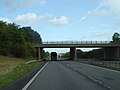
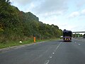
 A449 - A472 overbridge - geograph.org.uk - 2059456.jpg 640 × 480; 52 KB
-

-

-

-
 A449 - over the crest at Llantrisant - geograph.org.uk - 2059511.jpg 640 × 480; 60 KB
-

-

-
 A449 along the Usk Valley - geograph.org.uk - 3706000.jpg 2,485 × 1,693; 2.09 MB
-
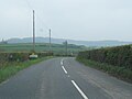
 A449 approaching the A472 junction - geograph.org.uk - 2059439.jpg 640 × 480; 55 KB
-
 A449 at Allt Farm access bridge - geograph.org.uk - 2059520.jpg 640 × 480; 69 KB
-
 A449 at Llanllowell - geograph.org.uk - 2059497.jpg 640 × 480; 45 KB
-
 A449 at the junction for Usk - geograph.org.uk - 2059444.jpg 640 × 480; 53 KB
-

-

-
 A449 exit to Parking and Picnic Area - geograph.org.uk - 3706011.jpg 2,388 × 1,653; 1.94 MB
-
 A449 heading north - geograph.org.uk - 2450150.jpg 640 × 480; 52 KB
-
 A449 heading south - geograph.org.uk - 3692561.jpg 1,024 × 624; 122 KB
-
 A449 in the Usk Valley - geograph.org.uk - 4890161.jpg 3,345 × 1,999; 1.4 MB
-
 A449 junction with A472 for Usk half mile ahead - geograph.org.uk - 3691416.jpg 2,536 × 1,555; 1.91 MB
-
 A449 looking north - geograph.org.uk - 2323304.jpg 640 × 480; 55 KB
-
 A449 looking north near Llantrisant - geograph.org.uk - 2323892.jpg 640 × 480; 38 KB
-
 A449 near Slough - geograph.org.uk - 2320172.jpg 640 × 480; 32 KB
-
 A449 north of Llantrisant - geograph.org.uk - 2059507.jpg 640 × 480; 59 KB
-
 A449 northbound near Pentwyn - geograph.org.uk - 2450173.jpg 640 × 480; 41 KB
-
 A449 northbound, east of Usk - geograph.org.uk - 2323906.jpg 640 × 480; 35 KB
-
 A449 overpass - geograph.org.uk - 4269323.jpg 800 × 451; 292 KB
-
 A449 south of Allt Farm - geograph.org.uk - 2059543.jpg 640 × 480; 60 KB
-
 A449 south of Llanllowell - geograph.org.uk - 2059502.jpg 640 × 480; 46 KB
-
 A449 south of Llantrisant - geograph.org.uk - 3692565.jpg 2,485 × 1,621; 1.83 MB
-
 A449 southbound - geograph.org.uk - 3692554.jpg 2,709 × 1,659; 2.59 MB
-
 A449 southbound, 7 miles to the M4 - geograph.org.uk - 3691554.jpg 2,583 × 1,638; 2.27 MB
-
 A472 about to cross Olway Brook - geograph.org.uk - 4299512.jpg 640 × 480; 73 KB
-
 A472 bridge over A449 - geograph.org.uk - 5163579.jpg 1,600 × 1,200; 688 KB
-

-

-
 Aircraft at South Wales Gliding Club - geograph.org.uk - 5345965.jpg 1,024 × 768; 237 KB
-
 Alpacas at Goytre Farm - geograph.org.uk - 5898396.jpg 1,600 × 1,200; 926 KB
-

-
 B4235 at Llangwm village boundary - geograph.org.uk - 5810400.jpg 1,024 × 769; 96 KB
-
 B4235 bridge over A449 - geograph.org.uk - 5163580.jpg 1,600 × 1,200; 673 KB
-
 B4235 crosses A449 east of Usk - geograph.org.uk - 2323928.jpg 640 × 480; 34 KB
-
 B4235 near Beaufort Bungalow - geograph.org.uk - 5810417.jpg 1,024 × 769; 124 KB
-
 B4235 on bend at site of Great Wood, now felled - geograph.org.uk - 5810425.jpg 1,024 × 808; 156 KB
-

-
 Barn, in splendid isolation - geograph.org.uk - 1122730.jpg 640 × 427; 50 KB
-
 Base of a cross^ - geograph.org.uk - 5345935.jpg 1,024 × 768; 347 KB
-

-
 Benchmark, Llangeview - geograph.org.uk - 3195374.jpg 1,024 × 680; 300 KB
-

-
 Bend in the Usk - geograph.org.uk - 4269336.jpg 800 × 451; 207 KB
-
 Bertholey House - geograph.org.uk - 6328349.jpg 4,896 × 3,264; 5.95 MB
-
 Bertholly Lodge - geograph.org.uk - 1709321.jpg 3,296 × 2,472; 1.8 MB
-

-
 Bridge carrying the A449 over an older road - geograph.org.uk - 3691233.jpg 1,024 × 768; 199 KB
-
 Brooklet in Llanllowell - geograph.org.uk - 5209579.jpg 589 × 800; 224 KB
-
 Building opposite Gwernesney church - geograph.org.uk - 5345940.jpg 1,024 × 768; 269 KB
-

-
 Cefn barn (2) - geograph.org.uk - 6328354.jpg 4,896 × 3,264; 4.38 MB
-
 Cefn barn in black and white - geograph.org.uk - 6328357.jpg 4,434 × 2,956; 1.71 MB
-

-
 Chepstow Road east of Olway Bridge - geograph.org.uk - 5810383.jpg 1,024 × 768; 164 KB
-

-

-

-

-
 Coed Cwnwr - geograph.org.uk - 1768025.jpg 640 × 480; 34 KB
-

-
 Coed y Pwll-llyn - geograph.org.uk - 3195266.jpg 1,024 × 680; 246 KB
-
 Cottage in Llangwm - geograph.org.uk - 5819487.jpg 1,024 × 683; 227 KB
-
 Cottages in Llangwm, Monmouthshire - geograph.org.uk - 5717072.jpg 800 × 514; 113 KB
-
 Country road near Llangeview - geograph.org.uk - 3195268.jpg 1,024 × 680; 264 KB
-
 Cwmbir crossroads - geograph.org.uk - 4272419.jpg 800 × 451; 234 KB
-
 Dead lorry by Llwyna Lane - geograph.org.uk - 4269329.jpg 800 × 451; 215 KB
-
 Dead tree at Cefn Barn - geograph.org.uk - 6328356.jpg 4,896 × 3,264; 5.21 MB
-

-

-

-

-
 Drive and track - geograph.org.uk - 4267503.jpg 800 × 451; 250 KB
-

-

-
 Emergency telephone point, A449 - geograph.org.uk - 3792242.jpg 1,024 × 774; 186 KB
-

-

-

-

-
 Entrance to South Wales Gliding Club - geograph.org.uk - 5346145.jpg 1,024 × 768; 202 KB
-

-
 Ewe and lamb on Corn Hill - geograph.org.uk - 1270494.jpg 640 × 426; 84 KB
-
 Farm buildings at Fernhill - geograph.org.uk - 4267869.jpg 800 × 451; 215 KB
-
 Farm buildings at Llangeview - geograph.org.uk - 3195371.jpg 1,024 × 680; 208 KB
-

-
 Farmland above Nant-y-March - geograph.org.uk - 5819523.jpg 1,024 × 683; 222 KB
-
 Farmland above the Usk valley - geograph.org.uk - 3192278.jpg 1,024 × 680; 232 KB
-

-

-
 Farmland near Gwernesney - geograph.org.uk - 2410677.jpg 1,024 × 680; 179 KB
-
 Farmland near Nantymark - geograph.org.uk - 5819511.jpg 1,024 × 683; 274 KB
-
 Farmland south of Allt Farm - geograph.org.uk - 3691215.jpg 1,024 × 768; 216 KB
-
 Farmland west of the A449 - geograph.org.uk - 3691237.jpg 1,024 × 768; 164 KB
-
 Feeding trough in a field - geograph.org.uk - 6130219.jpg 1,024 × 768; 238 KB
-
 Field above Llangwm - geograph.org.uk - 5818541.jpg 1,024 × 683; 209 KB
-

-

-
 Field and woods - geograph.org.uk - 6131648.jpg 1,024 × 768; 296 KB
-
 Field at Ty-Mawr Farm - geograph.org.uk - 1270484.jpg 640 × 426; 84 KB
-

-
 Field boundary, Usk valley - geograph.org.uk - 3691204.jpg 1,024 × 768; 166 KB
-
 Field by the roadside - geograph.org.uk - 1124580.jpg 640 × 427; 73 KB
-
 Field near Llanllowell Bridge - geograph.org.uk - 1124535.jpg 640 × 427; 102 KB
-

-

-

-
 Foot bridge in Llewelyn's Dingle - geograph.org.uk - 1768021.jpg 640 × 480; 158 KB
-
 Footpath below Pentwyn - geograph.org.uk - 1273533.jpg 640 × 426; 99 KB
-
 Footpath from Newbridge to White Hall - geograph.org.uk - 3671712.jpg 1,024 × 768; 154 KB
-
 Footpath sign and walkers on the road - geograph.org.uk - 6131661.jpg 1,024 × 768; 175 KB
-
 Forestry activities - geograph.org.uk - 5864670.jpg 1,600 × 898; 787 KB
-
 Forge Garage, Llantrisant, Monmouthshire - geograph.org.uk - 5211166.jpg 800 × 507; 118 KB
-
 Frozen Field - geograph.org.uk - 3305107.jpg 2,288 × 1,712; 1.17 MB
-

-
 Gateway to Bertholey House - geograph.org.uk - 6328350.jpg 4,896 × 3,264; 6.83 MB
-
 Gateway to Llantrisant - geograph.org.uk - 6328358.jpg 4,896 × 3,264; 6.59 MB
-
 Glen Court - geograph.org.uk - 3192284.jpg 1,024 × 680; 207 KB
-
 Golden Hill Farm entrance - geograph.org.uk - 5898322.jpg 1,600 × 900; 911 KB
-
 Grazing land, west of the A449 - geograph.org.uk - 3792236.jpg 1,024 × 768; 255 KB
-
 Gwern Ddu Hill - geograph.org.uk - 4267859.jpg 800 × 451; 272 KB
-
 Gwern Ddu Road - geograph.org.uk - 4267828.jpg 800 × 451; 290 KB
-
 Gwern-Ddu Hill - geograph.org.uk - 1270499.jpg 640 × 426; 57 KB
-
 Gwernesney boundary sign, Monmouthshire - geograph.org.uk - 5716261.jpg 800 × 575; 125 KB
-
 Gwernesney church - geograph.org.uk - 5345906.jpg 1,024 × 768; 257 KB
-
 Heading north on the A449 - geograph.org.uk - 1635887.jpg 640 × 480; 119 KB
-
 Heading north on the A449 - geograph.org.uk - 1635890.jpg 640 × 480; 105 KB
-
 Heading north on the A449 - geograph.org.uk - 1635891.jpg 640 × 480; 105 KB
-
 Hedge alongside Gwern Ddu Road - geograph.org.uk - 4267797.jpg 800 × 451; 204 KB
-

-
 Hills east of the Usk - geograph.org.uk - 4272414.jpg 800 × 451; 228 KB
-
 Hillside by the A449 - geograph.org.uk - 4890149.jpg 3,596 × 2,101; 1.63 MB
-

-
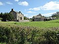 House and farm buildings - geograph.org.uk - 5345955.jpg 1,024 × 768; 294 KB
-
 House in Llantrisant - geograph.org.uk - 3691218.jpg 1,024 × 768; 165 KB
-
 Houses on the Usk Valley Walk - geograph.org.uk - 6130259.jpg 1,024 × 768; 307 KB
-
 Junction in Llanllowell - geograph.org.uk - 5209623.jpg 800 × 465; 88 KB
-
 Junction near Llantrisant, Monmouthshire - geograph.org.uk - 5211149.jpg 800 × 492; 107 KB
-

-
 Lady's Smock, near Newbridge on Usk - geograph.org.uk - 1256073.jpg 640 × 426; 77 KB
-
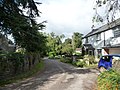
 Lane entering Llantrisant from the south-west - geograph.org.uk - 6130264.jpg 1,024 × 768; 317 KB
-
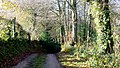
 Lane leading to Llantrisant - geograph.org.uk - 951658.jpg 640 × 480; 65 KB
-

-
 Lay-by and refreshment wagon by A449 - geograph.org.uk - 6092196.jpg 1,600 × 1,200; 1.03 MB
-
 Lay-by for northbound A449 near Newbridge on Usk - geograph.org.uk - 5163561.jpg 1,600 × 1,200; 737 KB
-
 Lay-by on northbound A449 near bridge to Llangeview - geograph.org.uk - 5163575.jpg 1,600 × 1,200; 732 KB
-
 Lay-by on northbound A449 north of Llantrisant - geograph.org.uk - 5163566.jpg 1,600 × 1,200; 644 KB
-
 Lay-by on the A449 - geograph.org.uk - 5737589.jpg 3,264 × 2,448; 2.82 MB
-
 Lay-by on the A449, near Newbridge on Usk - geograph.org.uk - 3311110.jpg 1,024 × 768; 147 KB
-
 Layby, A449 - geograph.org.uk - 976288.jpg 640 × 435; 79 KB
-

-

-

-

-
 Llangwm Parish Hall, Monmouthshire - geograph.org.uk - 5717037.jpg 800 × 514; 121 KB
-
 Llangwn Uchaf, Gwent, St Jerome - geograph.org.uk - 5929536.jpg 4,608 × 3,456; 5.2 MB
-
 Llanllywel Church - geograph.org.uk - 5048473.jpg 3,264 × 2,448; 3.16 MB
-
 Llantrisant Brook - geograph.org.uk - 4267845.jpg 800 × 451; 218 KB
-

-
 Llanynant Road, Llangwm, Monmouthshire - geograph.org.uk - 5717159.jpg 798 × 800; 189 KB
-
 Llewellyn's Dingle - geograph.org.uk - 1122701.jpg 640 × 427; 79 KB
-
 Llewelyn's Dingle - geograph.org.uk - 1241506.jpg 640 × 480; 109 KB
-
 Llwybr Bertholey Path - geograph.org.uk - 3734220.jpg 690 × 557; 169 KB
-
 Llwyna Lane - geograph.org.uk - 4269333.jpg 800 × 451; 204 KB
-
 Llwyna Lane, Newbridge on Usk - geograph.org.uk - 1256067.jpg 640 × 426; 116 KB
-
 Llwynau Brook - geograph.org.uk - 4269361.jpg 800 × 451; 185 KB
-
 Llwynau Lane and Brook - geograph.org.uk - 4269318.jpg 800 × 451; 212 KB
-

-
 Looking back - geograph.org.uk - 6328355.jpg 4,896 × 3,264; 6.18 MB
-
 Meadow by the Usk - geograph.org.uk - 4269347.jpg 800 × 451; 205 KB
-
 Meadow on the east bank of the Usk - geograph.org.uk - 3671687.jpg 1,024 × 768; 148 KB
-
 Meadowland at Llantrisant - geograph.org.uk - 1270509.jpg 640 × 426; 90 KB
-
 Meadowland in the Usk valley - geograph.org.uk - 1256081.jpg 640 × 426; 85 KB
-
 Milestone in Llangwm - geograph.org.uk - 5818835.jpg 683 × 1,024; 306 KB
-
 Milestone near Gwernesney - geograph.org.uk - 5346159.jpg 768 × 1,024; 371 KB
-
 Minor road crossing A449 near Pentwyn - geograph.org.uk - 5163572.jpg 1,600 × 1,200; 675 KB
-
 Mostly black sheep - geograph.org.uk - 6131651.jpg 1,024 × 768; 221 KB
-
 Nant y March, Llangwm, Monmouthshire - geograph.org.uk - 5720437.jpg 760 × 800; 303 KB
-
 Nant-y-banw Lane - geograph.org.uk - 4267922.jpg 800 × 451; 209 KB
-

-
 New farm building - geograph.org.uk - 4268718.jpg 800 × 451; 233 KB
-

-

-

-

-

-
 Oaks on a hilltop - geograph.org.uk - 4267511.jpg 800 × 452; 248 KB
-
 Old filling station - geograph.org.uk - 3311441.jpg 640 × 480; 72 KB
-

-

-
-
 On the A449 heading for Newport - geograph.org.uk - 1455645.jpg 640 × 480; 197 KB


_-_geograph.org.uk_-_6328354.jpg)


