Category:Llangrannog
Jump to navigation
Jump to search
Cymraeg: Pentref glan môr a Chymuned yng Ngheredigion yw Llangrannog. Mae'n gartref i un o wersylloedd yr Urdd.
village and seaside resort in Ceredigion, Wales  | |||||
| Upload media | |||||
| Instance of | |||||
|---|---|---|---|---|---|
| Location | Ceredigion, Wales | ||||
 | |||||
Subcategories
This category has the following 7 subcategories, out of 7 total.
C
- Capel Bancyfelin (4 F)
- Capel Pantycrugiau (4 F)
P
S
Y
- Ynys Lochtyn (39 F)
- Ysgoldy Pantycrugiau (3 F)
Media in category "Llangrannog"
The following 200 files are in this category, out of 292 total.
(previous page) (next page)-
 1 Castle Hall, Llangrannog - geograph.org.uk - 2072054.jpg 480 × 640; 83 KB
-

-
 A487 at the New Inn - geograph.org.uk - 4579175.jpg 1,280 × 851; 329 KB
-
 Above the Nant Fothau Valley - geograph.org.uk - 4881870.jpg 4,313 × 3,235; 2.9 MB
-
 At Llangrannog - geograph.org.uk - 3980064.jpg 640 × 360; 52 KB
-
 B4321 descends into Llangrannog - geograph.org.uk - 2678782.jpg 3,596 × 2,678; 1.7 MB
-
 B4321 east of Llangrannog - geograph.org.uk - 2017792.jpg 480 × 640; 138 KB
-
 B4321 minor road joins west of Lochland - geograph.org.uk - 2678767.jpg 3,648 × 2,627; 2.13 MB
-
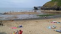
 Beach and cliffs at Llangrannog - geograph.org.uk - 2604332.jpg 640 × 480; 44 KB
-
 Beach at Llangrannog in August - geograph.org.uk - 3076107.jpg 640 × 480; 103 KB
-
 Beach in Llangrannog in August - geograph.org.uk - 3076125.jpg 640 × 480; 119 KB
-
 Beach near Llangrannog - geograph.org.uk - 2604271.jpg 640 × 480; 69 KB
-

-
 Bench Mark, The Pentre Arms - geograph.org.uk - 2122533.jpg 480 × 640; 63 KB
-
 Bend on road - geograph.org.uk - 1993799.jpg 1,000 × 669; 371 KB
-
 Between a rock and a hard place, Llangrannog - geograph.org.uk - 2301353.jpg 1,024 × 685; 214 KB
-
 Birdbath with mosaic - geograph.org.uk - 6022454.jpg 2,304 × 1,728; 1.7 MB
-
 Bridge parapet, Llangrannog - geograph.org.uk - 2121453.jpg 640 × 481; 88 KB
-
 Brynderwen, Llangrannog - geograph.org.uk - 2088580.jpg 640 × 480; 142 KB
-
 Car park near Llangrannog - geograph.org.uk - 2603949.jpg 640 × 480; 79 KB
-
 Cardigan coastline - geograph.org.uk - 6022146.jpg 2,304 × 1,728; 1.81 MB
-
 Carreg Bica - geograph.org.uk - 6022513.jpg 2,304 × 1,728; 1.7 MB
-
 Carreg Bica at Llangrannog - geograph.org.uk - 2604322.jpg 640 × 480; 50 KB
-
 Carreg Bica Bach - geograph.org.uk - 4910814.jpg 640 × 480; 91 KB
-
 Carreg Bica rock, Llangrannog.jpg 4,217 × 2,268; 4.91 MB
-
 Carreg Bica, Llangrannog beach - geograph.org.uk - 6022460.jpg 2,070 × 1,477; 1.24 MB
-
 Carreg Dôl Fran - geograph.org.uk - 6022519.jpg 2,304 × 1,728; 1.83 MB
-
 Cattle at Ciliau-Hwnt - geograph.org.uk - 2017611.jpg 640 × 480; 125 KB
-
 Cattle pasture, near Ciliau-Hwnt - geograph.org.uk - 2017602.jpg 640 × 480; 79 KB
-
 Cattle penned at Nantybach Farm - geograph.org.uk - 6022237.jpg 2,304 × 1,728; 1.76 MB
-
 Cattle, Llangrannog - geograph.org.uk - 2122283.jpg 640 × 480; 71 KB
-
 Ceredigion Coast at Trwyn Crou - geograph.org.uk - 4881825.jpg 3,081 × 3,167; 1.81 MB
-

-
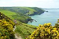
 Ceredigion Coast Path - geograph.org.uk - 4881811.jpg 4,608 × 3,456; 2.79 MB
-

-

-

-

-
 Ceredigion coast path plaque - geograph.org.uk - 2017516.jpg 480 × 640; 129 KB
-
 Ceredigion coastline from Pen Rhip - geograph.org.uk - 6022506.jpg 2,258 × 1,666; 1.74 MB
-

-
 Ciborth beach, Llangrannog - geograph.org.uk - 2678830.jpg 3,072 × 2,048; 1.62 MB
-
 Cilborth Beach - geograph.org.uk - 37377.jpg 640 × 480; 79 KB
-
 Cilborth Beath - geograph.org.uk - 6022168.jpg 2,304 × 1,728; 1.77 MB
-
 Ciliau-hwnt farm house - geograph.org.uk - 4104090.jpg 640 × 360; 43 KB
-

-
 Cliffside vegetation - geograph.org.uk - 2015696.jpg 480 × 640; 132 KB
-
 Coast path above Ynys-Lochtyn - geograph.org.uk - 4104345.jpg 640 × 360; 49 KB
-

-
 Coastline at Llangrannog - geograph.org.uk - 6323125.jpg 4,896 × 3,264; 6.17 MB
-

-
 Cortege in Pentre-gat - geograph.org.uk - 3129349.jpg 1,507 × 1,287; 348 KB
-
 Cottage on Rhiw Gam near Llangrannog - geograph.org.uk - 3075962.jpg 640 × 480; 85 KB
-
 Cranogwen statue.jpg 6,000 × 4,000; 11.23 MB
-
Cy-Llangrannog.ogg 1.5 s; 23 KB
-
 Date stone, Llangrannog - geograph.org.uk - 2121449.jpg 640 × 480; 99 KB
-
 Distant view of Pigeonsford - geograph.org.uk - 2088616.jpg 640 × 480; 98 KB
-
 Dol Meddyg - geograph.org.uk - 2987199.jpg 1,600 × 1,191; 343 KB
-
 Dol Meddyg - geograph.org.uk - 3716459.jpg 800 × 600; 161 KB
-

-
 Entering Plwmp on A487 - geograph.org.uk - 3557243.jpg 640 × 420; 41 KB
-
 Farm and houses north of Llangrannog - geograph.org.uk - 6022175.jpg 2,304 × 1,728; 1.8 MB
-
 Farm machinery in the field - geograph.org.uk - 4104096.jpg 640 × 360; 42 KB
-
 Fencing, Llangrannog - geograph.org.uk - 2121444.jpg 640 × 480; 86 KB
-
 Field edge path - geograph.org.uk - 4104100.jpg 640 × 360; 40 KB
-
 Field entrance off a lane - geograph.org.uk - 4104087.jpg 640 × 360; 98 KB
-
 Field near Trecregyn Farm - geograph.org.uk - 4881847.jpg 3,723 × 2,435; 1.87 MB
-
 Field north of the B4321, near the Urdd Centre - geograph.org.uk - 1960184.jpg 2,048 × 1,536; 1.16 MB
-
 Field on Moel Ciliau - geograph.org.uk - 1993774.jpg 1,000 × 669; 272 KB
-
 Fields and Coast near the Urdd Centre - geograph.org.uk - 4881844.jpg 1,453 × 791; 186 KB
-
 Fisher boat off Llangrannog - geograph.org.uk - 2015854.jpg 640 × 480; 117 KB
-
 Folded cliffs at Llangrannog beach - geograph.org.uk - 3980061.jpg 640 × 360; 45 KB
-
 Folded strata at Trwyn Crou - geograph.org.uk - 2015991.jpg 640 × 480; 147 KB
-
 Footbridge on the Ceredigion coast path - geograph.org.uk - 2016049.jpg 640 × 480; 161 KB
-
 Footpath along the wooded valley side - geograph.org.uk - 2603959.jpg 640 × 480; 140 KB
-
 Footpath and footbridge near Llangrannog - geograph.org.uk - 2661702.jpg 640 × 480; 164 KB
-
 Footpath out of Llangrannog - geograph.org.uk - 2661739.jpg 640 × 480; 129 KB
-
 Footpath steps, Llangrannog - geograph.org.uk - 2122331.jpg 480 × 640; 77 KB
-

-
 Gilfach Caravan Park entrance - geograph.org.uk - 2676286.jpg 3,441 × 2,560; 1.31 MB
-
 Gwersyll yr Urdd, Llangrannog - geograph.org.uk - 4910812.jpg 640 × 480; 57 KB
-
 Gwersyll yr Urdd, Llangrannog - geograph.org.uk - 4913186.jpg 640 × 480; 66 KB
-
 Gwersyll yr Urdd, Llangrannog.jpg 4,928 × 3,264; 8.56 MB
-
 Hedgerow flower - geograph.org.uk - 2017621.jpg 480 × 640; 151 KB
-
 Herring gull - geograph.org.uk - 6323136.jpg 4,896 × 3,264; 4.6 MB
-
 Herring gull and geology - geograph.org.uk - 6323166.jpg 4,896 × 3,264; 6.55 MB
-
 Holiday accommodation in Llangrannog - geograph.org.uk - 2604356.jpg 640 × 480; 88 KB
-
 Holiday cottage on Rhiw Gam - geograph.org.uk - 6022234.jpg 2,304 × 1,728; 1.79 MB
-
 Inlet at Trwyn Crou - geograph.org.uk - 4881832.jpg 3,235 × 4,313; 2.83 MB
-
 Inquisitive Dog at Troed-y-rhiw-fach Farm - geograph.org.uk - 4881860.jpg 3,168 × 2,528; 1.85 MB
-
 Inside the cave at Llangrannog beach - geograph.org.uk - 3980062.jpg 640 × 360; 43 KB
-
 Junction on the Llangrannog road - geograph.org.uk - 6022407.jpg 2,304 × 1,728; 1.8 MB
-
 Kayaks at Llangrannog slipway - geograph.org.uk - 2560172.jpg 4,000 × 3,000; 2.67 MB
-
 Lane into Llangrannog - geograph.org.uk - 2604344.jpg 640 × 480; 71 KB
-
 Lane junction near Ciliau-hwnt - geograph.org.uk - 4104081.jpg 640 × 360; 42 KB
-
 Llangrannog (gcf02850).jpg 1,200 × 925; 147 KB
-
 Llangrannog - coastal walk.jpg 960 × 540; 118 KB
-
 Llangrannog - geograph.org.uk - 192742.jpg 426 × 640; 57 KB
-
 Llangrannog 2.jpg 2,024 × 1,518; 1.95 MB
-
 Llangrannog beach - geograph.org.uk - 6022186.jpg 2,304 × 1,728; 1.89 MB
-
 Llangrannog beach - geograph.org.uk - 6492721.jpg 1,280 × 853; 663 KB
-
 Llangrannog beach - geograph.org.uk - 6492740.jpg 1,280 × 720; 465 KB
-
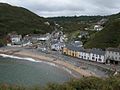
 Llangrannog beach and houses - geograph.org.uk - 952284.jpg 640 × 426; 71 KB
-
 Llangrannog Beach in July - geograph.org.uk - 4104473.jpg 640 × 360; 61 KB
-
 Llangrannog Beach in summer - geograph.org.uk - 4104402.jpg 640 × 360; 74 KB
-
 Llangrannog beach sunset 1.JPG 2,048 × 1,536; 1.41 MB
-
 Llangrannog beach sunset 2.JPG 2,048 × 1,536; 1.41 MB
-
 Llangrannog Dry Ski Slope - geograph.org.uk - 34326.jpg 640 × 480; 34 KB
-
 Llangrannog from above - geograph.org.uk - 6322420.jpg 4,896 × 3,264; 5.71 MB
-
 Llangrannog from across the grid line - geograph.org.uk - 6327072.jpg 4,896 × 3,264; 6.93 MB
-
 Llangrannog from near Ynys-Lochtyn - geograph.org.uk - 3076064.jpg 640 × 480; 76 KB
-
 Llangrannog from the beach - geograph.org.uk - 6022205.jpg 2,283 × 1,607; 1.68 MB
-
 Llangrannog from the beach - geograph.org.uk - 6322425.jpg 4,896 × 3,264; 4.51 MB
-
 Llangrannog from the rocks - geograph.org.uk - 6322427.jpg 4,896 × 3,264; 5.57 MB
-
 Llangrannog in August - geograph.org.uk - 3076114.jpg 640 × 480; 105 KB
-
 Llangrannog wales.jpg 1,632 × 1,232; 602 KB
-
 Llangrannog West Wales - geograph.org.uk - 4458331.jpg 640 × 360; 74 KB
-
 Llangrannog, Ceredigion - geograph.org.uk - 3363803.jpg 690 × 518; 138 KB
-
 Llangrannog-from-south-cliffs.jpg 1,200 × 900; 142 KB
-
 Llangrannog-Pano.jpg 2,960 × 400; 194 KB
-
 Llangranog - geograph.org.uk - 1524890.jpg 640 × 480; 43 KB
-
 Llangranog - geograph.org.uk - 1524901.jpg 640 × 480; 34 KB
-
 Llangranog - geograph.org.uk - 4579226.jpg 1,280 × 851; 341 KB
-
 Llangranog - geograph.org.uk - 4676899.jpg 1,600 × 1,059; 502 KB
-
 Llangranog - geograph.org.uk - 4676907.jpg 640 × 424; 39 KB
-
 Llangranog - geograph.org.uk - 602757.jpg 640 × 186; 38 KB
-
 Llangranog Beach - geograph.org.uk - 4579239.jpg 1,280 × 851; 276 KB
-
 Llangranog Beach - geograph.org.uk - 743614.jpg 640 × 434; 97 KB
-
 Llangranog coast - geograph.org.uk - 1524865.jpg 640 × 480; 58 KB
-
 Llangranog Mill - geograph.org.uk - 40151.jpg 640 × 480; 91 KB
-
 Llwybr Arfordir Ceredigion Coastal Path - geograph.org.uk - 2127155.jpg 690 × 518; 151 KB
-
 Looking down on Llangrannog - geograph.org.uk - 2302412.jpg 3,072 × 2,304; 2.32 MB
-
 Low tide at Llangranog beach - geograph.org.uk - 2297267.jpg 1,024 × 685; 145 KB
-
 Low tide at the beach of Llangrannog - geograph.org.uk - 917204.jpg 640 × 367; 69 KB
-
 Nant Fothau - geograph.org.uk - 1813573.jpg 3,168 × 4,224; 2.17 MB
-
 Nant Hawan meets the sea - geograph.org.uk - 747407.jpg 480 × 640; 48 KB
-
 Nant Hawen, Llangrannog - geograph.org.uk - 2072042.jpg 480 × 640; 136 KB
-
 Nantyparac - house on the crossroads - geograph.org.uk - 6022240.jpg 2,304 × 1,728; 1.67 MB
-
 Narrow gap in the coastal cliff - geograph.org.uk - 2015964.jpg 480 × 640; 107 KB
-
 New Inn, Brynhoffnant - geograph.org.uk - 4579166.jpg 1,280 × 851; 251 KB
-
 New Inn, Rhydlewis - geograph.org.uk - 6022249.jpg 2,221 × 1,652; 1.78 MB
-
 New Path - Wales Coast Path - geograph.org.uk - 4881801.jpg 3,639 × 1,847; 1.73 MB
-
 Northern end of Llangrannog beach - geograph.org.uk - 6022183.jpg 2,304 × 1,728; 1.85 MB
-
 Old lime kiln at Llangrannog - geograph.org.uk - 6022465.jpg 2,304 × 1,728; 1.63 MB
-

-
 Old signpost near Llangrannog - geograph.org.uk - 2017825.jpg 480 × 640; 125 KB
-
 On Llangrannog beach - geograph.org.uk - 3980059.jpg 640 × 360; 43 KB
-
 On the beach at Llangrannog - geograph.org.uk - 3980066.jpg 640 × 360; 66 KB
-
 On the beach at Llangrannog in May - geograph.org.uk - 3980056.jpg 640 × 360; 51 KB
-

-
 On the Ceredigion Coast Path - geograph.org.uk - 4104177.jpg 640 × 360; 50 KB
-
 On the coast path near Llangrannog - geograph.org.uk - 4104365.jpg 640 × 360; 56 KB
-

-

-
 Ordnance Survey 1GL Bolt - geograph.org.uk - 4668496.jpg 640 × 480; 96 KB
-
 Ordnance Survey Flush Bracket (S7788) - geograph.org.uk - 4668481.jpg 480 × 640; 138 KB
-
 Ordnance Survey Flush Bracket S778 - geograph.org.uk - 3485606.jpg 4,000 × 3,000; 5.01 MB
-
 Ordnance Survey Flush Bracket S7789 - geograph.org.uk - 3485624.jpg 4,000 × 3,000; 4.67 MB
-
 Ordnance Survey Flush Bracket S7790 - geograph.org.uk - 3485648.jpg 4,000 × 3,000; 2.15 MB
-
 Ornamental field gate, Pontgarreg - geograph.org.uk - 2017571.jpg 640 × 480; 158 KB
-
 Painting The Ship - geograph.org.uk - 6323064.jpg 4,896 × 3,264; 5.07 MB
-

-
 Part of Llangrannog in August - geograph.org.uk - 3076136.jpg 640 × 480; 99 KB
-

-
 Part of the beach at Llangrannog - geograph.org.uk - 2604275.jpg 640 × 480; 52 KB
-
 Part of the beach at Llangrannog - geograph.org.uk - 2661721.jpg 640 × 480; 61 KB
-
 Part of the Ceredigion Coast - geograph.org.uk - 4104139.jpg 640 × 360; 56 KB
-

-

-

-

-
 Part of the coast near Llangrannog - geograph.org.uk - 3076159.jpg 640 × 480; 83 KB
-

-

-

-
 Part of the Welsh coast - geograph.org.uk - 3076082.jpg 640 × 480; 66 KB
-
 Path to Llangrannog - geograph.org.uk - 1753613.jpg 2,048 × 1,360; 649 KB
-
 Pen Bilis - geograph.org.uk - 6022157.jpg 2,304 × 1,728; 2.01 MB
-
 Pen-rhip - geograph.org.uk - 481071.jpg 640 × 426; 93 KB
-
 Pen-rhip at Llangrannog - geograph.org.uk - 2678840.jpg 3,072 × 2,048; 986 KB
-
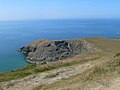
 Pendinas Lochtyn - geograph.org.uk - 6021968.jpg 2,304 × 1,728; 1.75 MB
-
 Pendinas Lochtyn hillfort - geograph.org.uk - 938512.jpg 640 × 423; 50 KB
-
 Penmorfa Primary School - geograph.org.uk - 40155.jpg 640 × 480; 44 KB
-
 Pentre Arms - geograph.org.uk - 722678.jpg 640 × 482; 102 KB
-
 Pentre Arms, Llangrannog - geograph.org.uk - 6022461.jpg 2,186 × 1,556; 1.6 MB
-
 Pentre Arms, Llangranog - geograph.org.uk - 743211.jpg 640 × 428; 96 KB
-
 Pentregat at Llangranog turning - geograph.org.uk - 3557241.jpg 640 × 472; 57 KB
-
 Pigeonsford farm - geograph.org.uk - 2603974.jpg 640 × 480; 102 KB
-
 Plaque for the Ceredigion Coast Path - geograph.org.uk - 4910825.jpg 480 × 640; 90 KB
-
 Postbox, Llangrannog - geograph.org.uk - 2121429.jpg 480 × 640; 71 KB
-
 Promontory headland of Traeth-yr-ynys - geograph.org.uk - 915723.jpg 640 × 480; 114 KB
-
 Railway carriage home. Llangrannog - geograph.org.uk - 2088608.jpg 640 × 480; 80 KB
-
 Reflections of Cardigan Bay - panoramio.jpg 2,045 × 1,156; 586 KB
-
 Reflections of Cardigan Bay, Llangrannog - panoramio.jpg 2,045 × 1,536; 955 KB
-
 Reflections of Llangrannog - panoramio.jpg 2,048 × 1,536; 1.09 MB
-
 Rhiw Gam - geograph.org.uk - 6022447.jpg 2,304 × 1,728; 1.7 MB
-
 Road junction in Blaencelyn - geograph.org.uk - 1993791.jpg 1,000 × 669; 281 KB
-
 Road junction west of Blaencelyn - geograph.org.uk - 1993786.jpg 1,000 × 669; 394 KB
-
 Rock ecology and erosion - geograph.org.uk - 638122.jpg 480 × 640; 182 KB
-
 Rock on Llangranog beach - geograph.org.uk - 733458.jpg 640 × 480; 74 KB


.jpg)


_-_geograph.org.uk_-_4668481.jpg)


