Category:Llangattock, Powys
Jump to navigation
Jump to search
village in Powys, Wales  | |||||
| Upload media | |||||
| Pronunciation audio | |||||
|---|---|---|---|---|---|
| Instance of | |||||
| Location | Powys, Wales | ||||
| Population |
| ||||
| Area |
| ||||
 | |||||
English: Llangattock (or Llangatwg in Welsh) is a village and community in the Brecon Beacons National Park in the south of Powys in south Wales. It lies in the Usk Valley just across the river from the town of Crickhowell. The Monmouthshire and Brecon Canal passes through the community en route between Brecon and Pontypool.
Cymraeg: Pentref a chymuned ym Mhowys yw Llangatwg
Subcategories
This category has the following 7 subcategories, out of 7 total.
Media in category "Llangattock, Powys"
The following 200 files are in this category, out of 471 total.
(previous page) (next page)-
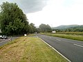
 30 on the A4077 in Legar - geograph.org.uk - 4757611.jpg 640 × 546; 93 KB
-

-
 A dry stone wall near Llangattock. - geograph.org.uk - 3109434.jpg 640 × 480; 113 KB
-
 A large chapel in Llangattock - geograph.org.uk - 2444817.jpg 640 × 480; 56 KB
-
 A Shake Hole on Cefn Onnau - geograph.org.uk - 3092614.jpg 640 × 480; 143 KB
-
-
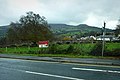
 A4077 at Llangattock - geograph.org.uk - 4328229.jpg 800 × 451; 190 KB
-
 A4077 from Legar towards Gilwern - geograph.org.uk - 4747554.jpg 800 × 517; 128 KB
-
 A4077 through Legar - geograph.org.uk - 4757573.jpg 800 × 681; 106 KB
-
 A4077, early morning - geograph.org.uk - 4327646.jpg 800 × 800; 270 KB
-
 Access land below Darren Cilau - geograph.org.uk - 5005677.jpg 1,600 × 901; 755 KB
-
 Across Crickhowell Bridge, Crickhowell - geograph.org.uk - 4763251.jpg 800 × 685; 134 KB
-

-
 Agen Allwedd Cave - geograph.org.uk - 609736.jpg 640 × 480; 110 KB
-

-
 Anti-litter sign scorned, Llangattock - geograph.org.uk - 3037198.jpg 640 × 564; 103 KB
-
 Approaching Blaen-Onneu - geograph.org.uk - 4370010.jpg 800 × 450; 197 KB
-

-
 Archway into stable courtyard, Glanusk Estate - geograph.org.uk - 4444371.jpg 3,240 × 4,320; 2.36 MB
-
 Attending to the sheep - geograph.org.uk - 4369969.jpg 800 × 451; 204 KB
-

-
 Autumn in the Llangattock escarpment - geograph.org.uk - 3707364.jpg 640 × 480; 79 KB
-

-
 Barges at Llangattock - geograph.org.uk - 4443930.jpg 4,320 × 3,240; 4.51 MB
-

-
 Beech View, Llangattock - geograph.org.uk - 4748563.jpg 800 × 645; 117 KB
-
 Beer across the water - geograph.org.uk - 4443990.jpg 3,240 × 4,320; 3.76 MB
-
 Bend in the A4077, Legar - geograph.org.uk - 4757618.jpg 800 × 650; 113 KB
-

-

-
 Bethesda Chapel, Llangattock - geograph.org.uk - 3667747.jpg 1,024 × 768; 103 KB
-
 Bethesda Chapel, Llangattock - geograph.org.uk - 4443924.jpg 4,320 × 3,240; 3.67 MB
-

-
 Blaen Onneu - geograph.org.uk - 4552993.jpg 640 × 480; 107 KB
-
 Blaen-Onneu - geograph.org.uk - 4380967.jpg 800 × 450; 186 KB
-
 Boats at Heron's Rest Marina - geograph.org.uk - 5473055.jpg 640 × 427; 96 KB
-
 Boats at Heron's Rest Marina - geograph.org.uk - 5473057.jpg 640 × 427; 108 KB
-
 Boats moored on the canal at Llangattock - geograph.org.uk - 3109667.jpg 640 × 480; 135 KB
-
 Boundary wall at Coed yr Eithin - geograph.org.uk - 4444328.jpg 4,320 × 3,240; 2.96 MB
-
 Bridge 110 on the Monmouthshire and Brecon Canal - geograph.org.uk - 6412520.jpg 3,264 × 1,632; 2.91 MB
-
 Bridge 110 on the Monmouthshire and Brecon Canal - geograph.org.uk - 6413233.jpg 3,264 × 1,632; 2.75 MB
-
 Bridge 110 on the Monmouthshire and Brecon Canal - geograph.org.uk - 6413234.jpg 3,264 × 1,384; 2.65 MB
-
 Bridge 113, Mon ^ Brec canal - geograph.org.uk - 6329689.jpg 2,816 × 2,112; 2.77 MB
-
 Bridge 120, Mon ^ Brec canal - geograph.org.uk - 6328961.jpg 4,896 × 3,264; 6.41 MB
-
 Bridge over the Mon ^ Brec - geograph.org.uk - 6328920.jpg 4,896 × 3,264; 5.01 MB
-
 Brook Cottage, Legar - geograph.org.uk - 4757626.jpg 800 × 542; 100 KB
-
 Brook flows towards the River Usk - geograph.org.uk - 3021035.jpg 640 × 480; 111 KB
-
 BT phonebox in Llangattock - geograph.org.uk - 4748519.jpg 800 × 726; 173 KB
-
 Burial cairn above the Usk Valley - geograph.org.uk - 3490806.jpg 640 × 480; 73 KB
-
 Burial cairn on Twr Pen-cyrn - geograph.org.uk - 3490840.jpg 640 × 480; 94 KB
-
 Campsite and canoe - geograph.org.uk - 6328683.jpg 4,896 × 3,264; 4.58 MB
-
 Canal above Fro Bridge, No. 122 - geograph.org.uk - 6228620.jpg 5,179 × 3,451; 4.01 MB
-
 Canal and path west of Dyfnant Bridge - geograph.org.uk - 4259517.jpg 800 × 706; 221 KB
-
 Canal at Llangattock - geograph.org.uk - 6328680.jpg 4,896 × 3,264; 6.25 MB
-
 Canal east of Dyfnant Bridge - geograph.org.uk - 4259514.jpg 800 × 584; 150 KB
-
 Canal from Dardy - geograph.org.uk - 2079854.jpg 3,216 × 2,136; 1.75 MB
-
 Canal House, Llangattock - geograph.org.uk - 4443949.jpg 4,230 × 2,594; 2.37 MB
-
 Canal House, Llangattock - geograph.org.uk - 6329321.jpg 4,771 × 3,181; 2.81 MB
-
 Canalside house, Llangattock - geograph.org.uk - 3667685.jpg 1,024 × 768; 198 KB
-

-
 Carn Coch, Llangattock - geograph.org.uk - 3241202.jpg 2,592 × 1,944; 1.69 MB
-
 Cars parked on a grass verge in Legar - geograph.org.uk - 4747660.jpg 800 × 603; 110 KB
-
 Cattle grid on road down to Llangattock - geograph.org.uk - 5264822.jpg 5,184 × 3,456; 7.02 MB
-
 Cattle take a splodge, on New Year's Day - geograph.org.uk - 1101740.jpg 640 × 480; 105 KB
-
 Cave entrance at the cliff base - geograph.org.uk - 3707329.jpg 640 × 480; 146 KB
-
 Cefn Onnau - geograph.org.uk - 3853827.jpg 800 × 467; 83 KB
-
 Cefn Onneu - geograph.org.uk - 5487875.jpg 1,600 × 1,200; 357 KB
-
 Church View, Llangattock - geograph.org.uk - 3035448.jpg 640 × 476; 68 KB
-
 Chwar Mawr - geograph.org.uk - 433578.jpg 480 × 640; 108 KB
-
 Chwar Mawr - geograph.org.uk - 4552936.jpg 640 × 480; 96 KB
-
 Cilffordd Laswern Byway, Llangatwg - geograph.org.uk - 2911676.jpg 690 × 518; 262 KB
-
 Coffee break - geograph.org.uk - 6329297.jpg 4,631 × 3,087; 4.82 MB
-

-

-

-
 Craig y Castell - geograph.org.uk - 3112821.jpg 640 × 480; 119 KB
-
 Craig y Cilau - geograph.org.uk - 1765292.jpg 640 × 480; 87 KB
-
 Craig y Cilau - geograph.org.uk - 956178.jpg 640 × 480; 75 KB
-
 Craig y Cilau nature reserve - geograph.org.uk - 1765300.jpg 640 × 480; 70 KB
-
 Craig y Ciliau - geograph.org.uk - 4552945.jpg 640 × 480; 90 KB
-
 Craig y Ciliau - geograph.org.uk - 4552952.jpg 640 × 480; 77 KB
-
 Crickhowel Bridge - geograph.org.uk - 4443985.jpg 4,320 × 2,466; 2.51 MB
-
 Crickhowel Bridge - geograph.org.uk - 4444172.jpg 4,320 × 3,240; 2.86 MB
-

-
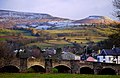
 Crickhowell Bridge - geograph.org.uk - 1947933.jpg 640 × 586; 108 KB
-
 Crickhowell bridge - geograph.org.uk - 2065158.jpg 3,216 × 2,136; 1.73 MB
-
 Crickhowell Bridge - geograph.org.uk - 2215551.jpg 800 × 534; 115 KB
-
 Crickhowell Bridge - geograph.org.uk - 5572686.jpg 2,592 × 1,944; 1.49 MB
-
 Crickhowell bridge - geograph.org.uk - 6414531.jpg 3,648 × 2,432; 5.03 MB
-
 Crickhowell Bridge and Crug Hywel - geograph.org.uk - 4328232.jpg 800 × 522; 273 KB
-

-

-
 Crickhowell Bridge, from the north - geograph.org.uk - 5474116.jpg 640 × 427; 87 KB
-
 Crickhowell from the road to Llangattock - geograph.org.uk - 2030604.jpg 1,600 × 1,200; 497 KB
-

-
 Crickhowell, bridge, town and hills - geograph.org.uk - 4328222.jpg 800 × 451; 193 KB
-

-
 Cwm Onnau, 1 - geograph.org.uk - 4340810.jpg 800 × 450; 193 KB
-
 Cwm Onnau, 2 - geograph.org.uk - 4369974.jpg 800 × 450; 180 KB
-
 Cwm Waun Llech - geograph.org.uk - 4553011.jpg 640 × 480; 107 KB
-
 Dardy fields with Crickhowell town in the distance - geograph.org.uk - 2080182.jpg 3,216 × 2,136; 1.72 MB
-
 Dardy from the back lane - geograph.org.uk - 2080183.jpg 3,216 × 2,136; 1.59 MB
-
 Dardy houses - geograph.org.uk - 4198308.jpg 800 × 775; 109 KB
-
 Darren Cilau - geograph.org.uk - 956187.jpg 640 × 480; 76 KB
-

-

-

-
 Dim Baeddu-No Fouling notice, Legar - geograph.org.uk - 4757639.jpg 800 × 600; 208 KB
-
 Disgwylfa mountain road - geograph.org.uk - 4340833.jpg 800 × 451; 170 KB
-
 Disgwylfa mountain road - geograph.org.uk - 4369988.jpg 800 × 450; 195 KB
-
 Downhill from Waun Watcyn - geograph.org.uk - 5354973.jpg 4,320 × 3,240; 3.45 MB
-
 Drinking fountain detail, Llangattock - geograph.org.uk - 3035127.jpg 640 × 480; 107 KB
-
 Drinking fountain, Llangattock - geograph.org.uk - 3035114.jpg 640 × 464; 57 KB
-

-
 Driveway to Penffawyddog - geograph.org.uk - 4369561.jpg 800 × 450; 188 KB
-
 Drove track and bridleway - geograph.org.uk - 4369968.jpg 800 × 450; 195 KB
-

-
 Early morning mist above Llangattock - geograph.org.uk - 4202853.jpg 1,024 × 768; 83 KB
-
 Empty canal at Llangattock - geograph.org.uk - 6329692.jpg 2,816 × 2,112; 2.81 MB
-

-
 Enclosed pastures - geograph.org.uk - 4369978.jpg 800 × 450; 172 KB
-
 Entering Crickhowell - geograph.org.uk - 373287.jpg 640 × 480; 140 KB
-
 Entering Llangattock from the west - geograph.org.uk - 3113137.jpg 640 × 480; 106 KB
-
 Entrance to Eglwys Faen cave - geograph.org.uk - 4253869.jpg 800 × 674; 198 KB
-
 Entrance to Llangattock Allotments - geograph.org.uk - 3037235.jpg 640 × 462; 80 KB
-

-
 Farmland near Llangattock - geograph.org.uk - 3109397.jpg 640 × 480; 116 KB
-
 Fence line above Cwm Onnau - geograph.org.uk - 5264799.jpg 5,179 × 3,451; 5.43 MB
-
 Ffarm Ty Mawr Farm, Llangatwg - geograph.org.uk - 2911662.jpg 690 × 518; 179 KB
-
 Field beside canal at bridge No. 111 - geograph.org.uk - 5474104.jpg 640 × 427; 79 KB
-
 Field beyond the houses in Legar - geograph.org.uk - 4757635.jpg 800 × 499; 118 KB
-
 Field House, Legar - geograph.org.uk - 4757605.jpg 800 × 554; 120 KB
-
 Field hydrants east of Llangynidr - geograph.org.uk - 4164249.jpg 800 × 618; 134 KB
-

-
 Field north of St. Catwg's church, Llangattock - geograph.org.uk - 2030592.jpg 1,600 × 1,200; 519 KB
-

-
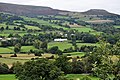
 Fields by the Usk Valley Walk - geograph.org.uk - 5572715.jpg 2,592 × 1,944; 1.24 MB
-
 Fields in the Usk Valley - geograph.org.uk - 1324194.jpg 640 × 426; 83 KB
-

-
 Footpath above the Nant Onneu valley - geograph.org.uk - 2444861.jpg 640 × 480; 120 KB
-

-

-
 Footpath below Craig y Cilau - geograph.org.uk - 2445128.jpg 640 × 480; 68 KB
-

-

-

-
 Footpath to Llwynon Farm - geograph.org.uk - 4369584.jpg 800 × 450; 219 KB
-
 Footpath up the incline - geograph.org.uk - 2444882.jpg 640 × 480; 146 KB
-

-
 Former tramway at the quarries above Llangattock - geograph.org.uk - 3753367.jpg 4,320 × 3,240; 2.18 MB
-
 From metal railings to stone wall, Legar - geograph.org.uk - 4757530.jpg 800 × 484; 131 KB
-
 Giant shakehole - geograph.org.uk - 4767245.jpg 2,345 × 850; 537 KB
-

-

-
 Glan Usk Estate offices - geograph.org.uk - 4198255.jpg 800 × 638; 97 KB
-

-
 Glanusk park - geograph.org.uk - 2079881.jpg 3,216 × 2,136; 1.8 MB
-
 Glanusk Park - geograph.org.uk - 2551668.jpg 1,600 × 1,200; 622 KB
-
 Glanusk Park Bridge - geograph.org.uk - 4444350.jpg 4,320 × 3,240; 3.42 MB
-
 Glanusk Park Farm - geograph.org.uk - 4198250.jpg 800 × 526; 79 KB
-
 Glanusk Park farm - geograph.org.uk - 4328254.jpg 800 × 451; 201 KB
-
 Glanusk Park, 1 - geograph.org.uk - 4328240.jpg 800 × 451; 216 KB
-
 Glanusk Park, 2 - geograph.org.uk - 4328244.jpg 800 × 451; 188 KB
-
 Glanusk Park, 3 - geograph.org.uk - 4328250.jpg 800 × 451; 195 KB
-

-

-
 Green lane - geograph.org.uk - 670822.jpg 640 × 480; 113 KB
-
 Greenman Festival - August 2014 - geograph.org.uk - 5729795.jpg 640 × 427; 108 KB
-
 Greenways near Crickhowell - geograph.org.uk - 4748590.jpg 800 × 526; 117 KB
-

-

-
 Heron's Nest marina - geograph.org.uk - 6329658.jpg 2,112 × 2,816; 2.89 MB
-
 Hill road to Llangattock, 2015 - geograph.org.uk - 4380965.jpg 800 × 450; 208 KB
-
 Hillside above Cwm Onneu Fach - geograph.org.uk - 2445114.jpg 640 × 480; 80 KB
-
 Hillside above Wern Watkin - geograph.org.uk - 5005717.jpg 1,600 × 901; 756 KB
-
 Hillside below the B4560 - geograph.org.uk - 4444286.jpg 4,320 × 2,340; 1.51 MB
-
 Hillside community - geograph.org.uk - 5005696.jpg 1,600 × 901; 691 KB
-

-

-
 Hillside Road, Llangattock - geograph.org.uk - 1414049.jpg 640 × 428; 74 KB
-
 Hillside Road, Llangattock - geograph.org.uk - 2022670.jpg 1,496 × 1,122; 654 KB
-
 Hillside Road, Llangattock - geograph.org.uk - 3667656.jpg 1,024 × 768; 146 KB
-
 Hilltop snow north of Crickhowell - geograph.org.uk - 4757534.jpg 800 × 506; 89 KB
-
 Horse Shoe Inn, Llangattock - geograph.org.uk - 3037172.jpg 640 × 399; 57 KB
-
 House below the road at Dardy - geograph.org.uk - 3667728.jpg 1,024 × 768; 150 KB
-
 Houses at the eastern edge of Legar - geograph.org.uk - 4757627.jpg 800 × 591; 102 KB
-
 Housing variety in Legar - geograph.org.uk - 4757624.jpg 800 × 647; 101 KB
-
 Improvised table - geograph.org.uk - 6328689.jpg 4,896 × 3,264; 6.58 MB
-

-
 Junction at Waun Watcyn - geograph.org.uk - 5005728.jpg 1,600 × 901; 669 KB
-

-

-
 Kate's Cottage, Legar - geograph.org.uk - 4757563.jpg 800 × 607; 110 KB
-
 Lane at Pant-y-rhiw - geograph.org.uk - 5005705.jpg 1,600 × 901; 773 KB
-
 Lane at Pencroeslan-isaf - geograph.org.uk - 4369578.jpg 800 × 450; 201 KB
-
 Lane from the A40 to Fro Farm - geograph.org.uk - 3021032.jpg 640 × 450; 78 KB
-
 Lime kilns at Llangattock - geograph.org.uk - 4443964.jpg 4,248 × 3,142; 3.3 MB
-
 Limestone blocks below Darren Cilau - geograph.org.uk - 3753370.jpg 4,320 × 3,240; 1.73 MB
-
 Llangattock , the road to Dardy - geograph.org.uk - 3035368.jpg 640 × 494; 71 KB
-
 Llangattock - geograph.org.uk - 1195271.jpg 640 × 426; 77 KB


