Category:Llanfaethlu
Jump to navigation
Jump to search
community and village in Anglesey, in north-west Wales  | |||||
| Upload media | |||||
| Instance of | |||||
|---|---|---|---|---|---|
| Location | Isle of Anglesey, Wales | ||||
| Inception |
| ||||
 | |||||
Subcategories
This category has the following 4 subcategories, out of 4 total.
Media in category "Llanfaethlu"
The following 200 files are in this category, out of 374 total.
(previous page) (next page)-
 "The Black Lion Inn" at Llanfaethlu - geograph.org.uk - 5344661.jpg 5,184 × 3,888; 6.07 MB
-
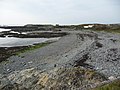
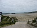
 A beach with sand^ - geograph.org.uk - 4857986.jpg 640 × 480; 45 KB
-
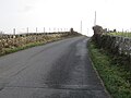
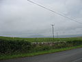
 A bend in the Llanfaethlu road - geograph.org.uk - 1400900.jpg 640 × 480; 80 KB
-
 A boat comes ashore on Holyhead Bay - geograph.org.uk - 2352073.jpg 640 × 480; 100 KB
-

-
 A field of rape north of Garreglwyd - geograph.org.uk - 1392861.jpg 640 × 480; 80 KB
-
 Agricultural Buildings, Cil Maenen - geograph.org.uk - 6241166.jpg 1,600 × 1,200; 414 KB
-
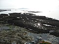
 Ancient rocks on Penrhyn headland - geograph.org.uk - 4858541.jpg 640 × 480; 88 KB
-
 Anglesey Coast Path - geograph.org.uk - 4857953.jpg 640 × 480; 97 KB
-
 Anglesey Coast Path - geograph.org.uk - 4857968.jpg 640 × 480; 66 KB
-
 Anglesey Coast Path - geograph.org.uk - 4858510.jpg 640 × 480; 105 KB
-
 Anglesey Coast Path - geograph.org.uk - 4858751.jpg 640 × 473; 88 KB
-
 Anglesey coastal footpath - geograph.org.uk - 6231256.jpg 800 × 600; 129 KB
-

-

-
 Approaching the summit of Tywyn-mawr - geograph.org.uk - 1370178.jpg 640 × 480; 101 KB
-
 Beach platform - geograph.org.uk - 6230695.jpg 800 × 600; 149 KB
-
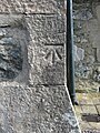 Bench mark on St Mwrog's church, Llanfwrog - geograph.org.uk - 5671530.jpg 769 × 1,024; 514 KB
-
 Bend in the road south of 'Refail - geograph.org.uk - 1368944.jpg 640 × 481; 120 KB
-

-
 Boat recovery, Porth-yr-afon - geograph.org.uk - 6230677.jpg 800 × 600; 132 KB
-
 Bovine creature near the path at Porthwen, Anglesey - geograph.org.uk - 6176654.jpg 4,000 × 3,000; 4.63 MB
-

-
 Capel Ebenezer, Llanfaethlu - geograph.org.uk - 1405588.jpg 640 × 480; 76 KB
-
 Capel Ebenezer, Llanfaethlu - geograph.org.uk - 4853044.jpg 640 × 480; 59 KB
-
 Capel Salem and Cae'r Leici - geograph.org.uk - 1367921.jpg 480 × 640; 84 KB
-
 Caravans at the Penrhyn Caravan Park - geograph.org.uk - 1380557.jpg 640 × 415; 40 KB
-
 Caravans at Tywyn Hir - geograph.org.uk - 1371143.jpg 640 × 350; 46 KB
-
 Carreglwyd Folly - geograph.org.uk - 3470517.jpg 640 × 452; 131 KB
-
 Carreglwyd Seat - geograph.org.uk - 3470518.jpg 640 × 480; 135 KB
-
 Cattle at Bryn Eglwys - geograph.org.uk - 1368941.jpg 640 × 394; 47 KB
-
 Cattle at Porthwen, Anglesey - geograph.org.uk - 6176647.jpg 4,000 × 3,000; 3.66 MB
-
-
 Cattle on valley floor land - geograph.org.uk - 1370158.jpg 640 × 306; 55 KB
-
 Cil Maenan Farmhouse, Llanfaethlu - geograph.org.uk - 1406486.jpg 640 × 466; 58 KB
-
 Coastal fields - geograph.org.uk - 6230690.jpg 800 × 600; 123 KB
-

-

-
 Cove at Porth-yr-afon - geograph.org.uk - 6230683.jpg 800 × 600; 165 KB
-
 Creigiau Cliperau on Trwyn Cliperau - geograph.org.uk - 1371178.jpg 640 × 480; 63 KB
-

-

-
 Derelict farm building at Penial Dowyn - geograph.org.uk - 5943354.jpg 4,184 × 2,789; 3.86 MB
-
 Dim Sbwriel - No Dumping - geograph.org.uk - 6099607.jpg 1,280 × 980; 982 KB
-
 Dissected rock platform - geograph.org.uk - 6231245.jpg 800 × 600; 141 KB
-
 Drumlin erosion, Porth Trefadog - geograph.org.uk - 6231012.jpg 800 × 600; 158 KB
-
 Drumlin west of Bodfardden-ddu - geograph.org.uk - 1272707.jpg 640 × 304; 23 KB
-
 Duneland behind Porth Tywyn-mawr - geograph.org.uk - 1370369.jpg 640 × 480; 60 KB
-
 Emerging reef as the tide retreats - geograph.org.uk - 1363437.jpg 640 × 349; 33 KB
-
-
 Erratic boulder - geograph.org.uk - 6231025.jpg 800 × 600; 114 KB
-
 Erratic boulder - geograph.org.uk - 6231660.jpg 800 × 600; 136 KB
-

-

-
 Fadog Frech Farm, Llanfaethlu - geograph.org.uk - 1353683.jpg 640 × 480; 79 KB
-
 Farm road to Bryn Eglwys farm - geograph.org.uk - 1367902.jpg 479 × 640; 63 KB
-

-
 Farm track to Penial Dowyn - geograph.org.uk - 4858741.jpg 640 × 480; 85 KB
-
 Farmland - geograph.org.uk - 38886.jpg 640 × 480; 63 KB
-
 Farmland at Tyddyn Gwasarn - geograph.org.uk - 1379851.jpg 640 × 481; 54 KB
-

-

-
 Farmland east of Trefadog bay - geograph.org.uk - 1406101.jpg 640 × 481; 61 KB
-
 Farmland south of the A5025 - geograph.org.uk - 1376353.jpg 640 × 480; 38 KB
-
 Farmland west of Maenir cottage - geograph.org.uk - 1408650.jpg 640 × 480; 87 KB
-
 Field at Graianfa - geograph.org.uk - 6093495.jpg 1,280 × 960; 856 KB
-
 Field near to Llanfaethlu - geograph.org.uk - 197437.jpg 640 × 480; 100 KB
-
 Footpath to Plas Uchaf - geograph.org.uk - 6159710.jpg 6,000 × 4,000; 3.65 MB
-
 Gamekeepers Cottage - geograph.org.uk - 1000881.jpg 640 × 480; 117 KB
-
 Gorse enclosed footpath - geograph.org.uk - 5635353.jpg 4,000 × 3,000; 4.6 MB
-

-
 Grazing land at Plas Uchaf - geograph.org.uk - 1408548.jpg 640 × 481; 53 KB
-
 Grazing land near Tyddyn-llwyn - geograph.org.uk - 1376348.jpg 640 × 480; 42 KB
-
 Grazing land south of Bryn-eglwys - geograph.org.uk - 1376347.jpg 640 × 363; 33 KB
-

-
-

-
 Haymaking at Gaerwen Farm - geograph.org.uk - 1356769.jpg 640 × 286; 46 KB
-
 Headland with rock armour - geograph.org.uk - 6230713.jpg 800 × 600; 151 KB
-
-
-
 Improvised sea-defences west of Penrhyn - geograph.org.uk - 1381005.jpg 640 × 480; 108 KB
-

-
 Kettle lake at Bryn Maethlu Farm - geograph.org.uk - 1390321.jpg 640 × 480; 58 KB
-
 Kite flying at Porth Tywyn-mawr - geograph.org.uk - 1366348.jpg 640 × 481; 41 KB
-
 Landslips and drumlin erosion - geograph.org.uk - 6231017.jpg 800 × 600; 141 KB
-
 Lane at Cil Maenan - geograph.org.uk - 6189877.jpg 4,000 × 3,000; 2.11 MB
-
 Lane at Rhyd Goch - geograph.org.uk - 6159733.jpg 6,000 × 4,000; 2.1 MB
-
 Lane near Llanfaethlu - geograph.org.uk - 6159722.jpg 6,000 × 4,000; 3.6 MB
-
 Lane towards swtan and Church Bay - geograph.org.uk - 5635349.jpg 4,000 × 3,000; 3.1 MB
-

-

-
 Llanfaethlu Coffee House - geograph.org.uk - 4853034.jpg 640 × 480; 51 KB
-
 Llanfaethlu, UK - panoramio.jpg 5,184 × 3,456; 1.67 MB
-
 Llanfwrog Church - St Mwrog's - geograph.org.uk - 3379092.jpg 640 × 480; 73 KB
-

-
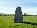
 Lone standing stone at Llanfaethlu - geograph.org.uk - 5350483.jpg 3,888 × 5,184; 5.27 MB
-
 Long straight road to Cilmaenan - geograph.org.uk - 2638443.jpg 640 × 480; 59 KB
-
 Low tide at Porthwen - geograph.org.uk - 4857942.jpg 640 × 478; 79 KB
-

-

-

-

-

-
 Minor road junction at Penrhos-ddu - geograph.org.uk - 1408459.jpg 640 × 480; 69 KB
-
 Minor road junction east of Penrhyn - geograph.org.uk - 1369411.jpg 640 × 480; 45 KB
-

-
 Natural arch at Porth y Ffynnon - geograph.org.uk - 1400970.jpg 480 × 640; 102 KB
-
 Natural arch at Porth y Ffynnon - geograph.org.uk - 1400977.jpg 404 × 640; 84 KB
-

-

-
 Not designed for modern traffic - geograph.org.uk - 1368972.jpg 640 × 481; 66 KB
-
 Old farm buildings at Cae Nethor - geograph.org.uk - 1405690.jpg 640 × 480; 109 KB
-
 Old farm buildings at Penial Dowyn - geograph.org.uk - 4858743.jpg 640 × 480; 90 KB
-

-
 On the Anglesey Coast Path - geograph.org.uk - 4858697.jpg 640 × 470; 58 KB
-
 Ordnance Survey Flush Bracket S7553 - geograph.org.uk - 5638111.jpg 4,000 × 3,000; 3.73 MB
-
-

-
 Pasture land north of Plas Newydd - geograph.org.uk - 1272689.jpg 640 × 341; 19 KB
-

-
 Path leading to Porth Delysg - geograph.org.uk - 1381029.jpg 640 × 480; 88 KB
-

-

-
 Penial Dowyn Farm from the beach - geograph.org.uk - 1366335.jpg 640 × 481; 61 KB
-
 Penial Fawr - geograph.org.uk - 4858704.jpg 640 × 480; 83 KB
-
 Penrallt Cottage - geograph.org.uk - 1405715.jpg 640 × 480; 65 KB
-
 Penrhyn Bay Caravan Site - geograph.org.uk - 4858544.jpg 640 × 480; 53 KB
-
 Penterfyn - geograph.org.uk - 1400895.jpg 640 × 480; 57 KB
-
 Plas Uchaf Farm, Llanfaethlu - geograph.org.uk - 1271333.jpg 640 × 480; 48 KB
-
 Plas y Glyn Farm from drumlin 31 - geograph.org.uk - 1369460.jpg 640 × 482; 50 KB
-
 Plot of land at Plas Newydd - geograph.org.uk - 6099600.jpg 1,280 × 960; 1,000 KB
-

-

-
 Pont Garreglwyd - geograph.org.uk - 1392489.jpg 640 × 480; 131 KB
-
 Pont Porth yr Afon bridge - geograph.org.uk - 1401009.jpg 640 × 480; 74 KB
-
-
 Porth Fudr - geograph.org.uk - 1401064.jpg 640 × 480; 71 KB
-
 Porth Fudr and Holyhead Bay - geograph.org.uk - 6178882.jpg 4,000 × 3,000; 3.75 MB
-
 Porth Fudr at sundown - geograph.org.uk - 5340862.jpg 3,617 × 4,822; 3.61 MB
-
 Porth Penterfyn - geograph.org.uk - 1401016.jpg 640 × 372; 62 KB
-
 Porth Trefadog - geograph.org.uk - 5469595.jpg 3,891 × 2,508; 1.8 MB
-
 Porth Trwyn - geograph.org.uk - 1285199.jpg 640 × 480; 84 KB
-
 Porth Trwyn - geograph.org.uk - 1285215.jpg 640 × 480; 125 KB
-
 Porth Trwyn - geograph.org.uk - 4857945.jpg 640 × 480; 90 KB
-
 Porth Trwyn - geograph.org.uk - 6241143.jpg 1,600 × 1,200; 584 KB
-
 Porth Trwyn beach at sunset - geograph.org.uk - 5350503.jpg 5,183 × 3,887; 3.88 MB
-
 Porth Trwyn, Anglesey - geograph.org.uk - 6178810.jpg 4,000 × 3,000; 4.28 MB
-
 Porth Tywyn Mawr - geograph.org.uk - 4858519.jpg 640 × 480; 64 KB
-
 Porth Tywyn Mawr at low tide - geograph.org.uk - 4858525.jpg 640 × 480; 60 KB
-
 Porth Tywyn-mawr beach - geograph.org.uk - 1370400.jpg 640 × 310; 29 KB
-

-
-

-
 Private access road to Tyddyn-y-waen - geograph.org.uk - 1353665.jpg 640 × 480; 79 KB
-
 Reef at Carreg-y-fran - geograph.org.uk - 1401050.jpg 640 × 480; 60 KB
-

-
 Reefs and inlets - geograph.org.uk - 6231643.jpg 800 × 600; 109 KB
-

-

-
 Reefs in Porth Penterfyn - geograph.org.uk - 1407166.jpg 640 × 480; 91 KB
-
 Reefs in Porth Tywyn-mawr - geograph.org.uk - 1370409.jpg 640 × 481; 49 KB
-
 Reefs off Trwyn Gwter-Fudr point - geograph.org.uk - 1401071.jpg 640 × 480; 71 KB
-

-
 Rhyd Goch Farm, Llanfaethlu - geograph.org.uk - 1356760.jpg 640 × 489; 65 KB
-
 Road junction at Penrallt - geograph.org.uk - 1406031.jpg 640 × 484; 60 KB
-
 Road junction in Llanfaethlu - geograph.org.uk - 2638429.jpg 640 × 479; 41 KB
-
 Road past Parcnewydd - geograph.org.uk - 2638467.jpg 640 × 482; 81 KB
-
 Road to Llanfaethlu near Maes Maethlu - geograph.org.uk - 5635356.jpg 4,000 × 3,000; 2.73 MB
-
 Road to Maes Maethlu in Llanfaethlu - geograph.org.uk - 5620694.jpg 4,000 × 3,000; 2.83 MB
-
 Rock pool in the wave cut platform - geograph.org.uk - 1400874.jpg 640 × 480; 149 KB
-
 Rocks at Trwyn Porth-yr-Afon point - geograph.org.uk - 1401030.jpg 640 × 480; 56 KB
-

-
 Rocky foreshore on Holyhead Bay - geograph.org.uk - 2352085.jpg 640 × 480; 83 KB
-
-
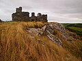 Ruined Telegraph Station, Carreglwyd - geograph.org.uk - 6241177.jpg 1,600 × 1,200; 569 KB
-
 Ruins of Telegraph Station - geograph.org.uk - 1000819.jpg 640 × 480; 87 KB
-
 Rutted lane near Ty Newydd - geograph.org.uk - 1400906.jpg 640 × 480; 53 KB
-
 Sant Maethlu, Llanfaethlu, Anglesey - geograph.org.uk - 3787822.jpg 1,600 × 865; 135 KB
-
 Seafront property - geograph.org.uk - 1285183.jpg 640 × 480; 113 KB
-
-

-
 Sewage Outfall on Traeth y Gribin - geograph.org.uk - 5942919.jpg 5,184 × 3,456; 5.58 MB
-

-
 Sheep above Trwyn Gwter-Fudr - geograph.org.uk - 1407031.jpg 640 × 480; 71 KB
-
-
-
 Shingle and bungalows at Porth Trwyn - geograph.org.uk - 4980330.jpg 5,184 × 3,888; 5.76 MB
-

-
 Shore view, Pen-terfyn - geograph.org.uk - 6230993.jpg 800 × 600; 130 KB
-

-

-

-

-
 Soar Standing Stone - geograph.org.uk - 6159715.jpg 3,680 × 2,891; 3.28 MB
-
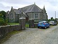
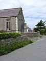
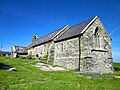
 St Maethlu's Church, Llanfaethlu - geograph.org.uk - 5058192.jpg 1,600 × 1,200; 475 KB
-
 St Maethlu's Church, Llanfaethlu - geograph.org.uk - 5344676.jpg 3,801 × 5,067; 3.95 MB
-
 St Maethlu's Church, Llanfaethlu - geograph.org.uk - 6157656.jpg 4,000 × 3,000; 4.03 MB
-
 St Maethlu's Church, Llanfaethlu - geograph.org.uk - 6157668.jpg 4,000 × 3,000; 3.61 MB
-
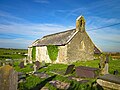 St Maethlu's Church, Llanfaethlu - geograph.org.uk - 6157676.jpg 4,000 × 3,000; 3.63 MB


_-_geograph.org.uk_-_1356755.jpg)


