Category:Llanelly
Jump to navigation
Jump to search
hamlet and community in Monmouthshire, Wales, United Kingdom | |||||
| Upload media | |||||
| Instance of | |||||
|---|---|---|---|---|---|
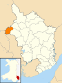
| Location | Monmouthshire, Wales | ||||
 | |||||

Cymraeg: Pentref a chymuned yn Sir Fynwy yw Llanelli (Saesneg: Llanelly). Saif rhwng Bryn-mawr a'r Fenni. Heblae Llanelli ei hun, mae'r gymuned yn cynnwys pentrefi Gilwern, Clydach a'r Darren Felen. Roedd poblogaeth y gymuned yn 2001 yn 3,810.
English: Llanelly is the name of both a village and its respective parish in Monmouthshire principal area, within the historic boundaries of Brecknockshire, south-east Wales.
Subcategories
This category has the following 10 subcategories, out of 10 total.
Media in category "Llanelly"
The following 200 files are in this category, out of 477 total.
(previous page) (next page)-
 2010 Wales Monmouthshire Community Llanelly map.svg 512 × 682; 699 KB
-
 2024 Wales Monmouthshire Community Llanelly map.svg 512 × 682; 603 KB
-
 A meeting of waters - geograph.org.uk - 3822937.jpg 640 × 480; 118 KB
-

-
 A Professional Beauty.jpg 1,569 × 2,357; 2.36 MB
-
 A very minor road - geograph.org.uk - 4362237.jpg 800 × 450; 207 KB
-
 A40 reaches Monmouthshire from Powys - geograph.org.uk - 2480915.jpg 640 × 537; 113 KB
-
 A40, Llanwenarth - geograph.org.uk - 2481166.jpg 640 × 480; 78 KB
-
 A4077 directions sign east of Gilwern - geograph.org.uk - 5497582.jpg 800 × 627; 165 KB
-

-
 A465 at Blackrock - geograph.org.uk - 2952459.jpg 640 × 480; 60 KB
-
 A465 at Gilwern - geograph.org.uk - 2154855.jpg 1,024 × 686; 201 KB
-
 A465 eastbound - geograph.org.uk - 2952532.jpg 640 × 480; 56 KB
-

-
 A465 near Cheltenham village - geograph.org.uk - 2952515.jpg 640 × 480; 51 KB
-
 A465 near Gilwern - geograph.org.uk - 2952561.jpg 640 × 480; 75 KB
-
 A465 south of Maesygwartha - geograph.org.uk - 2952544.jpg 640 × 480; 69 KB
-
 A465, Heads of the Valleys Road near Clydach, March 2017 - geograph.org.uk - 5304888.jpg 5,048 × 3,366; 4.24 MB
-
 Abergavenny Road leaves Gilwern - geograph.org.uk - 5497565.jpg 800 × 749; 165 KB
-

-
 Across canal bridge 104, Gilwern - geograph.org.uk - 5507029.jpg 800 × 600; 130 KB
-
 Across the Clydach gorge - geograph.org.uk - 4456806.jpg 4,320 × 3,240; 3.36 MB
-
 Across the Clydach Gorge from Darren Ddu - geograph.org.uk - 3753376.jpg 4,315 × 2,160; 1.44 MB
-
 Afon Clydach at Devils Bridge during Storm Dennis - geograph.org.uk - 6392830.jpg 1,200 × 1,600; 884 KB
-
 Ancient beech tree, Twyn Wenallt - geograph.org.uk - 5365254.jpg 5,179 × 3,451; 5.62 MB
-
 Annedd Dan Yr Eglwys, Llanelli - geograph.org.uk - 3996210.jpg 1,600 × 1,064; 499 KB
-

-
 Autumn colour near Pen-yr-heol - geograph.org.uk - 2145712.jpg 640 × 480; 140 KB
-
 Autumn in the Clydach Gorge - geograph.org.uk - 2648876.jpg 4,000 × 3,000; 4.48 MB
-

-

-
 B4248 near Waun Wen - geograph.org.uk - 3790723.jpg 640 × 481; 33 KB
-
 Back Road, Gilwern - geograph.org.uk - 5496597.jpg 672 × 800; 115 KB
-
 Bank Crescent, Gilwern - geograph.org.uk - 5504823.jpg 800 × 580; 90 KB
-
 Barns and horses at Coedcae Uchaf - geograph.org.uk - 2145725.jpg 640 × 480; 70 KB
-
 Basildene Close houses, Gilwern - geograph.org.uk - 5496344.jpg 800 × 649; 136 KB
-
 Beaconsfield Maesygwartha - geograph.org.uk - 3508460.jpg 800 × 558; 137 KB
-
 Beaufort Arms, Gilwern - geograph.org.uk - 2121816.jpg 640 × 480; 64 KB
-
 Beaufort Arms, Gilwern - geograph.org.uk - 5521082.jpg 800 × 640; 88 KB
-
 Beech Cottage, Back Road, Gilwern - geograph.org.uk - 5496576.jpg 796 × 800; 116 KB
-
 Beech Cottage, Gilwern - geograph.org.uk - 2121755.jpg 640 × 480; 63 KB
-
 Bench and litter bins, Gilwern - geograph.org.uk - 5496466.jpg 800 × 799; 128 KB
-

-

-

-
 Bilingual name sign on a Gilwern corner - geograph.org.uk - 5496360.jpg 800 × 665; 199 KB
-
 Bilingual name sign on a Gilwern corner - geograph.org.uk - 5505978.jpg 800 × 593; 148 KB
-

-
 Bole of ancient beech, Twyn Wenallt - geograph.org.uk - 5369266.jpg 5,179 × 3,451; 3.93 MB
-
 Bridge over former railway near Gilwern - geograph.org.uk - 2649290.jpg 4,000 × 3,000; 4.75 MB
-
 Bridge over the Nant Dyar - geograph.org.uk - 3822935.jpg 480 × 640; 106 KB
-
 Bridgend Inn, Gilwern - geograph.org.uk - 2121713.jpg 640 × 480; 72 KB
-
 Bridgend Inn, Gilwern - geograph.org.uk - 5499389.jpg 800 × 700; 114 KB
-
 Bridleway (unmarked) on Gilwern Hill - geograph.org.uk - 2476666.jpg 1,280 × 960; 682 KB
-
 Broadmead, Gilwern - geograph.org.uk - 2122035.jpg 640 × 480; 67 KB
-
 Broadmead, Gilwern - geograph.org.uk - 5496216.jpg 800 × 500; 94 KB
-

-
 Brooklyn Houses, Clydach - geograph.org.uk - 3508225.jpg 800 × 730; 144 KB
-
 Brynglas, Gilwern - geograph.org.uk - 5501351.jpg 800 × 607; 98 KB
-
 Bungalow and farm equipment - geograph.org.uk - 4343179.jpg 800 × 450; 195 KB
-
 Cambrian Inn, Llanelly Hill - geograph.org.uk - 1530884.jpg 640 × 480; 85 KB
-

-
 Canal NW of Church Road Gilwern - geograph.org.uk - 3508606.jpg 800 × 600; 159 KB
-
 Canal SE of Church Road Gilwern - geograph.org.uk - 3508604.jpg 800 × 600; 146 KB
-

-
 Canal, Gilwern - geograph.org.uk - 2121718.jpg 640 × 480; 95 KB
-
 Canalside moorings at Gilwern - geograph.org.uk - 3665365.jpg 640 × 480; 92 KB
-
 Canalside notice for cyclists, Gilwern - geograph.org.uk - 5521194.jpg 800 × 612; 172 KB
-
 Carreg Maen-Taro - geograph.org.uk - 497649.jpg 480 × 640; 100 KB
-
 Cartref, Gilwern - geograph.org.uk - 5508300.jpg 798 × 800; 128 KB
-
 Castle Boats hire base at Gilwern - geograph.org.uk - 5473084.jpg 640 × 427; 93 KB
-
 Chimneys, Llanelly - Sir George Clausen - ABDAG002689.jpeg 800 × 682; 54 KB
-
 Church Farm, Llanelly - geograph.org.uk - 507027.jpg 640 × 480; 91 KB
-
 Church Road and the Old Main Road - geograph.org.uk - 5005912.jpg 1,600 × 901; 736 KB
-
 Church Road telecoms cabinets, Gilwern - geograph.org.uk - 5504781.jpg 793 × 800; 126 KB
-
 Church Road, Clydach - geograph.org.uk - 3508372.jpg 800 × 600; 145 KB
-
 Clydach limeworks - geograph.org.uk - 2648922.jpg 4,000 × 3,000; 3.75 MB
-
 Clydach viaduct - geograph.org.uk - 2648745.jpg 4,000 × 3,000; 4.01 MB
-
 Coalwater Ponds - geograph.org.uk - 5487952.jpg 1,600 × 1,200; 729 KB
-
 Coalwater ponds, Lanelly Hill - geograph.org.uk - 1530909.jpg 640 × 480; 78 KB
-
 Coed Fyddlwyn, Clydach Gorge - geograph.org.uk - 5036735.jpg 5,179 × 3,451; 6.87 MB
-
 Coed Uchel, High Trees Road, Gilwern - geograph.org.uk - 5504701.jpg 800 × 634; 126 KB
-
 Common Road bungalows, Gilwern - geograph.org.uk - 5501378.jpg 800 × 526; 97 KB
-
 Common Road houses, Gilwern - geograph.org.uk - 5501367.jpg 800 × 617; 90 KB
-
 Common Road, Gilwern - geograph.org.uk - 2121644.jpg 640 × 556; 99 KB
-
 Construction of new carriageway for A465, near Gilwern - geograph.org.uk - 5349979.jpg 5,179 × 3,451; 4.19 MB
-
 Corn Exchange name sign, Gilwern - geograph.org.uk - 5505903.jpg 641 × 800; 85 KB
-
 Corn Exchange, Gilwern - geograph.org.uk - 2120684.jpg 640 × 480; 73 KB
-
 Corn Exchange, Gilwern - geograph.org.uk - 5500443.jpg 800 × 572; 87 KB
-

-

-
 Countdown to the 30mph zone in Blackrock - geograph.org.uk - 3500824.jpg 800 × 600; 189 KB
-
 Craig Amy Cottages, Clydach - geograph.org.uk - 3508354.jpg 800 × 594; 135 KB
-
 Crawshay Memorial in Gilwern - geograph.org.uk - 5504738.jpg 800 × 419; 109 KB
-

-
 Crickhowell Road houses, Gilwern - geograph.org.uk - 5505961.jpg 765 × 800; 111 KB
-
 Crickhowell Road houses, Gilwern - geograph.org.uk - 5508293.jpg 800 × 606; 101 KB
-
 Crickhowell Road semis, Gilwern - geograph.org.uk - 5508351.jpg 800 × 798; 121 KB
-
 Crickhowell Road, Gilwern, Monmouthshire - geograph.org.uk - 4980121.jpg 1,600 × 1,200; 342 KB
-
 Crossroads Cottages, Gilwern - geograph.org.uk - 2122204.jpg 640 × 617; 71 KB
-
 Crossroads Cottages, Gilwern - geograph.org.uk - 5496300.jpg 800 × 499; 79 KB
-

-
 Culvert taking the Nant yr Hafod under the road - geograph.org.uk - 2800194.jpg 3,296 × 2,472; 1.93 MB
-
 Cwm Clydach National Nature Reserve - geograph.org.uk - 5038119.jpg 5,179 × 3,451; 5.46 MB
-
 Cyclepath in Clydach Gorge - geograph.org.uk - 2648774.jpg 4,000 × 3,000; 4.58 MB
-
 Cyclepath in Clydach Gorge - geograph.org.uk - 2648794.jpg 4,000 × 3,000; 3.74 MB
-
 Darren Ddu quarry, Blackrock - geograph.org.uk - 4857070.jpg 5,179 × 3,451; 6.05 MB
-
 Dean's TV Services shop in Gilwern - geograph.org.uk - 5496383.jpg 709 × 800; 101 KB
-

-
 Derelict lime kilns, Gilwern - geograph.org.uk - 6214842.jpg 5,184 × 3,456; 6.91 MB
-
 Directions sign on a Gilwern corner - geograph.org.uk - 5496194.jpg 729 × 800; 163 KB
-
 Disused limekilns, Blackrock - geograph.org.uk - 3504338.jpg 800 × 790; 278 KB
-
 Disused quarry, Blackrock - geograph.org.uk - 3500814.jpg 800 × 600; 176 KB
-
 Diversion, Heads of the Valleys Road, Gilwern - geograph.org.uk - 5349928.jpg 5,179 × 3,451; 5.13 MB
-
 Down Common Road, Gilwern - geograph.org.uk - 5501377.jpg 800 × 648; 104 KB
-
 Driveway to house, Twyn Wenallt - geograph.org.uk - 5365159.jpg 5,179 × 3,451; 5.55 MB
-

-

-
 East along Cae Meldon, Gilwern - geograph.org.uk - 5501434.jpg 800 × 734; 130 KB
-
 East end of tunnel under canal - geograph.org.uk - 6214854.jpg 5,179 × 3,451; 4.8 MB
-
 Eastern boundary of Gilwern - geograph.org.uk - 5497547.jpg 800 × 578; 117 KB
-
 Eastern boundary of Maesygwartha - geograph.org.uk - 3508528.jpg 800 × 606; 220 KB
-
 Eastern edge of the B4246 - geograph.org.uk - 2123618.jpg 640 × 524; 102 KB
-
 Eastern portals of Gelli-Felen tunnel - geograph.org.uk - 2648807.jpg 4,000 × 3,000; 4.87 MB
-
 Eastern side of Cross Roads, Gilwern - geograph.org.uk - 2122522.jpg 640 × 480; 92 KB
-

-

-

-

-

-
 Exford Grove, Gilwern - geograph.org.uk - 5504759.jpg 800 × 551; 95 KB
-
 Falling rocks danger zone, Blackrock - geograph.org.uk - 3504321.jpg 800 × 694; 187 KB
-
 Farm off Station Road - geograph.org.uk - 6215081.jpg 5,179 × 3,451; 4.08 MB
-
 Farming bits and pieces - geograph.org.uk - 4360100.jpg 800 × 450; 208 KB
-
 Farmland in the Usk valley - geograph.org.uk - 4362223.jpg 800 × 450; 204 KB
-
 Farmland near Gilwern - geograph.org.uk - 3322626.jpg 640 × 480; 89 KB
-

-

-
 Fields east of dismantled railway - geograph.org.uk - 6215172.jpg 5,179 × 3,451; 4.06 MB
-

-
 Footpath from Bridge 101 - geograph.org.uk - 6214379.jpg 5,179 × 3,451; 5.28 MB
-

-
 Forest Hill, Gilwern - geograph.org.uk - 3508608.jpg 800 × 595; 130 KB
-
 Forest Hill, Gilwern - geograph.org.uk - 5506974.jpg 800 × 765; 139 KB
-
 Former canalside primary school, Gilwern - geograph.org.uk - 5499241.jpg 758 × 800; 177 KB
-

-
 Former crossings - geograph.org.uk - 3818515.jpg 640 × 480; 111 KB
-
 Former Ebenezer chapel, Clydach - geograph.org.uk - 3508169.jpg 786 × 800; 150 KB
-
 Former Hafod Inn, Blackrock - geograph.org.uk - 3500871.jpg 800 × 721; 137 KB
-
 Former quarry near Blackrock - geograph.org.uk - 4014706.jpg 1,600 × 848; 338 KB
-
 Former railway cutting near Gelli-Felen halt - geograph.org.uk - 2648826.jpg 4,000 × 3,000; 3.97 MB
-
 Former railway route in Clydach Gorge - geograph.org.uk - 2648904.jpg 4,000 × 3,000; 2.71 MB
-
 Former railway route in Clydach Gorge - geograph.org.uk - 2648908.jpg 4,000 × 3,000; 3.24 MB
-
 Former railway trackbed near Clydach - geograph.org.uk - 2648733.jpg 4,000 × 3,000; 4.88 MB
-
 Fossil Tree in Middle Coal Measures - geograph.org.uk - 4712874.jpg 1,024 × 768; 249 KB
-

-
 Friendly pony above Llanelly Hill - geograph.org.uk - 3254127.jpg 640 × 480; 100 KB
-
 From Church Road to Main Road, Clydach - geograph.org.uk - 3508366.jpg 800 × 600; 174 KB
-
 Fynnon Wenallt, Twyn Wenallt - geograph.org.uk - 5356621.jpg 5,174 × 3,446; 6.03 MB
-
 Gable end signage, Clydach North - geograph.org.uk - 3211302.jpg 640 × 480; 78 KB
-
 Gates to two riverside fields, Usk Valley - geograph.org.uk - 5350240.jpg 5,179 × 3,451; 6.3 MB
-
 Gavenny Catering van on a Gilwern corner - geograph.org.uk - 5499345.jpg 800 × 698; 110 KB
-
 Gilwern - geograph.org.uk - 4207482.jpg 640 × 454; 64 KB
-
 Gilwern boundary sign - geograph.org.uk - 5497560.jpg 787 × 800; 248 KB
-
 Gilwern Lower Common - geograph.org.uk - 4362236.jpg 800 × 450; 191 KB
-
 Gilwern Post Office - geograph.org.uk - 2121829.jpg 640 × 480; 61 KB
-
 Gilwern public toilets - geograph.org.uk - 5497602.jpg 796 × 800; 122 KB
-

-
 Gilwern United Reformed Church - geograph.org.uk - 5496614.jpg 800 × 660; 123 KB
-
 Gilwern Village Hall - geograph.org.uk - 5521032.jpg 800 × 540; 83 KB
-
 Gilwern Village Hall and Library - geograph.org.uk - 2121662.jpg 640 × 485; 95 KB
-
 Gilwern War Memorial - geograph.org.uk - 5521042.jpg 721 × 800; 168 KB
-
 Gilwern Wharf - geograph.org.uk - 1318717.jpg 640 × 426; 86 KB
-
 Gilwern Wharf - geograph.org.uk - 1417522.jpg 640 × 428; 93 KB
-
 Gilwern Wharf - geograph.org.uk - 1538720.jpg 3,872 × 2,402; 7.6 MB
-
 Glangrwyney Bridge - geograph.org.uk - 4230137.jpg 2,560 × 1,920; 2.26 MB
-
 Glanmoor, Gilwern - geograph.org.uk - 5501355.jpg 800 × 744; 101 KB
-
 Grassy area near bungalows in Gilwern - geograph.org.uk - 5501362.jpg 800 × 560; 139 KB
-
 Grazing land near Pwll Du - geograph.org.uk - 2072808.jpg 2,816 × 2,112; 1.56 MB
-

-
 Greenwood Place, Gilwern - geograph.org.uk - 2122216.jpg 640 × 556; 101 KB
-
 Greenwood Place, Gilwern - geograph.org.uk - 5496269.jpg 799 × 800; 151 KB
-

-
 Haulage business near Llanelly Hill - geograph.org.uk - 4076440.jpg 800 × 496; 92 KB
-
 Haulage yard - geograph.org.uk - 3254087.jpg 640 × 480; 59 KB
-
 Heads of the Valley Road near Clydach - geograph.org.uk - 5997128.jpg 1,024 × 760; 123 KB
-

-

-

-
 Heads of the Valleys Road, Blackrock - geograph.org.uk - 3504335.jpg 800 × 522; 149 KB
-
 High ground SE of Main Road Blackrock - geograph.org.uk - 3504312.jpg 800 × 645; 199 KB
-
 High tension - geograph.org.uk - 3822932.jpg 640 × 480; 94 KB
-
 High Trees Road, Gilwern - geograph.org.uk - 5496130.jpg 800 × 762; 161 KB
-
 High Trees Road, Gilwern - geograph.org.uk - 5504709.jpg 800 × 540; 94 KB
-
 Hiley Avenue houses, Gilwern - geograph.org.uk - 5506957.jpg 800 × 663; 112 KB
-
 Hiley Avenue, Gilwern - geograph.org.uk - 5505954.jpg 800 × 600; 110 KB
-
 Hillside meadow, Twyn Wenallt - geograph.org.uk - 5357904.jpg 5,169 × 3,441; 6.26 MB
-
 Hoar Frost near Blaenavon - geograph.org.uk - 526185.jpg 640 × 480; 85 KB
-
 Hope Centre, Gilwern - geograph.org.uk - 3508636.jpg 800 × 655; 122 KB
-


_on_Gilwern_Hill_-_geograph.org.uk_-_2476666.jpg)


_used_-_geograph.org.uk_-_2476600.jpg)


