Category:Llanddowror
Jump to navigation
Jump to search
village and community in Carmarthenshire, Wales, UK   | |||||
| Upload media | |||||
| Instance of | |||||
|---|---|---|---|---|---|
| Location | Carmarthenshire, Wales | ||||
| Population |
| ||||
| Area |
| ||||
 | |||||
Cymraeg: Pentref a chymuned yn Sir Gaerfyrddin yw Llanddowror, 3km i'r de-orllewin o Sanclêr. Mae 796 o bobl yn byw yng nghymuned Llanddowror (sy'n cynnwys New Mill a Llanmiloe hefyd), 28% ohonynt yn siarad Cymraeg (Cyfrifiad 2001).
English: Llanddowror is a community and small, historic village 2 miles from the town of St. Clears in Carmarthenshire in West Wales.
Subcategories
This category has the following 4 subcategories, out of 4 total.
L
- Llanddowror Pound (3 F)
- Llanmiloe (3 F)
S
Media in category "Llanddowror"
The following 200 files are in this category, out of 258 total.
(previous page) (next page)-
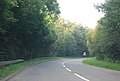
 A4066 approaching Llanmiloe - geograph.org.uk - 3267673.jpg 640 × 480; 53 KB
-
 A4066 climbs Whitehill Down - geograph.org.uk - 2665742.jpg 3,648 × 2,681; 1.25 MB
-
 A4066 near Four Wheels - geograph.org.uk - 3267655.jpg 640 × 480; 114 KB
-
 A4066 near Woodend - geograph.org.uk - 3267674.jpg 640 × 481; 43 KB
-
 A477 - geograph.org.uk - 3700287.jpg 640 × 430; 47 KB
-
 A477 - geograph.org.uk - 3719103.jpg 640 × 430; 63 KB
-
 A477 at Oernant Cottage - geograph.org.uk - 3719125.jpg 640 × 430; 77 KB
-
 A477 looking towards Backe - geograph.org.uk - 4676747.jpg 800 × 412; 70 KB
-
 A477, eastbound - geograph.org.uk - 3700289.jpg 640 × 430; 52 KB
-
 A477, eastwards - geograph.org.uk - 3700276.jpg 640 × 430; 87 KB
-
 A477, Llanddowror - geograph.org.uk - 3700286.jpg 640 × 430; 53 KB
-
 A477, Llanddowror - geograph.org.uk - 3719101.jpg 640 × 430; 59 KB
-
 A477, westbound - geograph.org.uk - 3719106.jpg 640 × 401; 62 KB
-
 A477, westbound - geograph.org.uk - 3719131.jpg 640 × 430; 61 KB
-
 Access road and footpath leading to Coed Las-fach - geograph.org.uk - 2951384.jpg 4,608 × 3,456; 6.42 MB
-
 Afon Taf - geograph.org.uk - 3403842.jpg 1,024 × 680; 127 KB
-
 Afon Taf from Pont St Clears - geograph.org.uk - 2665736.jpg 3,648 × 2,736; 1.69 MB
-
 Another Carmarthenshire "Footpath" - geograph.org.uk - 3959404.jpg 612 × 408; 172 KB
-
 Arable field near Colston Farm - geograph.org.uk - 3410979.jpg 1,024 × 680; 199 KB
-
 Artistic collection of flotsam - geograph.org.uk - 5419706.jpg 1,958 × 1,469; 871 KB
-
 Autumn colours - geograph.org.uk - 1004374.jpg 640 × 339; 112 KB
-
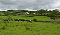
 Beef herd, west of Llanddowror - geograph.org.uk - 1002818.jpg 640 × 480; 89 KB
-
 Bend, A477 - geograph.org.uk - 3700273.jpg 640 × 430; 70 KB
-
 Bend, A477 - geograph.org.uk - 3719081.jpg 640 × 405; 50 KB
-
 Bishop's Court Farm - geograph.org.uk - 1002795.jpg 640 × 480; 53 KB
-
 Brook Farm, Llanmiloe - geograph.org.uk - 2667587.jpg 3,648 × 2,736; 3.2 MB
-
 Brook View - geograph.org.uk - 2755450.jpg 800 × 600; 210 KB
-
 Bwlchnewydd Chapel - baptism pool - geograph.org.uk - 4643897.jpg 2,576 × 1,932; 1.13 MB
-
 Bwlchnewydd Chapel - geograph.org.uk - 4643919.jpg 2,576 × 1,932; 1.12 MB
-
 Bwlchnewydd Chapel - geograph.org.uk - 4643984.jpg 2,576 × 1,932; 1.21 MB
-
 Bwlchnewydd Chapel - graveyard - geograph.org.uk - 4643900.jpg 2,576 × 1,932; 1.12 MB
-
 Bwlchnewydd Chapel - interior - taken through window - geograph.org.uk - 4643977.jpg 2,576 × 1,932; 1,010 KB
-
 Bwlchnewydd Chapel - ladies toilet - geograph.org.uk - 4643902.jpg 2,576 × 1,932; 1.12 MB
-
 Bwlchnewydd Chapel - main doorway - geograph.org.uk - 4643950.jpg 2,576 × 1,932; 1.18 MB
-
 Bwlchnewydd Chapel - ouitbuilding - geograph.org.uk - 4643963.jpg 2,576 × 1,932; 1.09 MB
-
 Bwlchnewydd Chapel - ouitbuilding - geograph.org.uk - 4643974.jpg 2,576 × 1,932; 1.11 MB
-
 Bwlchnewydd Chapel - outbuilding - geograph.org.uk - 4643955.jpg 2,576 × 1,932; 1.1 MB
-
 Bwlchnewydd Chapel - plaque - geograph.org.uk - 4643986.jpg 2,576 × 1,932; 1.17 MB
-
 Bwlchnewydd Chapel - rear - geograph.org.uk - 4643908.jpg 2,576 × 1,932; 1.06 MB
-
 Bwlchnewydd Chapel - rear - geograph.org.uk - 4643913.jpg 2,576 × 1,932; 1.16 MB
-
 Bwlchnewydd Chapel - rear to gents toilet - geograph.org.uk - 4643966.jpg 2,576 × 1,932; 1.12 MB
-
 Bwlchnewydd Chapel - roadway - geograph.org.uk - 4643943.jpg 2,576 × 1,932; 1.14 MB
-
 Bwlchnewydd Chapel - vestry-kitchen - geograph.org.uk - 4643959.jpg 2,576 × 1,932; 1.04 MB
-
 Bwlchnewydd Chapel notice board - geograph.org.uk - 4643917.jpg 2,576 × 1,932; 1.04 MB
-
 Carmarthenshire Footpath - geograph.org.uk - 2471506.jpg 4,000 × 3,000; 3.86 MB
-
 Castle Lloyd grasstrack circuit - geograph.org.uk - 2540376.jpg 1,024 × 558; 109 KB
-
 Ceuffordd Llanddowror Holloway - geograph.org.uk - 2141830.jpg 690 × 517; 177 KB
-
 Chapel at Halfpenny Furze, Llanddowror - geograph.org.uk - 3404254.jpg 1,024 × 680; 167 KB
-
-
 Closed and Disused Chapel, Llanddowror - geograph.org.uk - 3260251.jpg 2,576 × 1,932; 864 KB
-
 Cows grazing near Backe - geograph.org.uk - 2540425.jpg 1,024 × 608; 194 KB
-
 Cwmbrwyn farm - geograph.org.uk - 994520.jpg 640 × 479; 132 KB
-
 Daft Dog investigates - geograph.org.uk - 5419530.jpg 2,122 × 1,591; 591 KB
-
 Dairy herd, at lunch - geograph.org.uk - 1002806.jpg 640 × 480; 58 KB
-
 Dead end road at Brook - with old closed school in distance - geograph.org.uk - 4838345.jpg 2,576 × 1,932; 1.24 MB
-
 Drive to Pen-y-back - geograph.org.uk - 3411012.jpg 1,024 × 680; 293 KB
-
 Dunes behind Pendine Sands beach - geograph.org.uk - 5419713.jpg 1,958 × 1,469; 936 KB
-
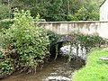 Elim Bridge - geograph.org.uk - 1004258.jpg 640 × 479; 190 KB
-
 Elim Chapel - geograph.org.uk - 4644017.jpg 2,576 × 1,932; 1.23 MB
-
 Elim Chapel - geograph.org.uk - 4645121.jpg 2,576 × 1,932; 1.23 MB
-
 Elim Chapel - geograph.org.uk - 4645132.jpg 2,576 × 1,932; 1.23 MB
-
 Elim Chapel - geograph.org.uk - 4645135.jpg 2,576 × 1,932; 1.24 MB
-
 Elim Chapel - Gothic Headstone - geograph.org.uk - 4645131.jpg 2,576 × 1,932; 1.1 MB
-
 Elim Chapel - litter warning sign - geograph.org.uk - 4645143.jpg 2,576 × 1,932; 1.21 MB
-
 Elim Chapel - old stone gate pillars - geograph.org.uk - 4643996.jpg 2,576 × 1,932; 1.05 MB
-
 Elim Chapel - overgrown garden by vestry - geograph.org.uk - 4644012.jpg 2,576 × 1,932; 1.18 MB
-
 Elim Chapel - plaque - geograph.org.uk - 4645111.jpg 2,576 × 1,932; 1.18 MB
-
 Elim Chapel - plaque - geograph.org.uk - 4645112.jpg 2,576 × 1,932; 1.18 MB
-
 Elim Chapel - river - geograph.org.uk - 4644000.jpg 2,576 × 1,932; 1.09 MB
-
 Elim Chapel - river - geograph.org.uk - 4644010.jpg 2,576 × 1,932; 1.19 MB
-
 Elim Chapel - river - geograph.org.uk - 4645156.jpg 2,576 × 1,932; 1.18 MB
-
 Elim Chapel - river - geograph.org.uk - 4645159.jpg 2,576 × 1,932; 1.19 MB
-
 Elim Chapel Graveyard - geograph.org.uk - 4645113.jpg 2,576 × 1,932; 1.07 MB
-
 Elim Chapel Graveyard - geograph.org.uk - 4645118.jpg 2,576 × 1,932; 1.09 MB
-
 Elim Chapel Graveyard and Vestry - geograph.org.uk - 4645126.jpg 2,576 × 1,932; 1.23 MB
-
 Elim Chapel Vestry - geograph.org.uk - 4643994.jpg 2,576 × 1,932; 1.1 MB
-
 Entering Llanddowror, A477 - geograph.org.uk - 3700283.jpg 640 × 430; 58 KB
-
 Entrance to Castle Lloyd Farm - geograph.org.uk - 3410988.jpg 1,024 × 680; 187 KB
-
 Entrance to Newton Wood - geograph.org.uk - 994523.jpg 640 × 421; 181 KB
-
 Entrance to Qinetiq - geograph.org.uk - 1299930.jpg 640 × 598; 93 KB
-
 Entrance to woods - geograph.org.uk - 994517.jpg 640 × 451; 194 KB
-
 Farm entrance - geograph.org.uk - 1020726.jpg 640 × 409; 119 KB
-
 Farm Work at Castle Lloyd - geograph.org.uk - 1299856.jpg 597 × 640; 199 KB
-
 Farmhouse, at New Mill - geograph.org.uk - 1002742.jpg 640 × 480; 75 KB
-
 Farmland above Hall Down - geograph.org.uk - 3404277.jpg 1,024 × 680; 153 KB
-
 Farmland and Cresswell Farm - geograph.org.uk - 3404269.jpg 1,024 × 680; 165 KB
-
 Farmland at Halfpenny Furze - geograph.org.uk - 3404264.jpg 1,024 × 680; 226 KB
-
 Farmland by Mylett Farm - geograph.org.uk - 3404214.jpg 1,024 × 680; 186 KB
-
 Farmland opposite Mylett Farm - geograph.org.uk - 3404186.jpg 1,024 × 680; 226 KB
-
 Feed silo, Penlan Farm - geograph.org.uk - 1002719.jpg 640 × 480; 69 KB
-
 Ffarm y Parciau - Parciau Farm - geograph.org.uk - 6154270.jpg 1,024 × 768; 280 KB
-
-
 Field near Castell Toch - geograph.org.uk - 1008123.jpg 640 × 480; 97 KB
-
 Flowerpot People, St Clears ^1 - geograph.org.uk - 3404168.jpg 1,024 × 680; 255 KB
-
 Flowerpot People, St Clears ^2 - geograph.org.uk - 3404174.jpg 1,024 × 680; 263 KB
-
 Footbridge near Llanddowror - geograph.org.uk - 2471495.jpg 4,000 × 3,000; 3.76 MB
-
 Footpath ends here - geograph.org.uk - 1300016.jpg 640 × 480; 200 KB
-
 Go Kart Track - geograph.org.uk - 2838822.jpg 2,592 × 1,936; 1.6 MB
-
 Green square^ - geograph.org.uk - 1008303.jpg 640 × 480; 79 KB
-
 High Tide on the Taf - geograph.org.uk - 2106424.jpg 1,600 × 1,265; 483 KB
-
 Japanese knotweed Llanmiloe - geograph.org.uk - 5039092.jpg 1,024 × 575; 216 KB
-

-
 Line of gas pipeline, near Llanddowror - geograph.org.uk - 3404239.jpg 1,024 × 680; 309 KB
-
 Llanddowror - geograph.org.uk - 4192832.jpg 640 × 480; 97 KB
-
 Llanddowror - hall and chapel walls - geograph.org.uk - 4641539.jpg 2,576 × 1,932; 1.12 MB
-
 Llanddowror - Information Board - English side - geograph.org.uk - 4641000.jpg 1,576 × 1,552; 674 KB
-
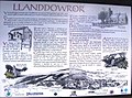 Llanddowror - Information Board - geograph.org.uk - 4640998.jpg 2,268 × 1,681; 1.02 MB
-
 Llanddowror - lane past closed chapel - geograph.org.uk - 4641547.jpg 2,576 × 1,932; 1.1 MB
-
 Llanddowror - locked gate and disused chapel field - geograph.org.uk - 4641555.jpg 2,576 × 1,932; 1.13 MB
-
 Llanddowror - phone and letter box - geograph.org.uk - 4641131.jpg 2,576 × 1,932; 1.26 MB
-
 Llanddowror - Pocket Lane - geograph.org.uk - 4641152.jpg 2,576 × 1,932; 1.1 MB
-
 Llanddowror - Pocket Park - geograph.org.uk - 4641003.jpg 2,576 × 1,932; 1.02 MB
-
 Llanddowror - quiet crossroads - geograph.org.uk - 4641127.jpg 2,576 × 1,932; 1.25 MB
-
 Llanddowror - quiet road - geograph.org.uk - 4640978.jpg 2,576 × 1,932; 1.03 MB
-
 Llanddowror - quiet road and Old School - geograph.org.uk - 4640976.jpg 2,576 × 1,932; 1.1 MB
-
 Llanddowror - quiet road now there is a bypass - geograph.org.uk - 4641559.jpg 2,576 × 1,932; 1.05 MB
-
 Llanddowror - thatched cottage and Old School - geograph.org.uk - 4640955.jpg 2,576 × 1,932; 1.11 MB
-
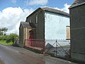
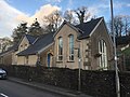
 Llanddowror Old School - geograph.org.uk - 4588586.jpg 960 × 720; 115 KB
-
 Llanddowror Pocket Park - geograph.org.uk - 4640982.jpg 2,576 × 1,932; 1.11 MB
-
 Llanddowror Primary School - geograph.org.uk - 5668121.jpg 3,264 × 2,448; 2.76 MB
-
 Llanddowror Village Hall - geograph.org.uk - 4640985.jpg 2,576 × 1,932; 1.25 MB
-
 Llanddowror Village Hall - geograph.org.uk - 4640987.jpg 2,576 × 1,932; 1.05 MB
-
 Llanddowror Y Tadau Methodistaidd.jpg 2,088 × 1,517; 1.04 MB
-
 Llandowror Old School and Graveyard - geograph.org.uk - 4640952.jpg 2,576 × 1,932; 1.12 MB
-
 Llwybr coedog - Wooded path - geograph.org.uk - 5901388.jpg 1,024 × 768; 359 KB
-
 Llwybr Ffarm Penlan Farm Path - geograph.org.uk - 4192556.jpg 640 × 480; 145 KB
-

-
 Llwybr Ffarm y Parciau - Parciau Farm Path - geograph.org.uk - 6154279.jpg 1,024 × 768; 261 KB
-
 Llwybr Llanddowror - Llanddowror Path - geograph.org.uk - 5901357.jpg 1,024 × 768; 327 KB
-
 Llwybr y Parciau - Parciau Path - geograph.org.uk - 6154425.jpg 1,024 × 768; 365 KB
-
 Looking across Castle Lloyd to the sea - geograph.org.uk - 2540390.jpg 1,024 × 767; 274 KB
-
 Looking east of the wind farm turbines - geograph.org.uk - 2951361.jpg 4,608 × 3,456; 5.86 MB
-
 Marshland and view down river Taf - geograph.org.uk - 2106448.jpg 1,600 × 1,000; 419 KB
-
 Milestone - Carmarthen 11 - geograph.org.uk - 4531183.jpg 480 × 640; 102 KB
-
 Milestone at Llanddowror - geograph.org.uk - 5668054.jpg 3,264 × 2,448; 2.47 MB
-
 Milestone old A477 - Red Roses-Llanddowror road - geograph.org.uk - 4366756.jpg 2,576 × 1,932; 1.12 MB
-
 Milestone old A477 - Red Roses-Llanddowror road - geograph.org.uk - 4366763.jpg 2,576 × 1,932; 1.25 MB
-
 Milestone old A477 - Red Roses-Llanddowror road - geograph.org.uk - 5084133.jpg 2,576 × 1,932; 1.19 MB
-
 Milestone old A477 - Red Roses-Llanddowror road - geograph.org.uk - 5084136.jpg 2,576 × 1,932; 1.19 MB
-
 Milestone, Llanddowror - geograph.org.uk - 4366747.jpg 2,576 × 1,932; 1.22 MB
-
 Milestone, Llanddowror - geograph.org.uk - 4366751.jpg 2,576 × 1,932; 1.24 MB
-
 Mooring on the river Taf at St Clears - geograph.org.uk - 2106432.jpg 1,600 × 1,200; 547 KB
-
 More sand than he knows what to do with - geograph.org.uk - 6402772.jpg 3,264 × 2,448; 1.24 MB
-
 Muddy footpath and stile - geograph.org.uk - 2152235.jpg 800 × 600; 166 KB
-
 New Mill - geograph.org.uk - 994536.jpg 640 × 479; 92 KB
-
 Oernant Cottage - geograph.org.uk - 1004252.jpg 640 × 508; 143 KB
-
 Old A477 near Elim Chapel - geograph.org.uk - 4643988.jpg 2,576 × 1,932; 1.08 MB
-
 Old A477 near Elim Chapel - geograph.org.uk - 4643991.jpg 2,576 × 1,932; 1.07 MB
-

-
 Old Boundary Marker east of Llanddowror - geograph.org.uk - 6061269.jpg 528 × 531; 150 KB
-
 Old farm building - geograph.org.uk - 994546.jpg 640 × 509; 163 KB
-

-
 Old Milestone on Brandy Hill - geograph.org.uk - 6629691.jpg 343 × 609; 98 KB
-
 Old Milestone on Brandy Hill - geograph.org.uk - 6629694.jpg 370 × 657; 142 KB
-
 Old Milestone west of Llanddowror - geograph.org.uk - 6102243.jpg 367 × 400; 127 KB
-
 Old Mill Cafe - geograph.org.uk - 1004364.jpg 640 × 457; 137 KB
-
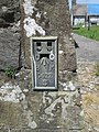
 Ordnance Survey Flush Bracket (G5129) - geograph.org.uk - 4144157.jpg 480 × 640; 133 KB
-
 Ordnance Survey Flush Bracket (S0622) - geograph.org.uk - 4531179.jpg 480 × 640; 119 KB
-
 Ordnance Survey Flush Bracket S0622 - geograph.org.uk - 3500974.jpg 4,000 × 3,000; 3.64 MB
-
 Overlooking the wind farm - geograph.org.uk - 2951365.jpg 4,608 × 3,456; 6.03 MB
-
 Parciau Wood - geograph.org.uk - 1004255.jpg 640 × 432; 156 KB
-
 Pendine Bowls Club - geograph.org.uk - 4071886.jpg 640 × 478; 83 KB
-
 Pendine Sands - geograph.org.uk - 1886633.jpg 746 × 496; 68 KB
-
 Penlan Farm - geograph.org.uk - 1002713.jpg 640 × 480; 67 KB
-
 Pentrehowell Farm - geograph.org.uk - 1002815.jpg 640 × 480; 59 KB
-
 Plaque on the A477 - geograph.org.uk - 4000748.jpg 640 × 480; 106 KB
-

-
 Post box at Brook - geograph.org.uk - 4838346.jpg 2,576 × 1,932; 1.17 MB
-
 Power lines, near Cnwce - geograph.org.uk - 1002703.jpg 640 × 480; 43 KB
-
 Quality Farmland - geograph.org.uk - 1299993.jpg 640 × 480; 67 KB
-
 Right of way - geograph.org.uk - 3404283.jpg 1,024 × 680; 216 KB
-
 Road cutting at Llanddowror - geograph.org.uk - 5668047.jpg 3,264 × 2,448; 2.64 MB
-
 Road improvements, A477 - geograph.org.uk - 3719065.jpg 640 × 430; 49 KB
-
 Road junction - geograph.org.uk - 1004372.jpg 640 × 437; 128 KB
-
 Road leading past Three Lords. - geograph.org.uk - 2951369.jpg 4,608 × 3,456; 6.39 MB
-
 Road to Laugharne - geograph.org.uk - 1369761.jpg 640 × 495; 129 KB
-
 Road to Llanddowror - geograph.org.uk - 5668040.jpg 3,264 × 2,448; 1.72 MB
-
 Road to Three Lords. - geograph.org.uk - 2838809.jpg 2,592 × 1,936; 1.66 MB
-
 Roadworks, A477 - geograph.org.uk - 3708693.jpg 640 × 430; 49 KB
-
 Roadworks, A477 - geograph.org.uk - 3719079.jpg 640 × 430; 58 KB
-
 Rough grazing and reed beds - geograph.org.uk - 3404142.jpg 1,024 × 680; 196 KB
-
 Rural MOT - geograph.org.uk - 1369758.jpg 640 × 458; 121 KB
-
 Sands in the Pendine firing range - geograph.org.uk - 6351470.jpg 4,128 × 3,096; 3.72 MB
-
 Secluded farm - geograph.org.uk - 994542.jpg 640 × 386; 113 KB
-
 Silage all wrapped up - geograph.org.uk - 1885970.jpg 746 × 496; 113 KB
-
 Silage all wrapped up - geograph.org.uk - 1885982.jpg 746 × 496; 116 KB
-
 Silage all wrapped up - geograph.org.uk - 1886000.jpg 746 × 496; 113 KB
-
 Silage bales on the roadside - geograph.org.uk - 3404246.jpg 1,024 × 680; 170 KB
-
 Small wood, on Penlan Farm - geograph.org.uk - 1002727.jpg 640 × 480; 76 KB
-
 St Clears Motocross circuit - geograph.org.uk - 1002784.jpg 640 × 480; 97 KB
-
 St Teilo's Church Llanddowror - geograph.org.uk - 4640973.jpg 2,576 × 1,932; 1.14 MB
-
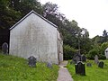
 St Teilo's Church Llanddowror - graveyard - geograph.org.uk - 4640916.jpg 2,576 × 1,932; 1.11 MB
-
 St Teilo's Church Llanddowror - graveyard - geograph.org.uk - 4640930.jpg 2,576 × 1,932; 1.13 MB
-
 St Teilo's Church Llanddowror - graveyard and path - geograph.org.uk - 4640963.jpg 2,576 × 1,932; 1.12 MB
-
 St Teilo's Church Llanddowror - graveyard and path - geograph.org.uk - 4640967.jpg 2,576 × 1,932; 1.13 MB
-
 St Teilo's Church Llanddowror - lane at side - geograph.org.uk - 4640936.jpg 2,576 × 1,932; 1.08 MB
-
 St Teilo's Church Llanddowror - north side - geograph.org.uk - 4640959.jpg 2,576 × 1,932; 1.14 MB
-
 St Teilo's Church Llanddowror - plant by graveyard wall - geograph.org.uk - 4640940.jpg 2,576 × 1,932; 1.11 MB
-
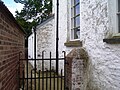
 St Teilo's Church Llanddowror - side entrance - geograph.org.uk - 4640932.jpg 2,576 × 1,932; 1.12 MB
-
 St Teilo's Church Llanddowror - window detail - geograph.org.uk - 4640925.jpg 2,576 × 1,932; 1.05 MB


_-_geograph.org.uk_-_4144157.jpg)
_-_geograph.org.uk_-_4531179.jpg)


