Category:Llanbradach
Jump to navigation
Jump to search
village in Caerphilly, Wales, UK  | |||||
| Upload media | |||||
| Instance of | |||||
|---|---|---|---|---|---|
| Location | Llanbradach and Pwllypant, Caerphilly County Borough, Wales, UK | ||||
 | |||||
Cymraeg: Mae Llanbradach yn bentref i'r gogledd o dref Caerffili ym Mwrdeistref Sirol Caerffili. Saif ger y briffordd A469.
English: Llanbradach is a small village in the Welsh county borough of Caerphilly, within the historic boundaries of Monmouthshire, south Wales less than 3 miles north of the town of Caerphilly.
Subcategories
This category has only the following subcategory.
L
- Llanbradach railway station (12 F)
Media in category "Llanbradach"
The following 31 files are in this category, out of 31 total.
-
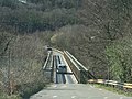
 Bridge across the Rhymney River (geograph 5955705).jpg 4,320 × 3,240; 3.06 MB
-
-
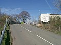
 De Winton Terrace, Llanbradach - geograph.org.uk - 372318.jpg 640 × 470; 65 KB
-
 Dry Stone wall - geograph.org.uk - 421967.jpg 640 × 480; 151 KB
-
 Ebenezer Baptist Church, Llanbradach (geograph 6016710).jpg 2,964 × 2,420; 1.26 MB
-
 Ebenezer Chapel - geograph.org.uk - 372327.jpg 640 × 480; 64 KB
-
 Ebenezer church hall, Llanbradach (geograph 2473575).jpg 640 × 480; 62 KB
-
 Field Boundary - geograph.org.uk - 424699.jpg 640 × 480; 139 KB
-
 Footpath to Llanbradach - geograph.org.uk - 1079221.jpg 640 × 428; 97 KB
-
 Llanbradach Community Centre - geograph.org.uk - 2920036.jpg 640 × 499; 66 KB
-
 Llanbradach Library (geograph 6017962).jpg 1,024 × 978; 199 KB
-
 Llanbradach Post Office (geograph 6018137).jpg 1,024 × 899; 297 KB
-
 Llanbradach War Memorial November 2009.jpg 2,991 × 2,222; 2.56 MB
-
 Railway arch, above Llanbradach - geograph.org.uk - 372487.jpg 640 × 480; 145 KB
-
 Simpsons Funeral Directors Pontyberry (5539607238).jpg 3,264 × 2,448; 3.55 MB
-
 Stiles and Gates near Llanbradach - geograph.org.uk - 235485.jpg 640 × 480; 80 KB
-
 The Wingfield - geograph.org.uk - 372334.jpg 640 × 494; 64 KB
-
 Trehir Tip, Llanbradach - geograph.org.uk - 372620.jpg 640 × 480; 66 KB
-
 Victoria Terrace, Llanbradach - geograph.org.uk - 372341.jpg 640 × 499; 84 KB
-
 Wingfield Crescent, Llanbradach - geograph.org.uk - 372337.jpg 640 × 507; 76 KB
-
 Access to woods above Llanbradach - geograph.org.uk - 736536.jpg 639 × 479; 176 KB
-
 Dyffryn Isaf - geograph.org.uk - 372495.jpg 640 × 480; 76 KB
-
 Graddfa Villas, Llanbradach - geograph.org.uk - 735905.jpg 635 × 466; 94 KB
-
 Green Lane to the Mountain - geograph.org.uk - 424526.jpg 640 × 480; 175 KB
-
 Llanbradach Woods - geograph.org.uk - 736633.jpg 638 × 475; 74 KB
-

-
 Minor road to Ystrad Mynach - geograph.org.uk - 372488.jpg 640 × 467; 118 KB
-
 Morning Mist over Caerphilly Basin - geograph.org.uk - 418801.jpg 640 × 485; 46 KB
-
 Spoil Heaps near Llanbradach - geograph.org.uk - 235486.jpg 640 × 480; 61 KB
-
 The Fire Break - geograph.org.uk - 424728.jpg 640 × 480; 148 KB
-
 The Rhymney valley - geograph.org.uk - 372490.jpg 480 × 640; 94 KB
.jpg)


.jpg)

.jpg)


.jpg)
.jpg)


.jpg)


